WARMER AND WET BY MID-WEEK
Sunday was another miserable day. Areas of mist, combined with gusty northwest winds, gave us a cold and nasty Sunday across the area. Monday and Tuesday will remain in the 40’s, but by Wednesday, highs return to the middle and upper 50’s! Highs on Thursday and Friday will be in the lower 60’s. Rain will also move back in on Thursday, lingering through next weekend. As of now, it looks like the coldest air of the season could move into our area next Sunday! Highs are going to struggle to stay in the upper 30’s!
SUNDAY NIGHT: Gusty winds and cloudy skies will persist overnight tonight. Temperatures will drop down into the middle and upper 30’s, with our rain chances remaining at 0%. Winds will vary between 8 and 12 MPH.
MONDAY: It is going to be a cold and cloudy start to our work week. Highs on Monday will reach the middle 40’s, but thanks to gusty winds out of the northwest, its going to feel like we’re in the lower 40’s and upper 30’s all day! Thankfully, we will have no rain to worry about on Monday. We could sneak in a few peaks of sunshine during the afternoon hours on Monday. Overnight, lows are going to drop down into the upper 20’s and lower 30’s across the region.
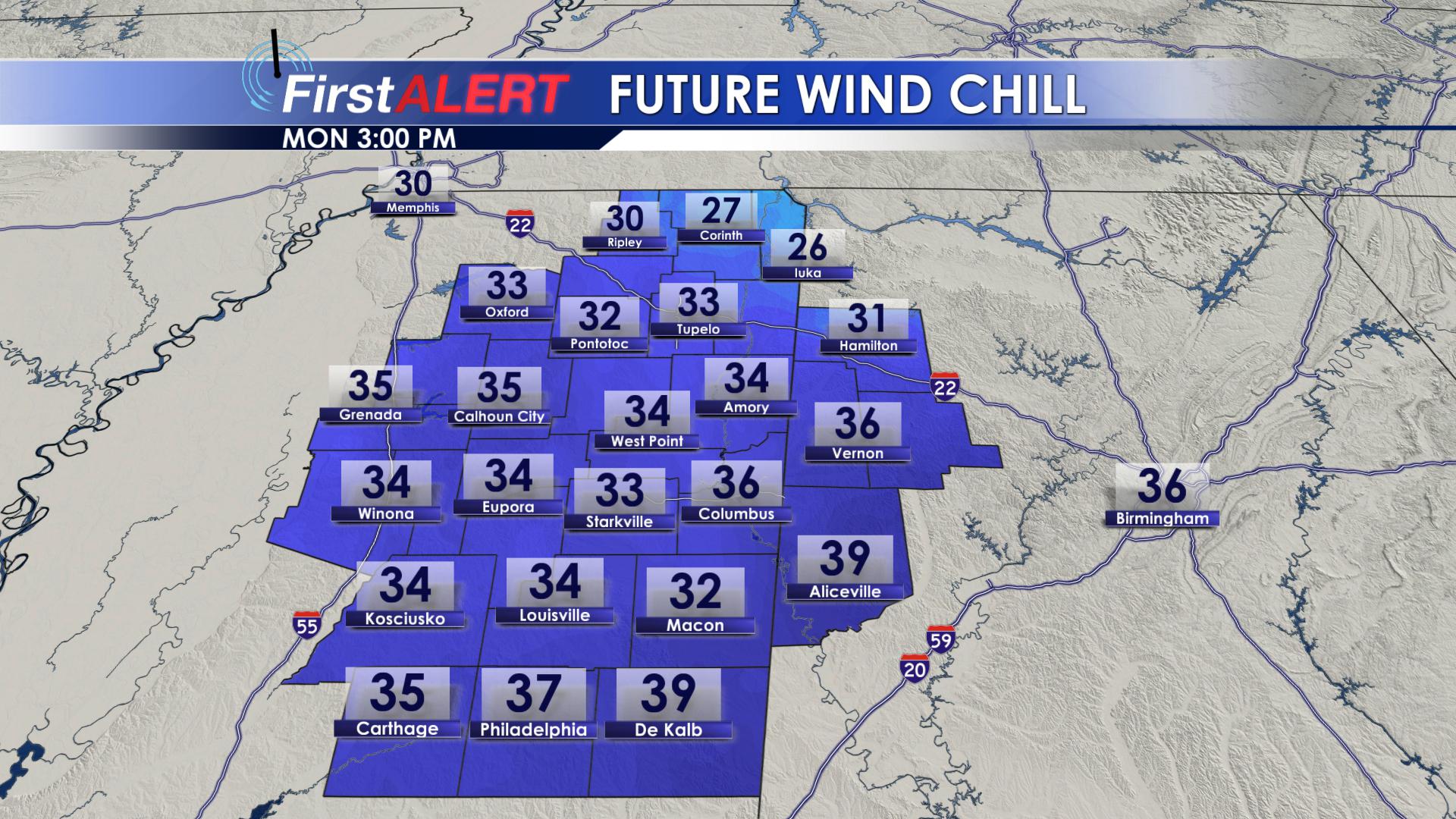
Feel-Like Temps Monday Afternoon
TUESDAY: Tuesday will be another cold day, with highs topping out in the upper 40’s and lower 50’s. Winds will still be out of the north on Tuesday, but not as strong as they were on Monday. As we go throughout the day on Tuesday, we will see more peaks of sunshine across the area! Overnight Tuesday, lows will drop down into the lower 30’s.
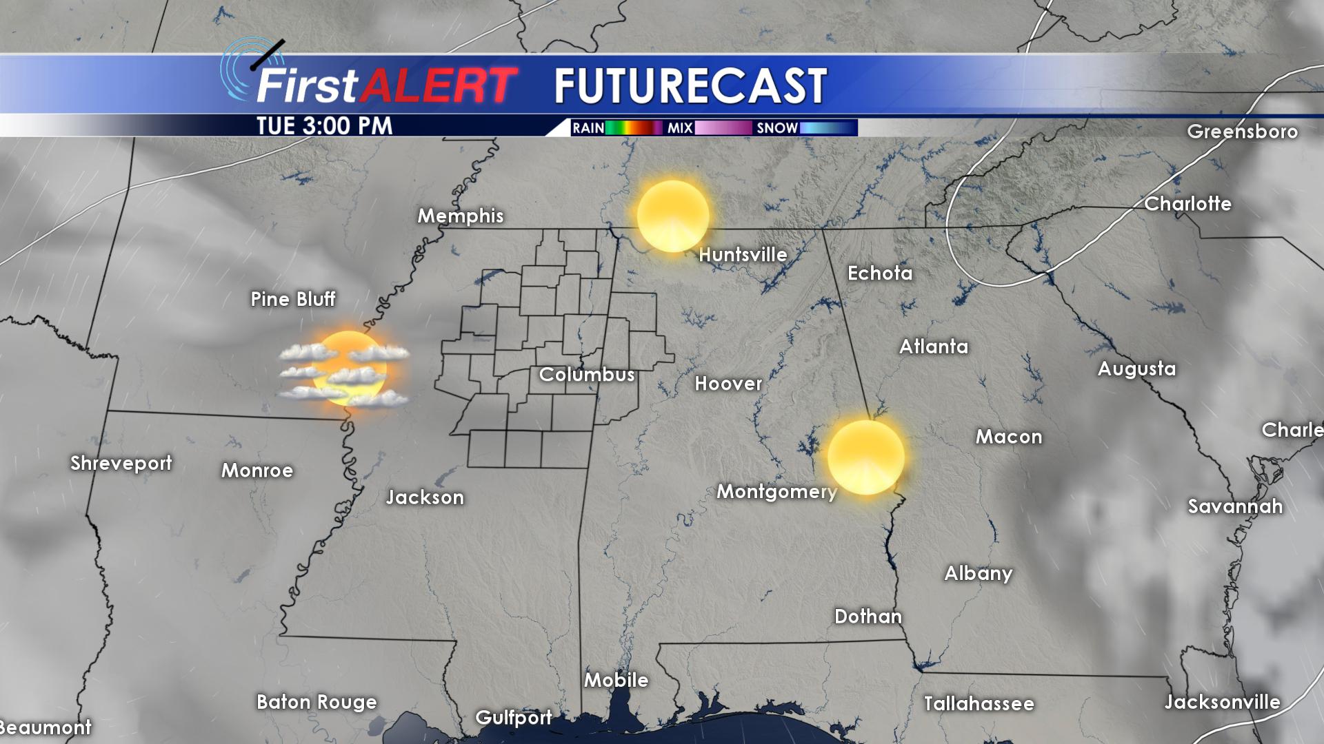
More Sunshine on Tuesday
WEDNESDAY: Our warming trend will kick off on Wednesday. Highs on Wednesday will be in the middle to upper 50’s across the area. Skies will remain partly cloudy. Winds will be shifting to the southwest, which will help to bring in some warmer air! We will stay mild overnight on Wednesday, with lows in the upper 40’s.
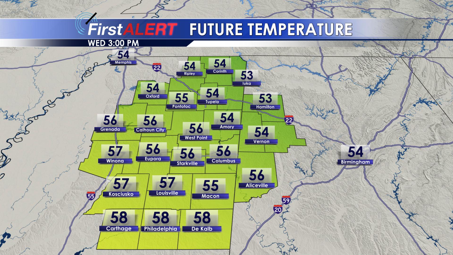
Warmer Wednesday
THURSDAY: Clouds will be back on the increase for Thursday. Our next weather system will bring rain to our area on Thursday. Rainfall amounts will vary across the region, but it looks like most of us could see around 0.25″ of rain on Thursday. Highs Thursday will top out in the upper 50’s and lower 60’s, with overnight lows in the lower 50’s.
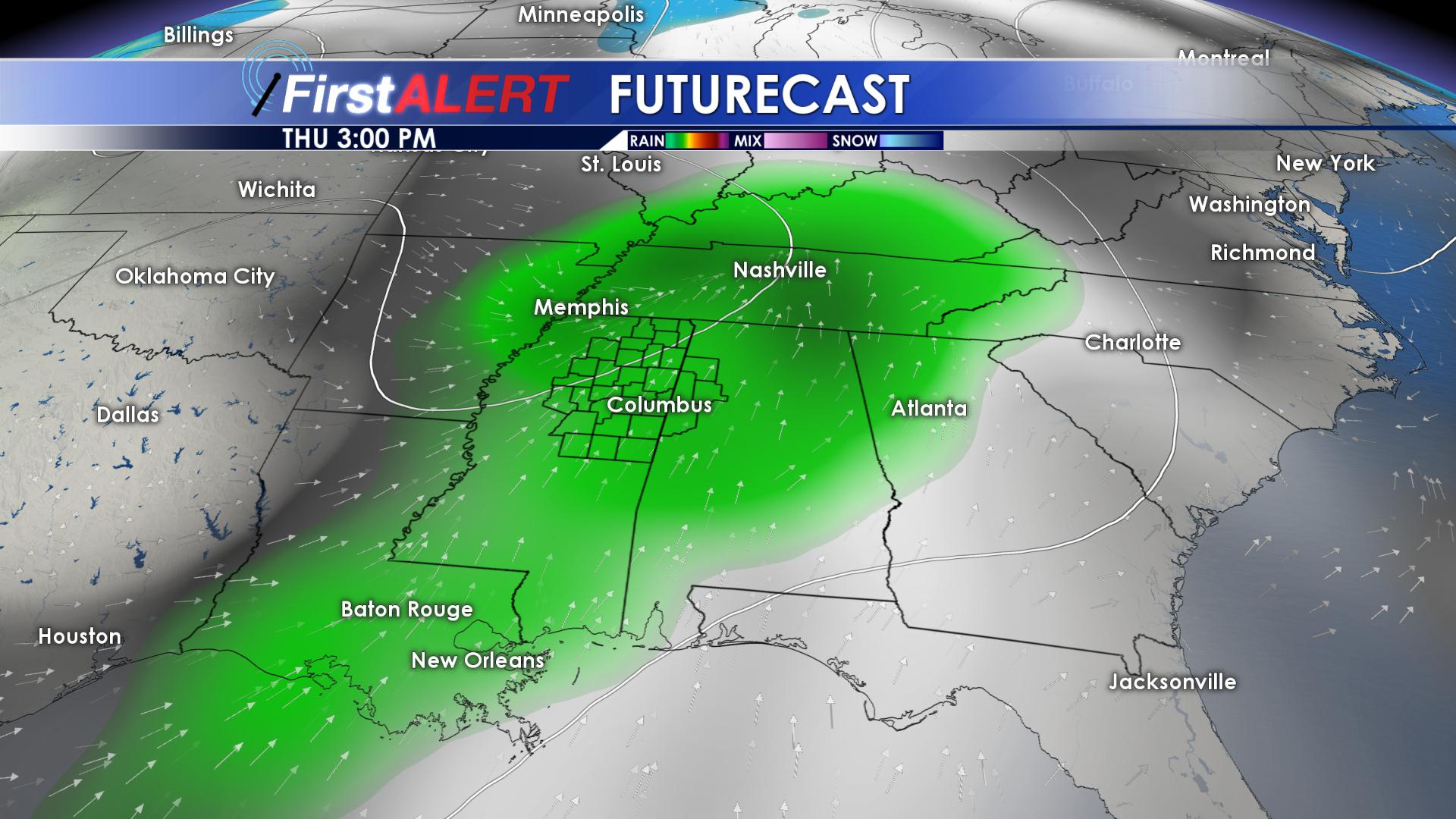
Thursday Rain
FRIDAY:Friday will remain dry, with winds out of the south. Skies will remain partly cloudy, with highs in the lower 60’s. Friday looks like our last warm day for a while. Overnight lows on Friday remain warm, only reaching the lower 50’s.
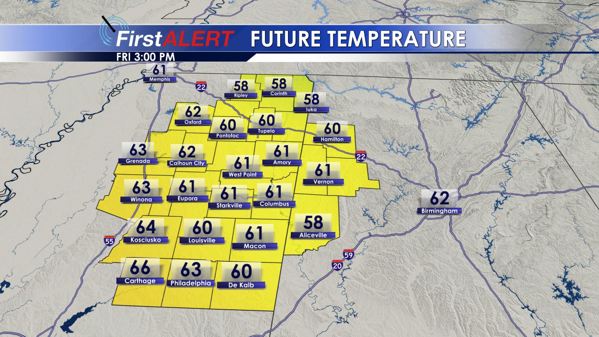
Highs on Friday
SATURDAY: A strong storm system will begin to move into our area early Saturday morning. This storm system will likely bring us the coldest air that we have seen so far this season. Rain showers will begin early in the morning hours on Saturday. As we move into the afternoon hours on Saturday, colder air will begin to invade our region. As this colder air moves in, we will still have some light precipitation ongoing across the area. There is a brief window for a transition to a brief wintry mix on Saturday evening before this system pulls out of our area. With highs being in the 60’s on Friday, we will not see any accumulation due to the ground being so warm. No accumulations or impacts are expected across the area. If anything, a few of us may get lucky and see a few snowflakes mix in with the rain. Overnight lows on Saturday will plummet into the upper 20’s.
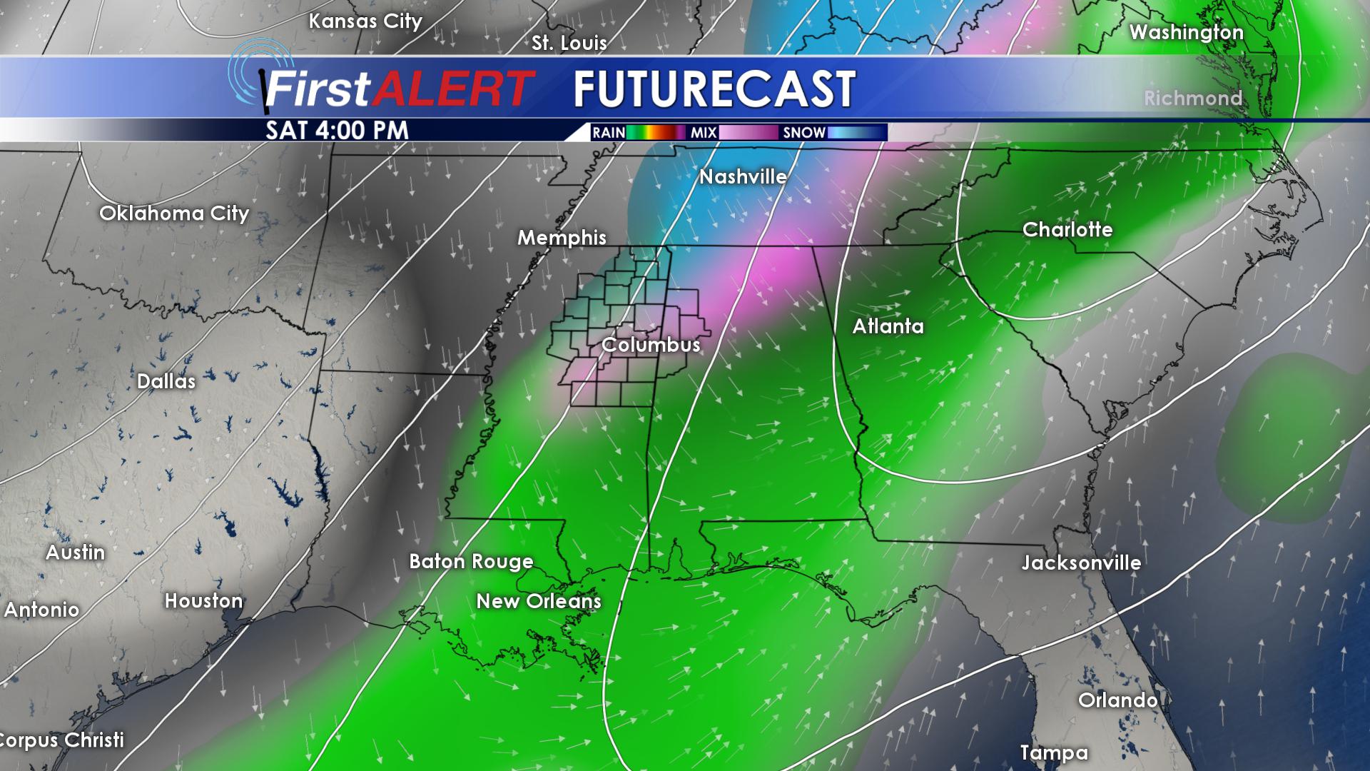
Saturday Evening
SUNDAY: After the passage of the cold front, temperatures are going to take a nose dive. Highs on Sunday will only be in the upper 30’s, with overnight lows in the lower 20’s.
Be sure to follow us on Facebook, Twitter, Instagram and Snapchat @WCBIWEATHER


Leave a Reply