Watching 2 cold fronts coming our way
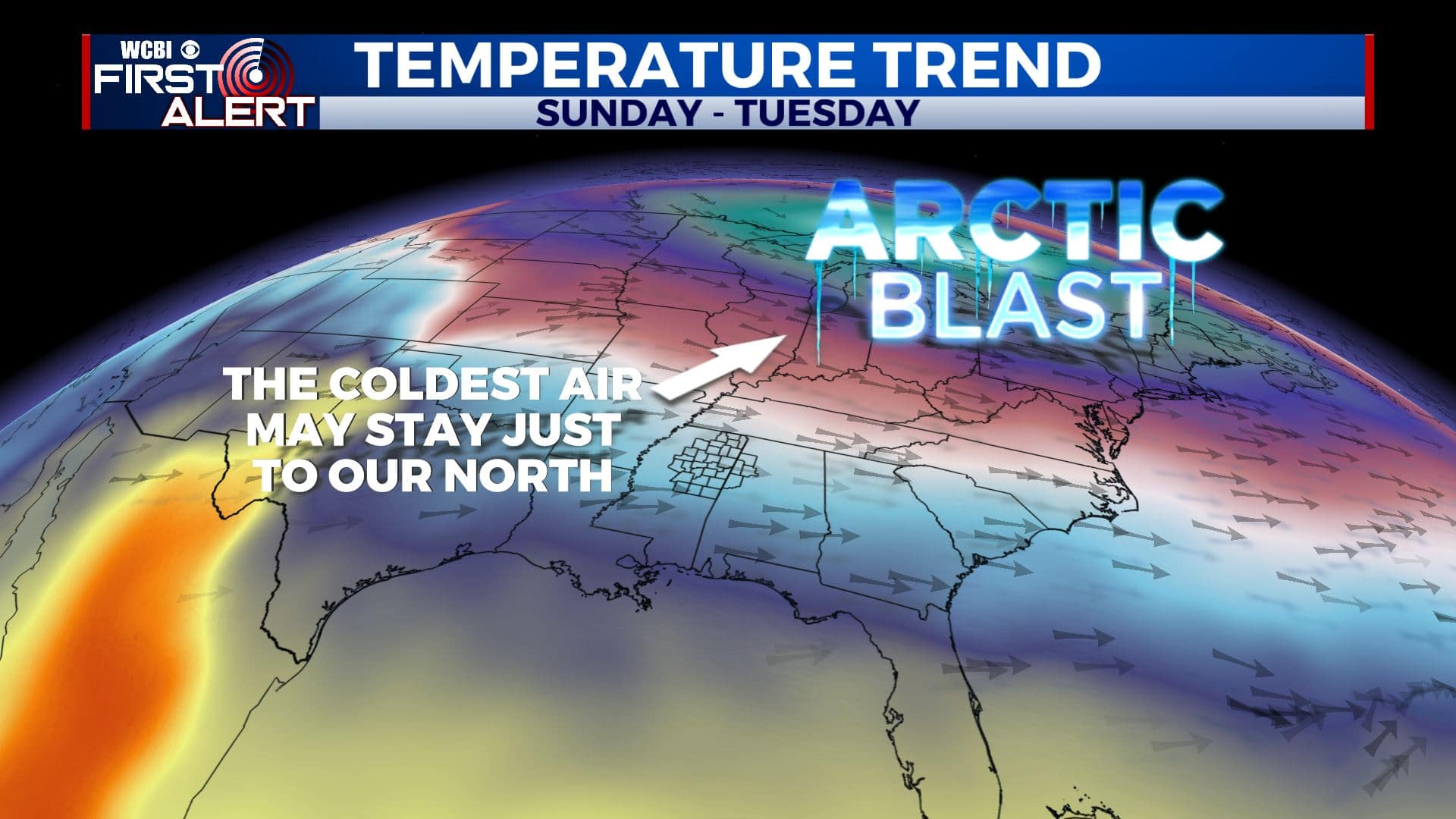
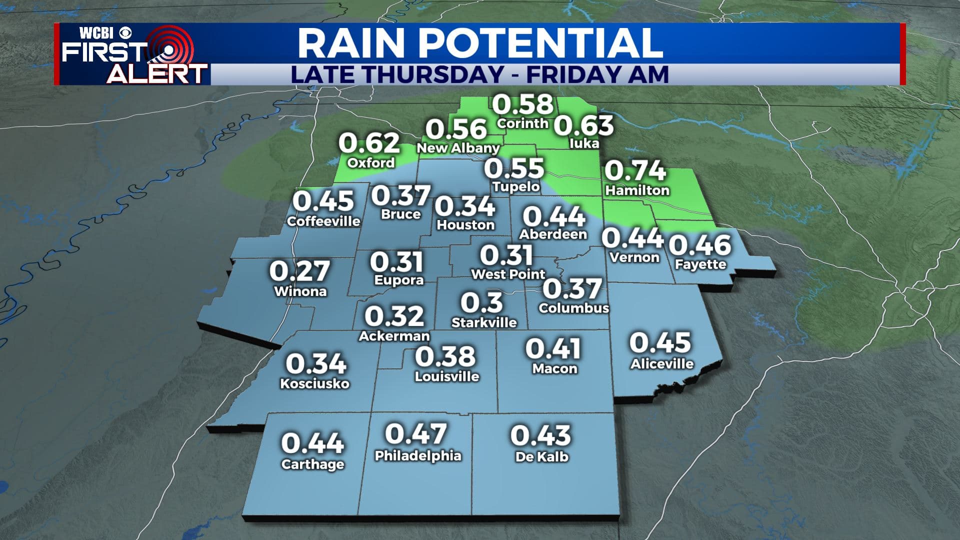
SUMMARY: Up and down temperatures will continue over the next week with a few more cold fronts coming our way. Some rain will occur late Thursday and early Friday morning with front #1. Some additional showers are possible late Saturday into early Sunday with front #2. The latest data is backing off on the extremely cold air we’ve had in the forecast for Sunday and early next week and our forecast numbers have been adjusted upward accordingly. We’ll continue to monitor the cold air coming into the Lower 48 but the most intense part of it may stay to our northeast.
TUESDAY NIGHT: Clear, calm, and cold. Lows in the mid 20s.
WEDNESDAY: Bright sunshine. Highs in the low 50s. Light and variable winds.
WEDNESDAY NIGHT: Partly cloudy. Lows in the mid 30s.
THURSDAY: Mostly cloudy, breezy, and mild. Highs in the low 60s. Winds SSE 10-25 mph with some higher gusts possible. Late afternoon and evening rain is possible.
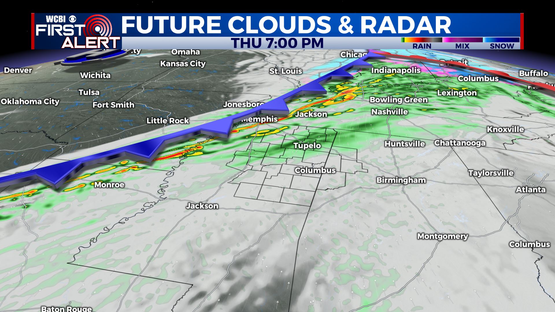
THURSDAY NIGHT: Areas of rain. Lows in the upper 30s.
FRIDAY: Turning partly cloudy. Highs in the low 50s.
SATURDAY: Increasing clouds. Highs in the mid 50s.
SUNDAY: Mostly cloudy with a chance of showers. Highs in the upper 40s.
MONDAY & TUESDAY: Partly to mostly cloudy. Highs around 50.
Follow @WCBIWEATHER on Facebook, Twitter, Instagram, and the WCBI News App


Leave a Reply