Holiday weekend outlook
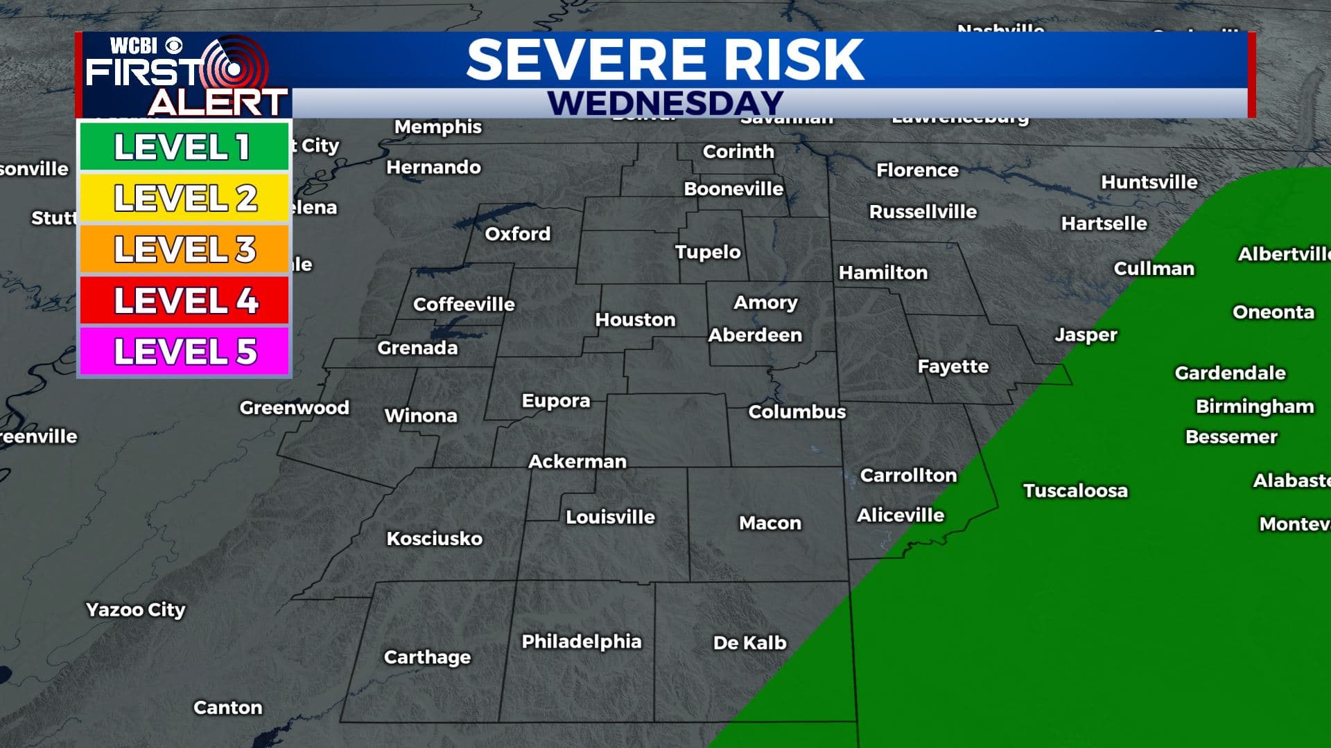
WEDNESDAY AFTERNOON: Most spots will remain dry but there is a low end chance of some isolated showers and storms across far eastern MS and north AL. The severe threat is very low and there may not end up being much activity but we’ll keep watching it. We stay breezy with highs in the upper 60s to lower 70s.
WEDNESDAY NIGHT: Turning partly cloudy as the rain exits the region. Lows in the mid 40s.
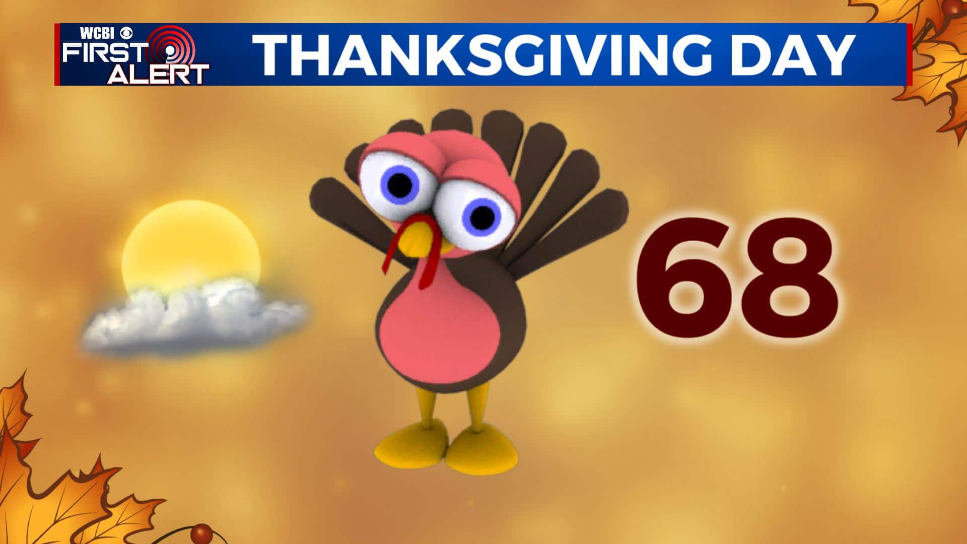
THANKSGIVING DAY: Thankfully, the holiday will be looking great with mostly sunny skies. Highs in the mid to upper 60s.
THURSDAY NIGHT: Partly cloudy. Lows in the mid 40s.
FRIDAY: Turning mostly cloudy with afternoon and evening rain developing. Highs in the upper 60s.
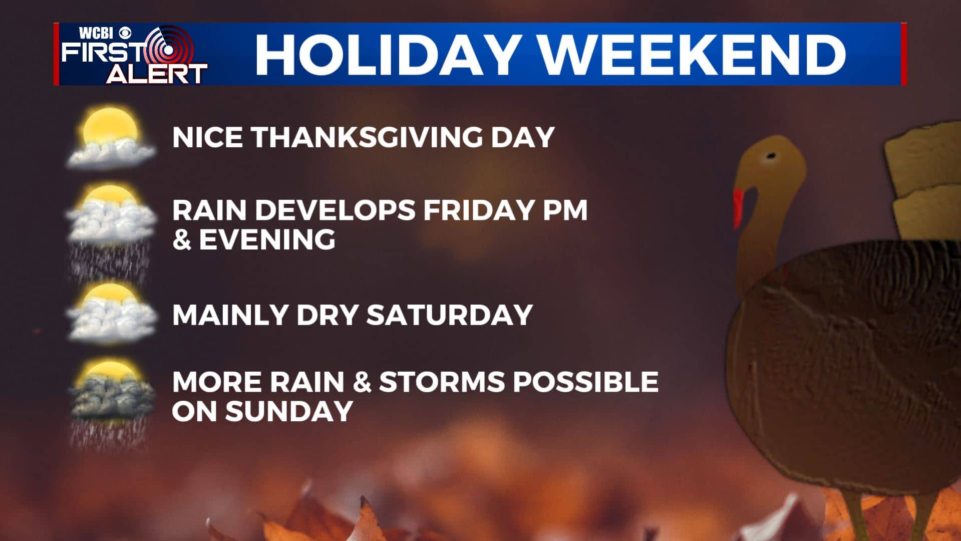
SATURDAY: Mostly cloudy with a chance of a shower or two Higher odds of rain farther to our south. Highs in the low 60s. Weather looks fair for the Egg Bowl in Oxford.
SUNDAY: Additional rain and storms develop. There could be some strong activity somewhere across the Twins States so stay tuned for updates. Highs should range from the upper 50s to low 60s.
EARLY NEXT WEEK: Much cooler highs in the 40s. Lows in the 30s and 20s.
Stay connected with @WCBIWEATHER on Facebook, Twitter, Instagram, and the WCBI News App


Leave a Reply