Watching Zeta and a Cold Front
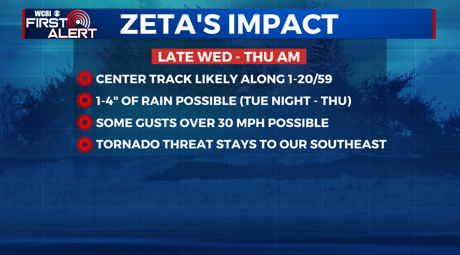
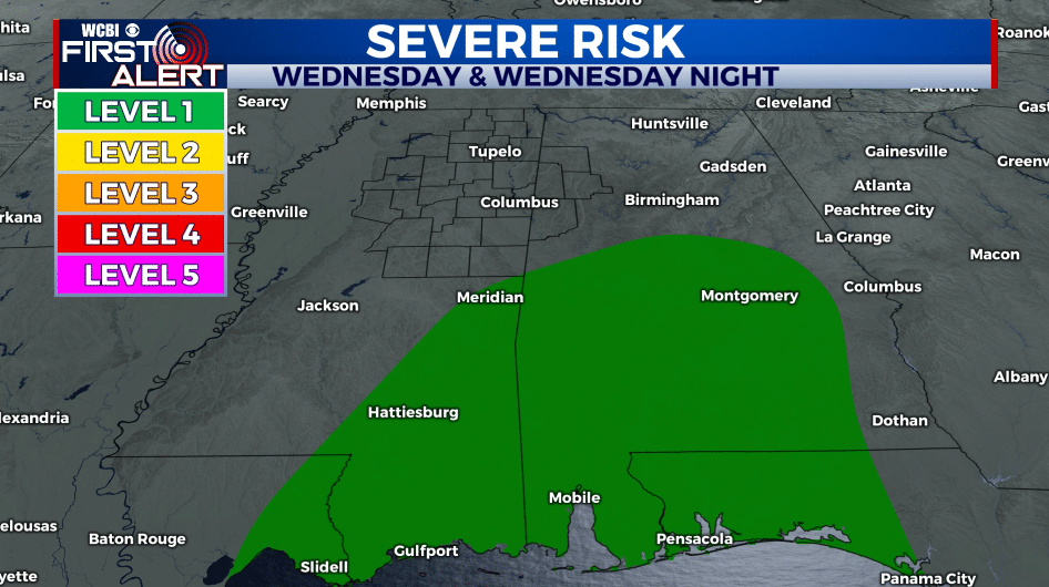
BIG PICTURE: Moisture from tropical storm/hurricane Zeta is going to merge with a cold front and upper low pressure center Tuesday night into Thursday. The end result will be a good chance of rain and a period of gusty winds. The highest wind from Zeta and and the isolated tornado threat currently looks to be along and south of the I-20/59 corridor Wednesday night and Thursday morning.
MONDAY NIGHT: Partly to mostly cloudy. Lows in the 50s. Winds NNE 5-10 mph.
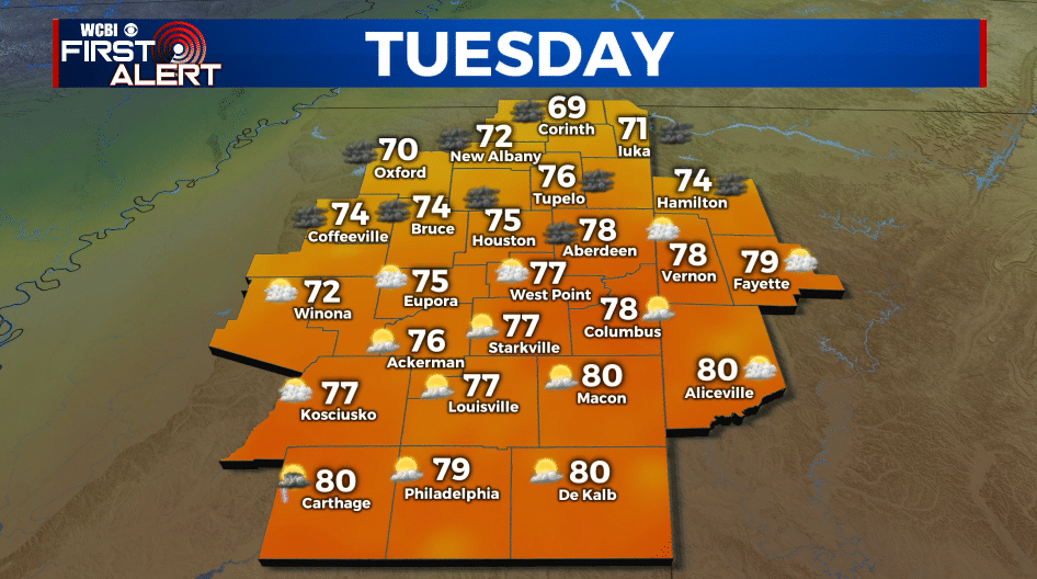
TUESDAY: Partly to mostly cloudy. Some showers are possible during the afternoon with higher odds of rain moving in during the evening. Highs mainly in the 70s but there will likely be a big gradient from NW to SE across our area. Winds NE 5-15 mph.
TUESDAY NIGHT: Cloudy with areas of rain. Some could be locally heavy or or at least steady. Milder lows in the 60s.
WEDNESDAY: Mostly cloudy with a 70% chance of rain. Highs in the 70s. Winds SE 5-15 mph with higher gusts.
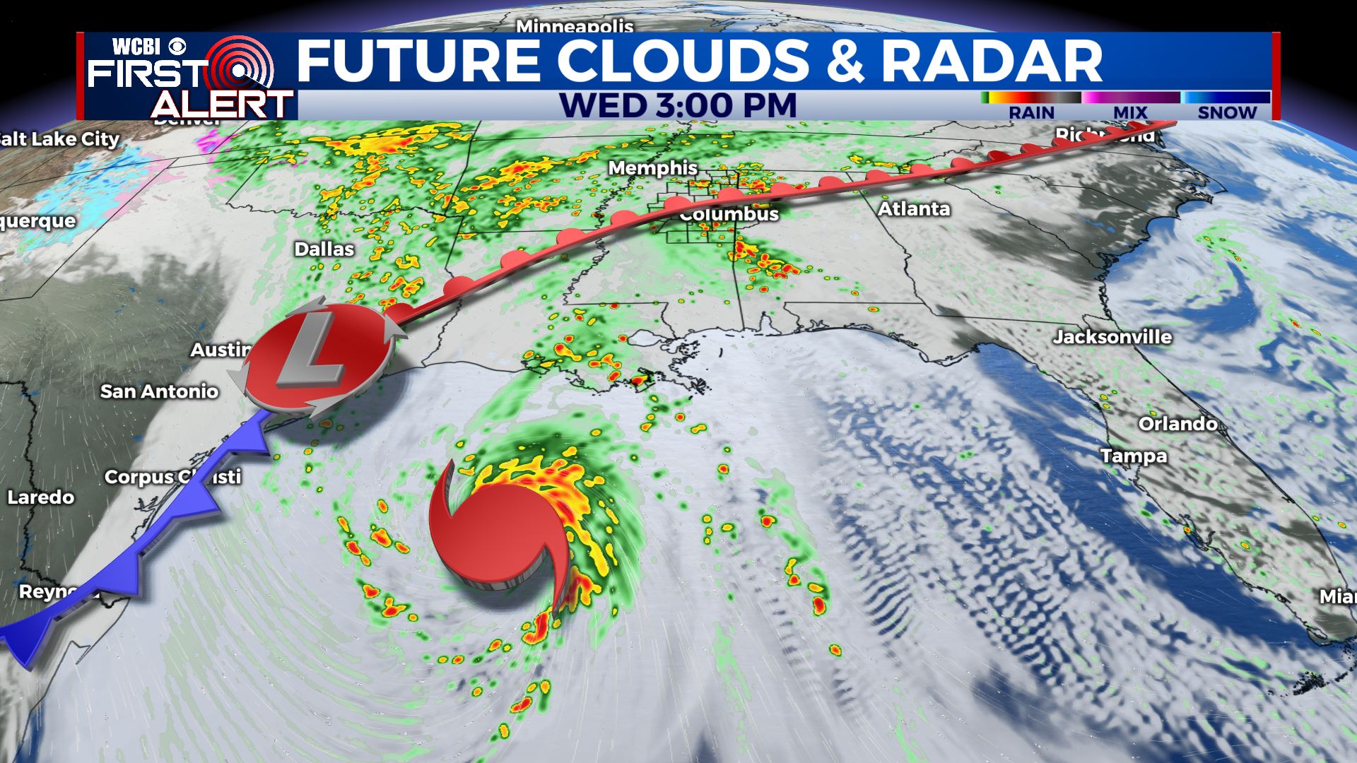
WEDNESDAY NIGHT: Rainy and breezy and the remnants of Zeta swirl through the region. Lows around 70. Winds SE 10-20 mph with higher gusts.
THURSDAY: Wet and breezy, especially during the first half of the day. Some gusts could be over 30 mph. The heaviest rain is likely during the morning hours with a drying trend taking over during the afternoon. Highs in the 70s.
FRIDAY: Partly cloudy and cooler. Highs in the 60s.
WEEKEND: Mostly sunny. Highs in the 60s. Lows in the 40s.
Follow @WCBIWEATHER on Facebook, Twitter, Instagram, and the WCBI News App


Leave a Reply