Wednesday storms, cooler Thu & Fri
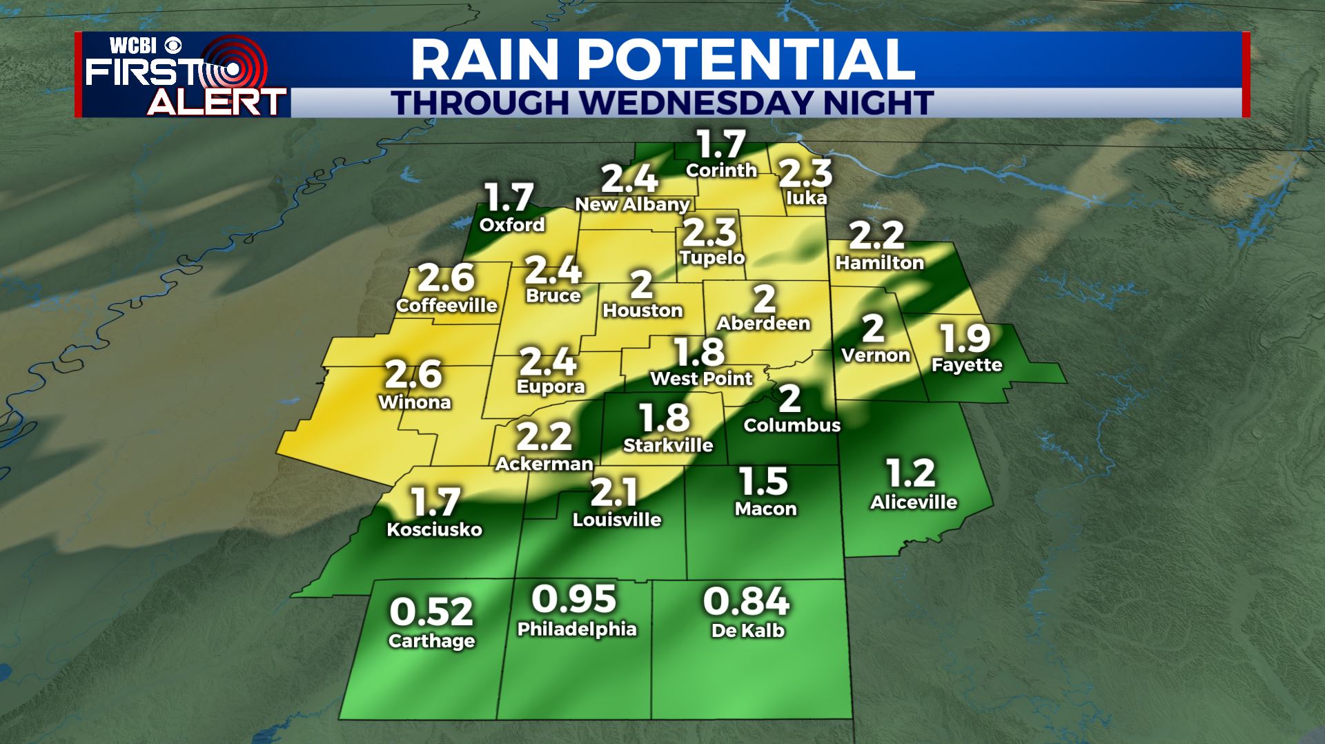
SUMMARY: Flooding remains a concern with another 1-3″ or more possible between now and Thursday morning. Strong to severe storms with damaging wind, heavy rain, and even an isolated tornado or two are in the forecast from about mid afternoon Wednesday through midnight. Colder air blows in behind the storms with highs both Thursday and Friday falling into the 40s with overnight lows tumbling into the 20s. Dry weather builds in briefly for Friday and Saturday before rain chances return.
TUESDAY NIGHT: Areas of rain. Steady temperatures in the upper 40s. Northerly winds around 10 mph will become easterly by sunrise.
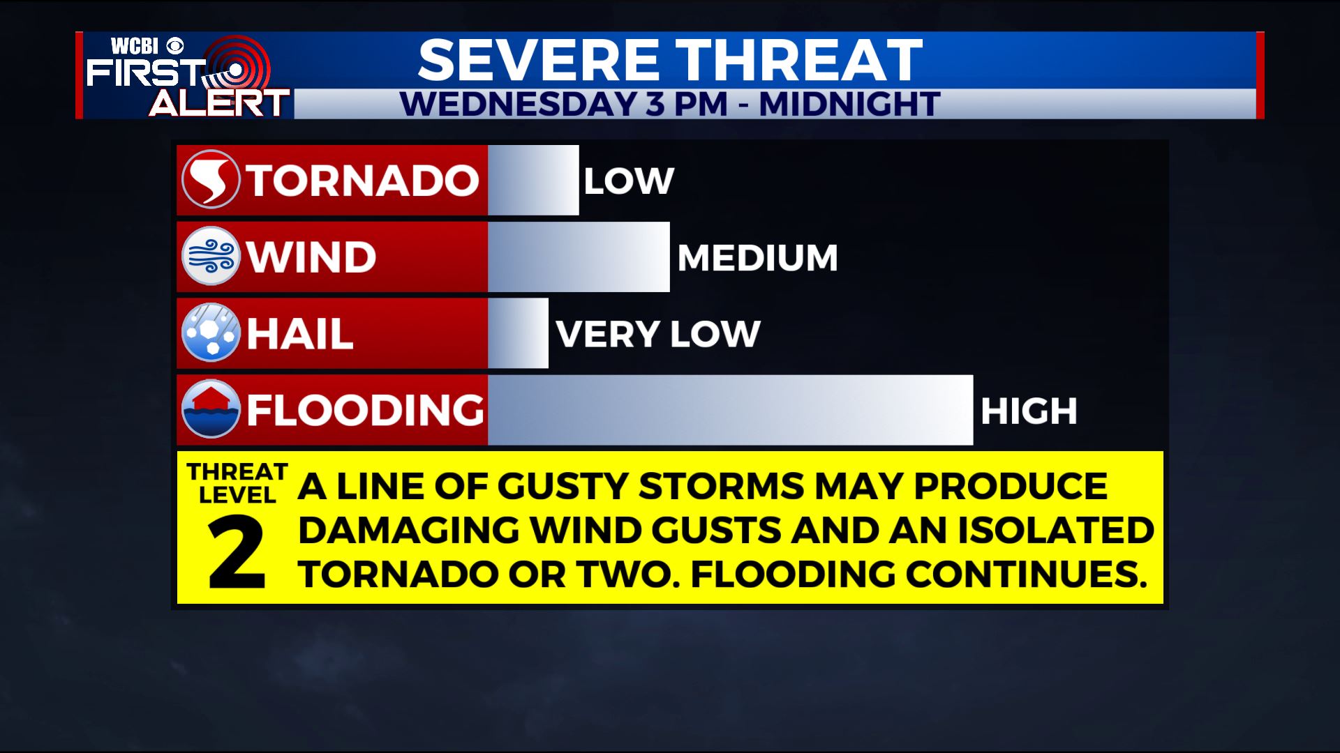
WEDNESDAY: A few showers will be around north Mississippi Wednesday morning but they will exit to the north by midday. We should get into a little lull for a few hours during the early afternoon where temperatures perk back into the 70s. Strong southerly winds 10-20 mph with higher gusts will usher in the warm air. Storms are possible by mid to late afternoon west of the Trace and they’ll march eastward during the evening. Damaging wind gusts, heavy rain, and isolated tornadoes will remain possible.
WEDNESDAY NIGHT: Lingering showers continue during the night with temperatures falling back into the 40s.
THURSDAY: Mostly cloudy, breezy, and cool. Temperatures for most of the day look like they’ll remain in the 40s.
THURSDAY NIGHT: Clearing. Much colder lows in the upper 20s.
FRIDAY: Sunny and cool. Highs in the mid 40s.
FRIDAY NIGHT: Clear and cold. Lows in the mid to upper 20s.
SATURDAY: Partly cloudy. Highs in the mid 50s.
SUNDAY: Mostly cloudy with a 30% chance of showers. Highs in the low 60s.
MONDAY & TUESDAY: Mostly cloudy. A 50% chance of rain both days.
Follow @WCBIWEATHER on Facebook, Twitter, Instagram, and the WCBI News App


Leave a Reply