Weekend Forecast
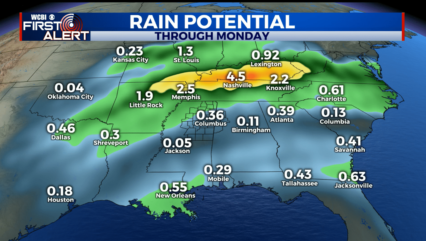
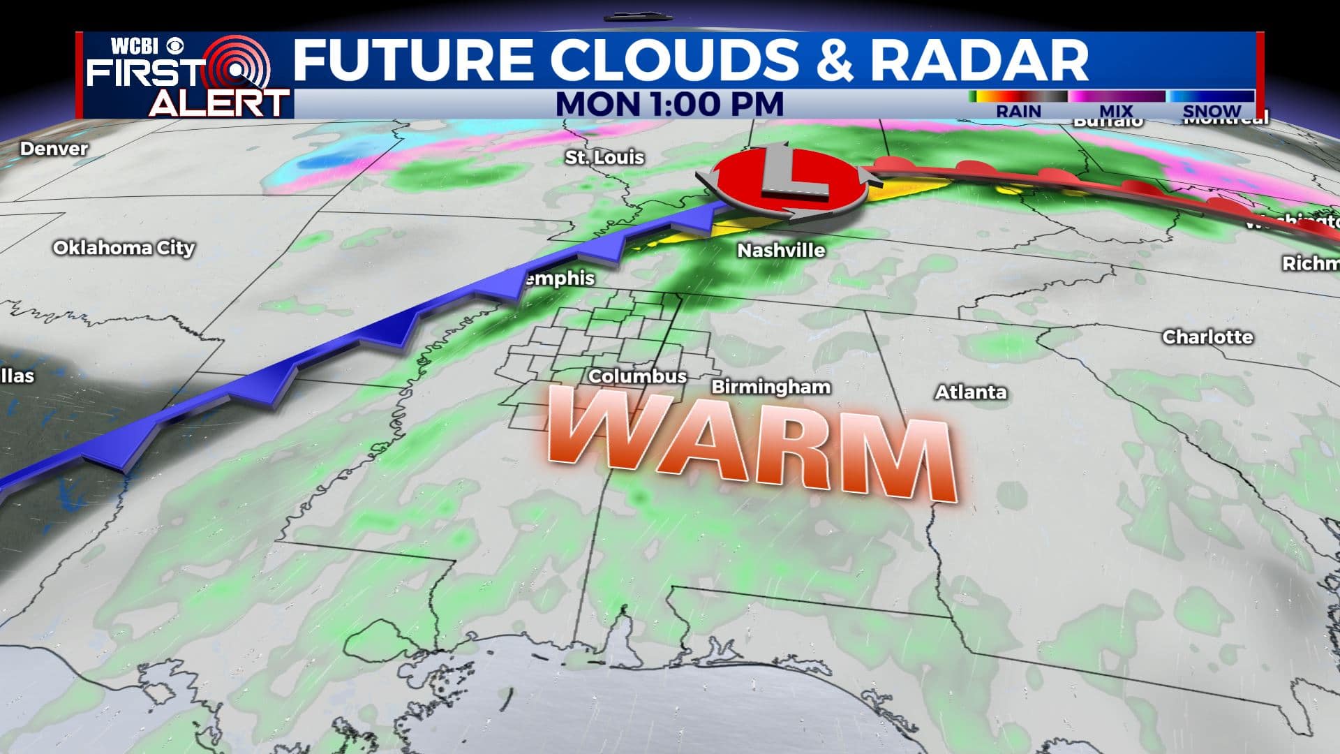
SUMMARY: The weekend will start off on a dry note but more shower activity is on tap for Sunday. More rain is likely on Monday as temperatures warm into the 70s. There is also the potential for some storms in the region once again but it’s too early to tell if any will be strong or not. Recent data suggest the heaviest rain may end up in Tennessee Sunday into Monday.
FRIDAY NIGHT: Mainly clear across our northern counties with lows in the upper 20s to around 30. More clouds across our southern and western areas may keep low in the low to mid 30s.
SATURDAY: Clouds and sun. Highs in the mid 50s. Winds ENE 5-10 mph.
SATURDAY NIGHT: Mostly cloudy. Lows in the low to mid 40s. Winds SE 4-8 mph.
SUNDAY: Mostly cloudy. A 40-50% chance of showers developing during the day. Highs in the upper 50s.
SUNDAY NIGHT: Cloudy with areas of rain possible. Lows in the upper 50s.
MONDAY: Mostly cloudy, breezy, and warm. Highs in the low 70s. Areas of rain and storms are possible during the day. Southerly winds 10-25 mph with higher gusts.
MONDAY NIGHT: Rain ends, clouds thin out. Lows in the mid 40s.
TUESDAY: Sun & clouds. Highs in the low 60s. Mid 40s for lows Tuesday night.
WEDNESDAY: Mostly cloudy. A 40% chance of rain showers. Highs in the low 60s.
THURSDAY & FRIDAY: Mostly sunny. Highs in the mid 50s. Lows in the 30s.
Follow @WCBIWEATHER on Facebook, Twitter, Instagram, and the WCBI News App


Leave a Reply