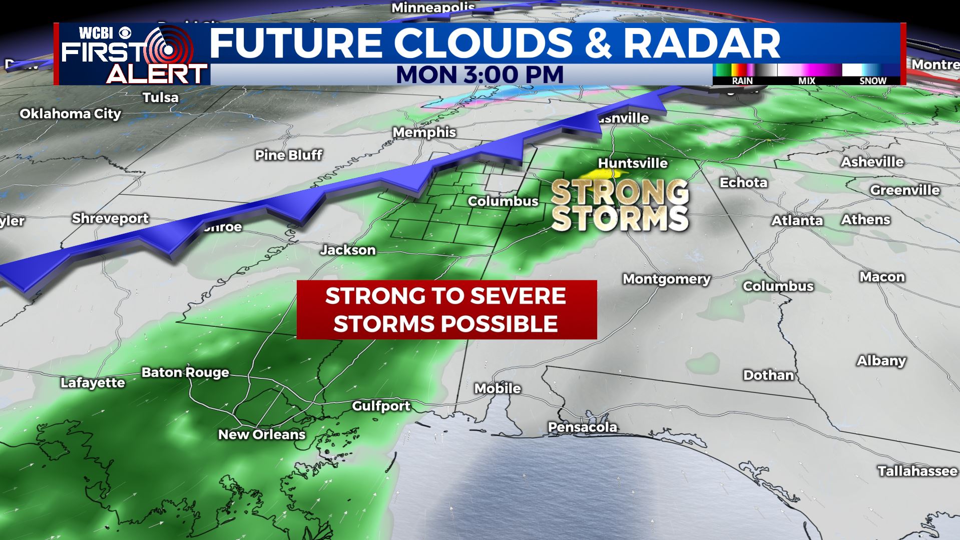
Weekend looks OK, storms Monday
SUMMARY: Fairly quiet weather is expected for the weekend but it may start off on a cloudy note Saturday morning, with perhaps even a few showers. We should have more sun by Saturday afternoon. Temperatures are expected to warm into the 60s Sunday it actually may end up being the better of the 2 weekend days. A cold front will spark showers and storms on Monday, some of which may be strong to severe. Stay tuned for more details on that this weekend. Sunny and cooler weather slides back in starting Tuesday.
SATURDAY: Morning clouds and isolated showers with more sun as the day wears on. Highs mainly in the 50s. Winds WNW 5-10 mph.
SATURDAY NIGHT: Partly cloudy and quiet. Lows in the upper 30s to around 40.
SUNDAY: A mix of sun and clouds. Milder with highs in the mid 60s. Southeasterly winds 5-15 mph. Warmer 50s for lows Sunday night.
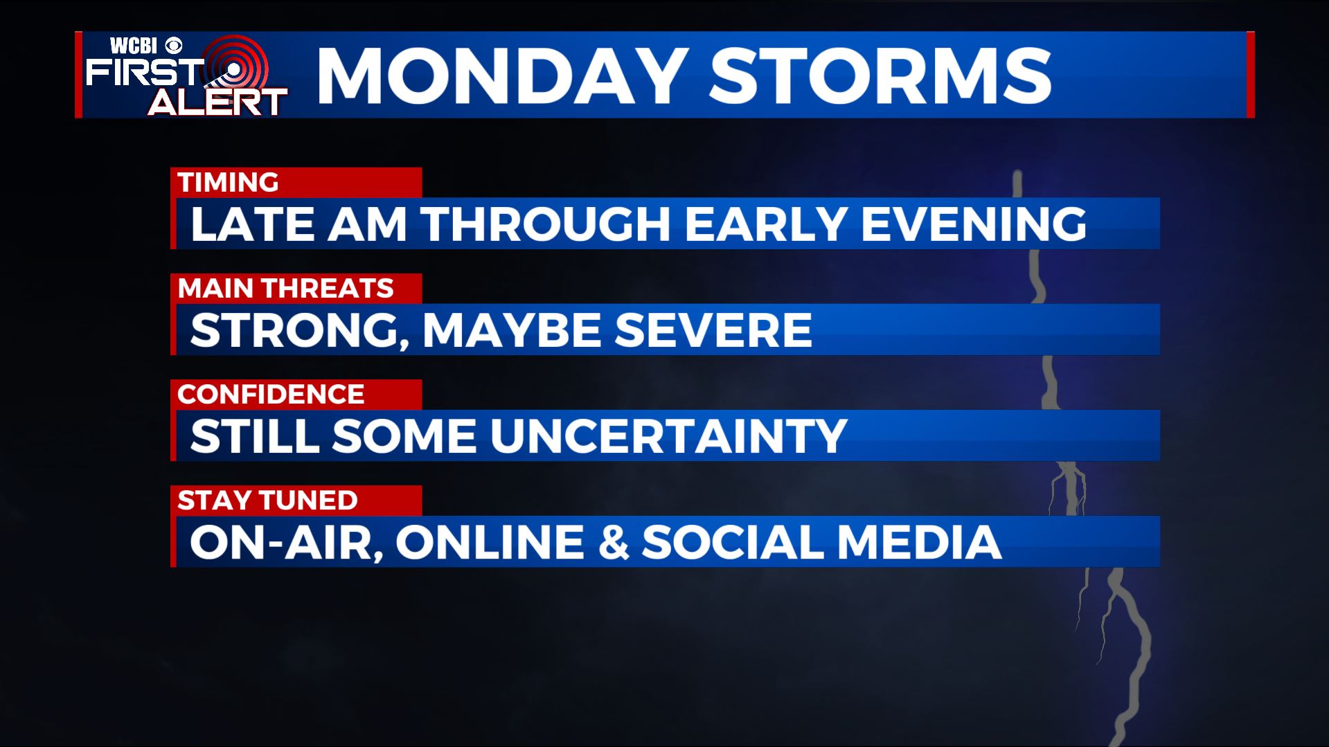
MONDAY: Unseasonably warm highs around 70 are expected with the trade-off being the risk for showers and storms. Some storms may be strong or severe anytime from late morning through early to mid evening. Our recommendation now is to simply stay tuned for updates this weekend as we fine tune the threats and timing for you.
TUESDAY-THURSDAY: Lots of sunshine. Highs in the 40s to low 50s with overnight lows in the 20s.
Follow @WCBIWEATHER on Facebook, Twitter, Instagram, and the WCBI News app


Leave a Reply