Wet & Breezy Saturday
FRIDAY NIGHT: Areas of rain continue along with northeasterly winds between 5 and 10 mph. Temperatures hover in the lower 40s.
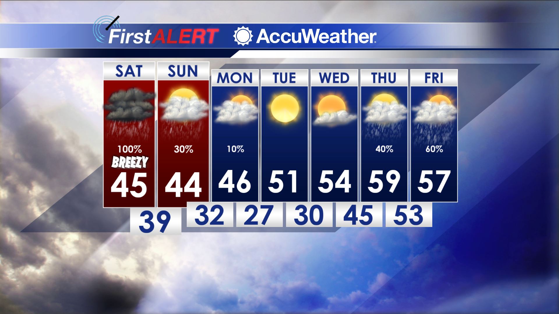
SATURDAY: Cloudy, windy, and wet. The chance of rain is 100% with an additional 1” to 3” of rain possible during the day. Temperatures are expected to hover in the 40s all day long. Northeasterly winds increase between 10 and 25 with some higher gusts.
SATURDAY NIGHT: Showery and cool. Lows in the upper 30s to lower 40s.
SUNDAY: Lingering showers, mainly during the first half of the day. Highs may only top out only in the low 40s under cloudy skies. Winds become northwesterly between 10 and 15 mph.
SUNDAY NIGHT: Cloudy and chilly with lows in the mid 30s. A few stray snow flakes can’t be ruled out but there won’t be any impacts in our area.
MONDAY: The morning will start out cloudy but we’re hopeful for some breaks developing during the day. Highs remain in the 40s.
TUESDAY-WEDNESDAY: High pressure returns to the region and that means brighter skies and warmer 50s.
THURSDAY-FRIDAY: Another few rounds of rain are possible but details remain unclear. Highs should remain in the 50s.
Follow @WCBIWEATHER on Facebook, Twitter, Instagram, and Snapchat


Leave a Reply