Wet & raw weather maker coming Thursday
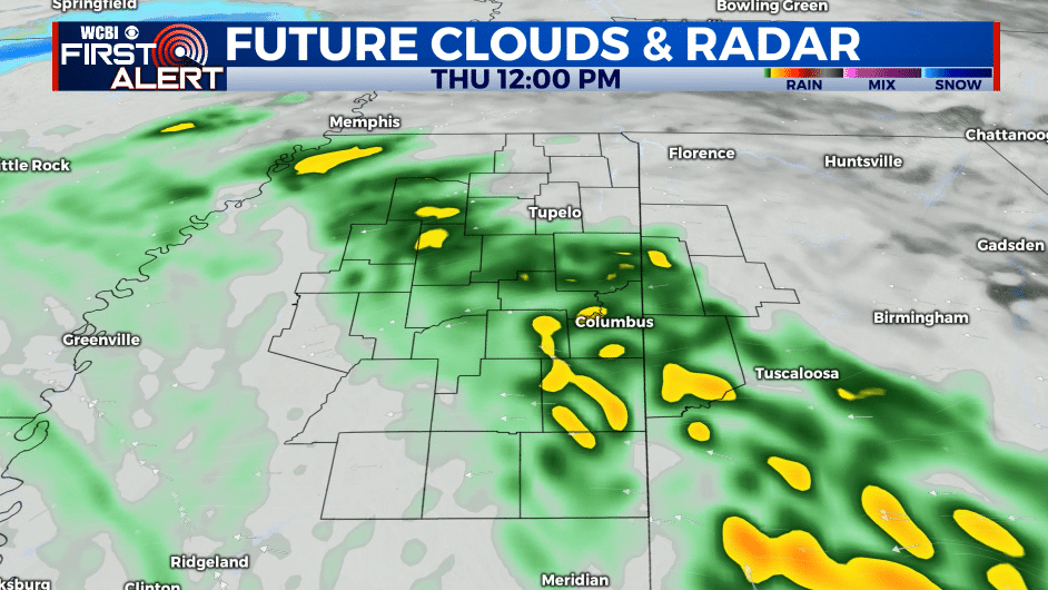
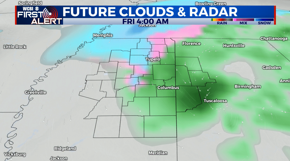
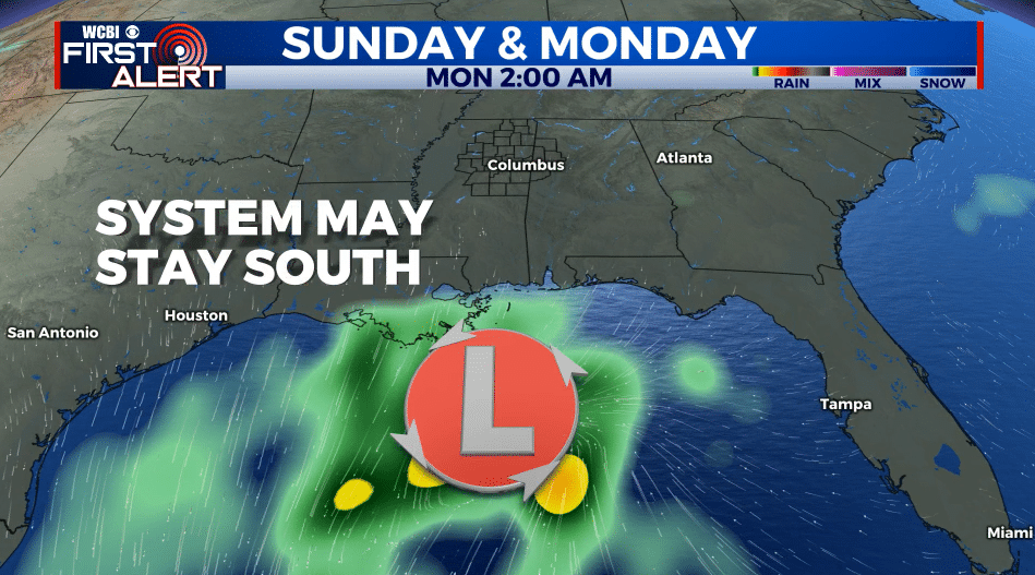
SUMMARY: A weather maker Wednesday night through Friday morning will give our area rain and even the chance of some wet snow. At this point no major winter weather issues are expected with temperatures staying too warm, even if snow can develop Thursday night. Another system late Sunday into Monday will need to be watched but the the most recent data suggest most of it may stay to our south.
TUESDAY NIGHT: Clear and chilly. Lows in the upper 20s. Light wind.
WEDNESDAY: Increasing clouds. Highs in the 50s. Winds ESE 3-8 mph.
WEDNESDAY NIGHT: Cloudy with areas of rain developing from west to east. Lows in the upper 30s to around 40.
THURSDAY: Areas of rain with highs in the 40s. Easterly winds 10-20 mph will make it feel pretty raw and nasty during the day. Some wet snowflakes could mix in during the afternoon and early evening across parts of north Mississippi.
THURSDAY NIGHT: Cloudy with lingering rain and/or snow showers. No major issues are anticipated even if snow develops since temperatures will remain above freezing. Lows in the mid 30s.
FRIDAY: Mostly cloudy and cool. Highs in the low 40s. Lows around 30 Friday night.
SATURDAY: Party to mostly cloudy and chilly. Highs in the low 40s. Lows in the upper 20s Saturday night.
SUNDAY: Party to mostly cloudy. Chilly highs the mid 40s. Lows around 30 Sunday night.
MONDAY: Party to mostly cloudy Highs in the mid 40s. Lows around 30 Monday night.
TUESDAY: Partly cloudy. Highs in the mid 40s.
Follow @WCBIWEATHER on Facebook, Twitter, Instagram, and the WCBI News App


Leave a Reply