Wet through Thursday then drying out
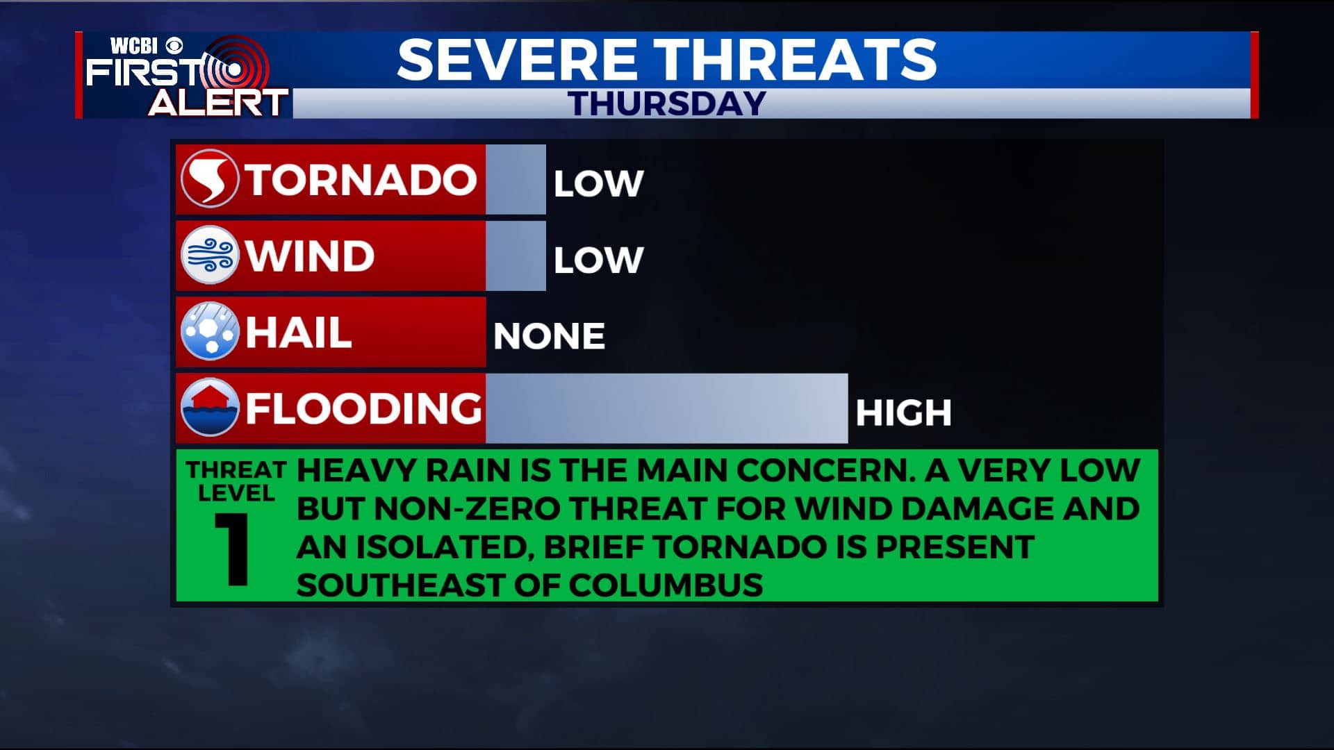
SUMMARY: Widespread steady to heavy rain is expected to continue into Thursday as the remnants of Tropical Storm Beta swirl through the region. Total rainfall may range from 1” to 5” depending on where the heaviest band sets up. Some flooding or flash flooding could occur. There is also a small window of severe weather potential mainly south and east of Columbus Thursday, primarily during the first half of the day, if the air can become unstable enough. Local wind damage and perhaps even a brief tornado can’t totally be ruled out but it’s just a conditional threat at this point.
WEDNESDAY NIGHT: Cloudy with widespread rain. Lows in the 60s. Winds E 10-15 mph.
THURSDAY: Mostly cloudy with areas of rain and even a few storms. Highs around 70. The chance of rain is 90%. Winds shift from the ESE to the NW during the day between 5 and 15 mph.
THURSDAY NIGHT: Cloudy with a few lingering showers possible. Lows in the 60s.
FRIDAY: Cloudy skies to start with some breaks developing as the day wears on. The chance of showers is just 20% or less. Highs top out in the upper 70s. Conditions for high school football are looking mainly dry and quiet.
WEEKEND: Partly cloudy Saturday with a low chance of a shower or storm on Sunday. Highs return to the low to mid 80s while overnight lows stay in the 60s.
NEXT WEEK: Mild early fall weather (highs in the 80s) continues through at least Tuesday but data suggest that a sharp cool down is possible starting Wednesday after more powerful fall front passes. Highs in the 70s are likely by Thursday & Friday along with lows in the low 50s and even 40s.
Follow @WCBIWEATHER on Facebook, Twitter, Instagram, and the WCBI News App


Leave a Reply