Very wet week ahead
SUMMARY: As if this summer has not been wet enough, we are entering a very wet pattern across the region. Saturday looks very wet with several rounds of showers and storms. Sunday and Monday look very similar as well, with mostly cloudy skies and lots of rainfall across the area. Highs will be held down into the low to mid 80s. Some rogue storms could be severe each day with gusty winds and small hail, but most storms should stay under severe limits. Flash flooding is also a possibility with repeated days of heavy rainfall. Rain chances remain very high through Tuesday, before diminishing a bit later in the week. Still, widespread showers and storms are possible each day through the end of the week
SATURDAY: Showers and storms are likely throughout the day on Saturday. Highs will be a bit cooler under mostly cloudy skies, in the low to mid 80s. Upper 70s are not out of the question. Storms will bring heavy rain and gusty winds, and flash flooding and a stray severe storm or 2 is not out of the question.
SATURDAY NIGHT: Showers and storms continue into Saturday night. Cloudy skies, with lows in the low 70s.
SUNDAY: Rain and storms will be even more widespread for Sunday, and a total washout is very possible. Mostly cloudy to cloudy skies, with highs in the low to mid 80s. Flash flood threat will continue.
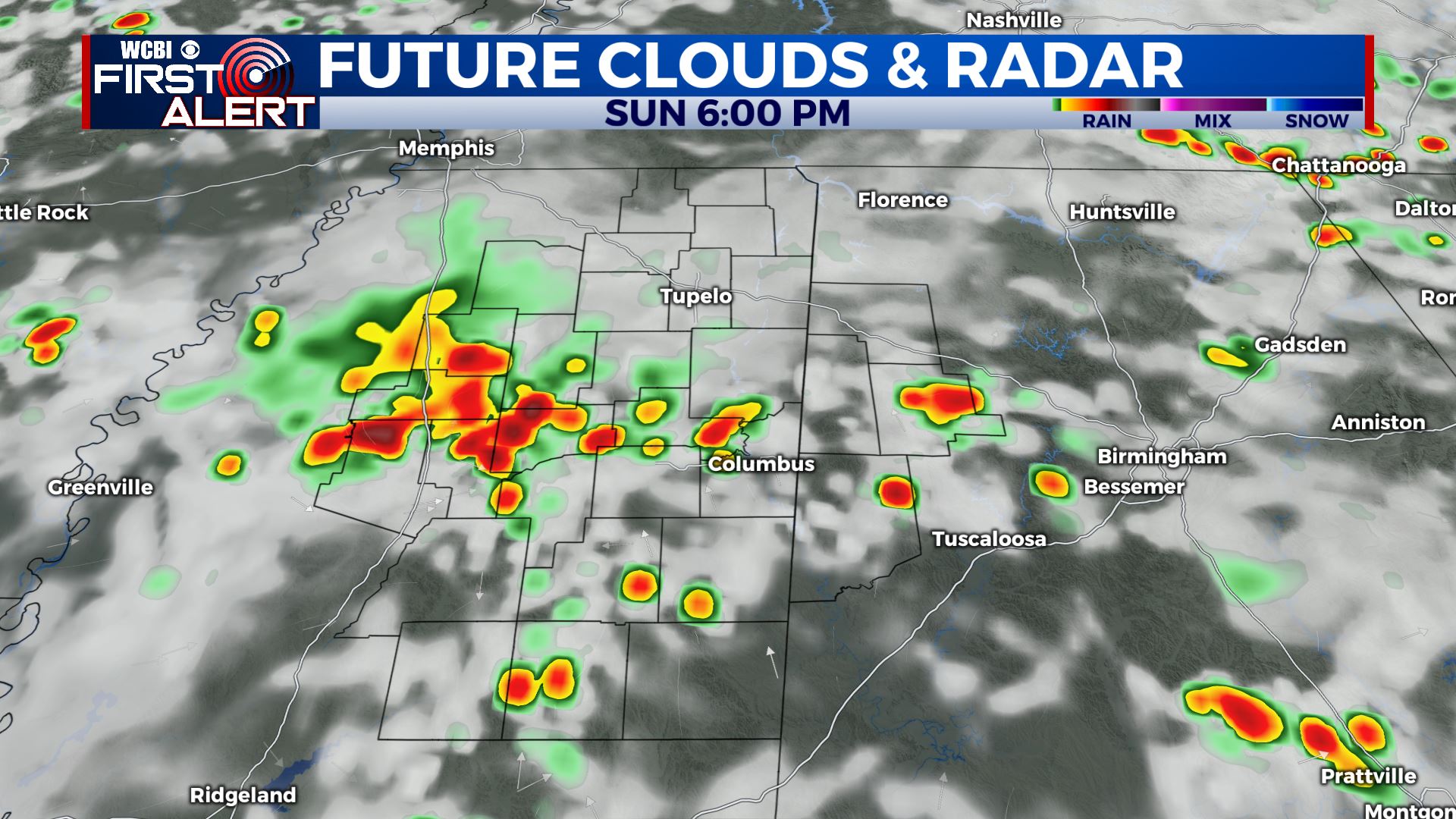
SUNDAY NIGHT: A lull in activity will occur early in the evening, but more showers and storms will move in during the overnight hours. Cloudy skies, with a low right around 70 degrees.
MONDAY TO FRIDAY: Showers and storms will be widespread again on Monday, with temperatures in the low to mid 80s. Flash flooding could become an issue after several days of heavy rain across the area. Tuesday looks quite similar to Monday, with widespread showers and storms throughout the day. Highs in the mid 80s. The rain looks to abate a bit by Wednesday, but still expect some scattered showers and storms throughout the day. This looks to be the case for Thursday and Friday as well, with temperatures rebounding a bit into the mid to upper 80s.
CONNECT WITH @WCBIWEATHER ON TWITTER, FACEBOOK AND INSTAGRAM


Leave a Reply