Wetter Midweek, Strong Storms Saturday Night
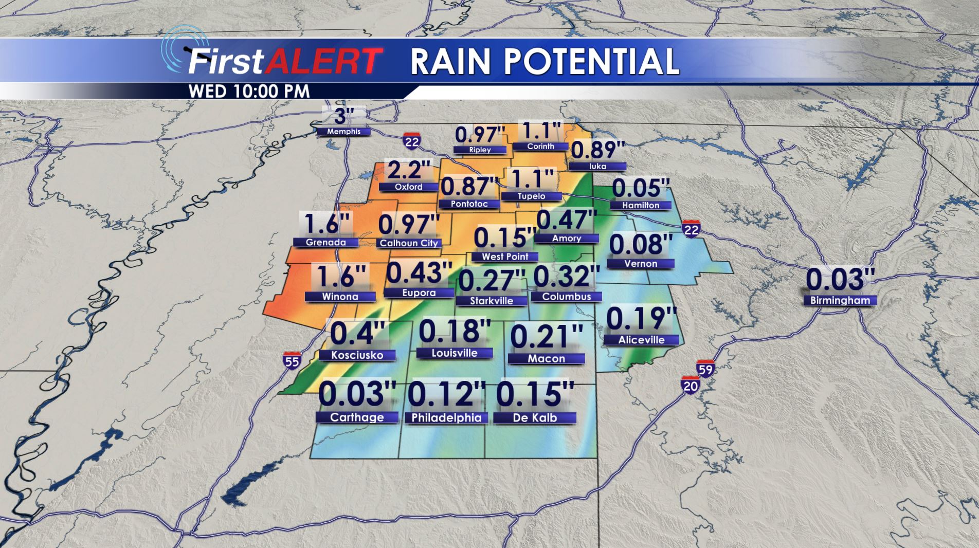
Potential Rainfall Through Wednesday
TONIGHT: Variably cloudy skies will be the norm during the evening but clouds are going to fill in during the night. Lows will only be in the low to mid 60s. Southeasterly winds between 5 and 15 mph will continue.
WEDNESDAY: A frontal boundary will push into the northwestern part of the area. Rain, storms, and cooler 60s and 70s will be more likely northwest of the Golden Triangle. Less rain and warmer highs around 80 will be found closer to the Golden Triangle and points southeast. Winds will be in the 10 to 15 mph range. Rainfall amounts may range from less the 1/4” near Columbus to over 1” near Oxford and to the west.
THURSDAY: Additional showers are possible with the greatest concentration of rain favoring spots along and northwest of the Natchez Trace. Mild highs in the mid to upper 70s are a decent bet across a good chunk of the area. The exception may be our northern and western counties where it may remain cooler.
FRIDAY: We’re all back into the warm and humid air. Highs in the upper 70s to around 80 are likely. Rain chances drop to around 20% or 30%.
SATURDAY: There is a 50% of passing showers during the day. Mild highs near 80 are expected once again. A cold front will pass through Saturday night and it will give us all a chance at some strong to severe storms. It’ll definitely be something to keep an eye on.
SUNDAY: Lingering morning showers are possible with a clearing trend developing during the day. Cooler mid to upper 60s should filter into the region.
Follow @WCBIWEATHER on Facebook, Twitter, Instagram, and Snapchat


Leave a Reply