Windy, Rainy, & Stormy Thursday
WEDNESDAY NIGHT: Showers develop as southeasterly winds increase between 10 and 25 mph. The strongest winds will occur late tonight. Milder lows in the low 50s are expected around the region.
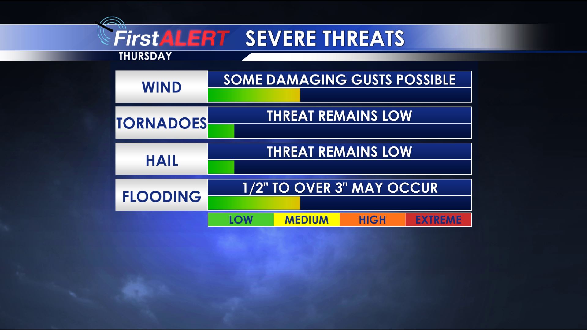
THURSDAY: It’s going to be a windy and unsettled day all around the Twin States. Southeasterly winds are going to continue between 15 and 25 mph with some gusts over 30 mph at times. Showers are possible during the morning and early afternoon with heavier rain and gusty storms possible from about 2 p.m. through about 10 p.m. in our area. The potential for some damaging gusts to 60 mph exists with the storms but the tornado and hail threat still appears low in north Mississippi and west Alabama. We’ll continue to monitor things as they develop but the most unstable air still looks like it’ll stay across central and southern Mississippi. We do have the risk for heavy rain between 1” to 3” (or more) through Thursday night. Some flash flooding is possible.
Severe Threat Thursday
FRIDAY: A few showers may linger during the morning but we still anticipate brighter and drier conditions as the day wears on. Look for highs in the 60s.
WEEKEND: Shower chances will continue in the region as disturbances move in from the southwest. Highs in the 50s are likely both Saturday and Sunday. Lows may dip back into the 30s Saturday morning but 40s are more likely Sunday morning.
MONDAY: Additional showers and perhaps a few storms are possible as yet another disturbance swings through. We’re going to keep highs in the 50s for now. Early data suggest it may be a bit damp for New Year’s Eve celebrations around the area.
NEW YEAR’S DAY: A drier air mass may return for the start of 2019 as high pressure noses in from the Central Plains. Temperatures may only be in the 40s to low 50s but that’s a big improvement over that bitterly cold first day of 2018 we had last year.
Follow @WCBIWEATHER on Facebook, Twitter, Instagram, and Snapchat


Leave a Reply