Windy Thursday, Severe Threat Lurking
OVERVIEW: Active weather is slated to return to the region over the next week. Some storms are possible Thursday night into Friday but severe weather is unlikely. A more significant risk for severe weather lurks for Saturday afternoon/night. Yet another system may give rise to severe storms next Wednesday/Thursday. Stay weather aware during the coming week and be sure to have multiple ways of getting warning information.
WEDNESDAY NIGHT: Clear and quiet. Overnight lows in the upper 50s to around 60. Southeasterly winds between 3 and 7 mph.
THURSDAY: Partly cloudy, warm, and windy. Highs should top out in the low to mid 80s. Southerly winds between 15 and 25 mph will develop with some gusts topping 30 mph.
THURSDAY NIGHT: A narrow line of gusty showers and storms may push in from the west after midnight. At this point no severe weather is expected. Overnight lows may only fall back into the low to mid 60s.
FRIDAY: A cold stalls across the area and that means a continuing chance of showers and storms. There is the potential for a few isolated strong storms Friday into Friday night but it;s still a bit uncertain. Highs should remain in the mid to upper 70s.
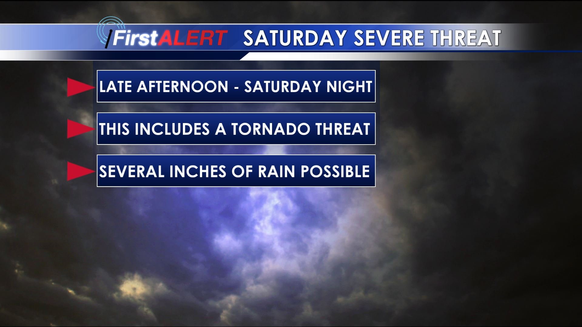
SATURDAY: Some showers and storms are possible during the morning through early afternoon but any big severe weather episode is not currently expected during this part of the day. A bigger, more significant batch of storms is possible anytime from late in the afternoon through Saturday night. All modes of severe weather are possible with the second round of storms, including tornadoes. Afternoon highs now look like they’ll be in the upper 70s to around 80. Several more inches of rain are possible through Saturday night and that may lead to more flooding issues around the area.
Saturday Storm Threat
SUNDAY: Storms should clear out during the morning hours but a few isolated showers/storms could redevelop during the rest of the day. Any severe threat appears like it’ll end by mid morning at the latest. If we’re lucky we’ll see a mix of sun and clouds for the 2nd half of the day along with highs in the 70s.
NEXT WEEK: Mostly sunny to partly cloudy conditions settle back in for Monday and Tuesday. It’ll be pretty nice with highs in the 70s Monday and near 80 Tuesday. Lows are going to dip back into the 40s. Another round of strong to severe storms is possible sometime Wednesday into Thursday.
Follow @WCBIWEATHER on Facebook, Twitter, and Instagram


Leave a Reply