Wintry Mix On The Way!
A WINTER WEATHER ADVISORY IS IN EFFECT FOR AREAS NORTH AND WEST OF THE NATCHEZ TRACE FROM WEDNESDAY MORNING THROUGH THURSDAY MORNING. A MIXTURE OF FREEZING DRIZZLE/RAIN, SLEET AND FLURRIES ARE ALL POSSIBLE. NO MAJOR IMPACTS ARE EXPECTED, BUT SOME MINOR SLICK SPOTS MAY OCCUR, PARTICULARLY ON ELEVATED SURFACES.
TONIGHT: Look for temperatures to fall into the upper 20s and low 30s. Some light wintry mixture in the form of flurries or freezing drizzle can’t be ruled out in spots. No accumulation is expected, and impacts will remain low.
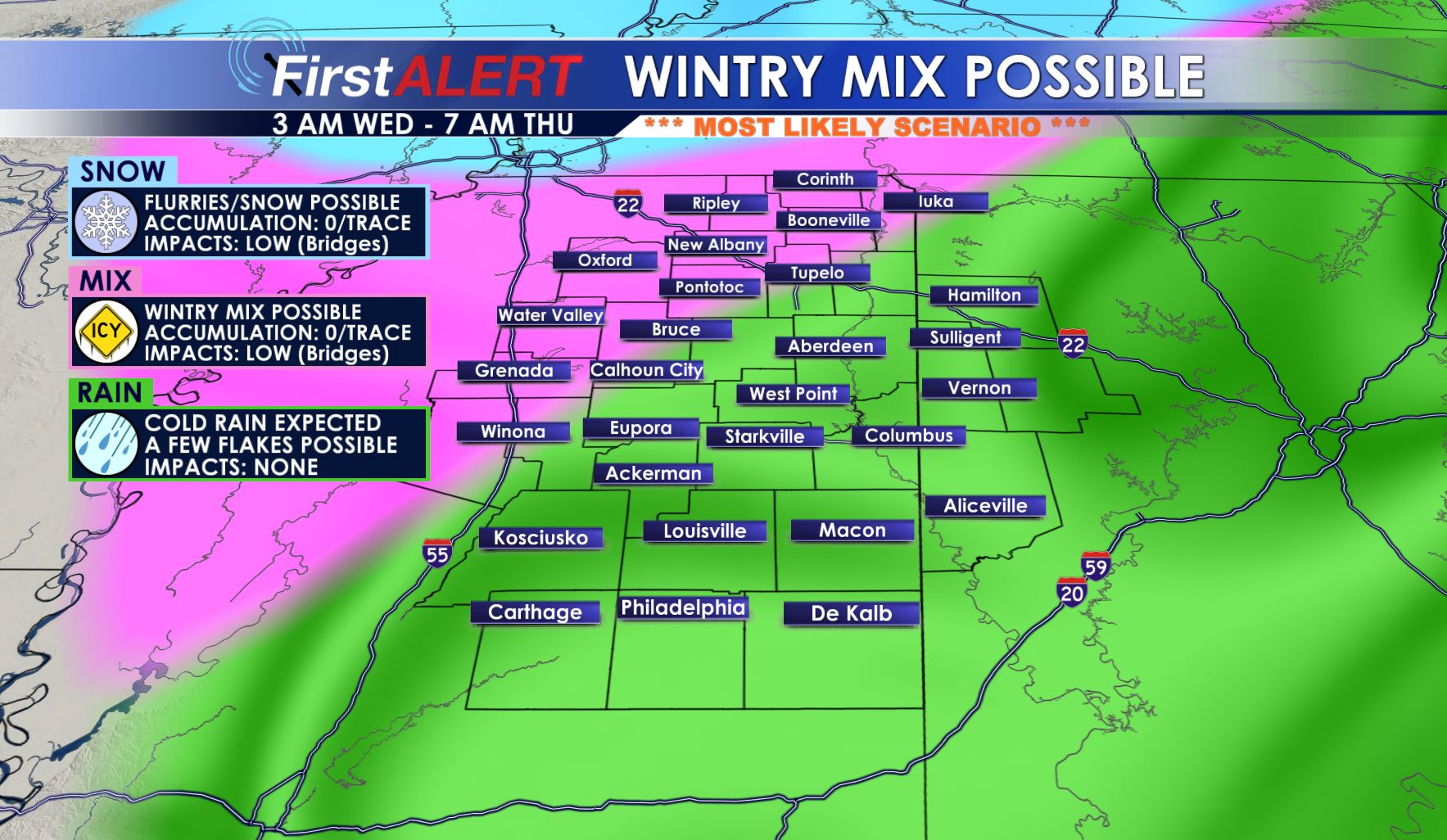
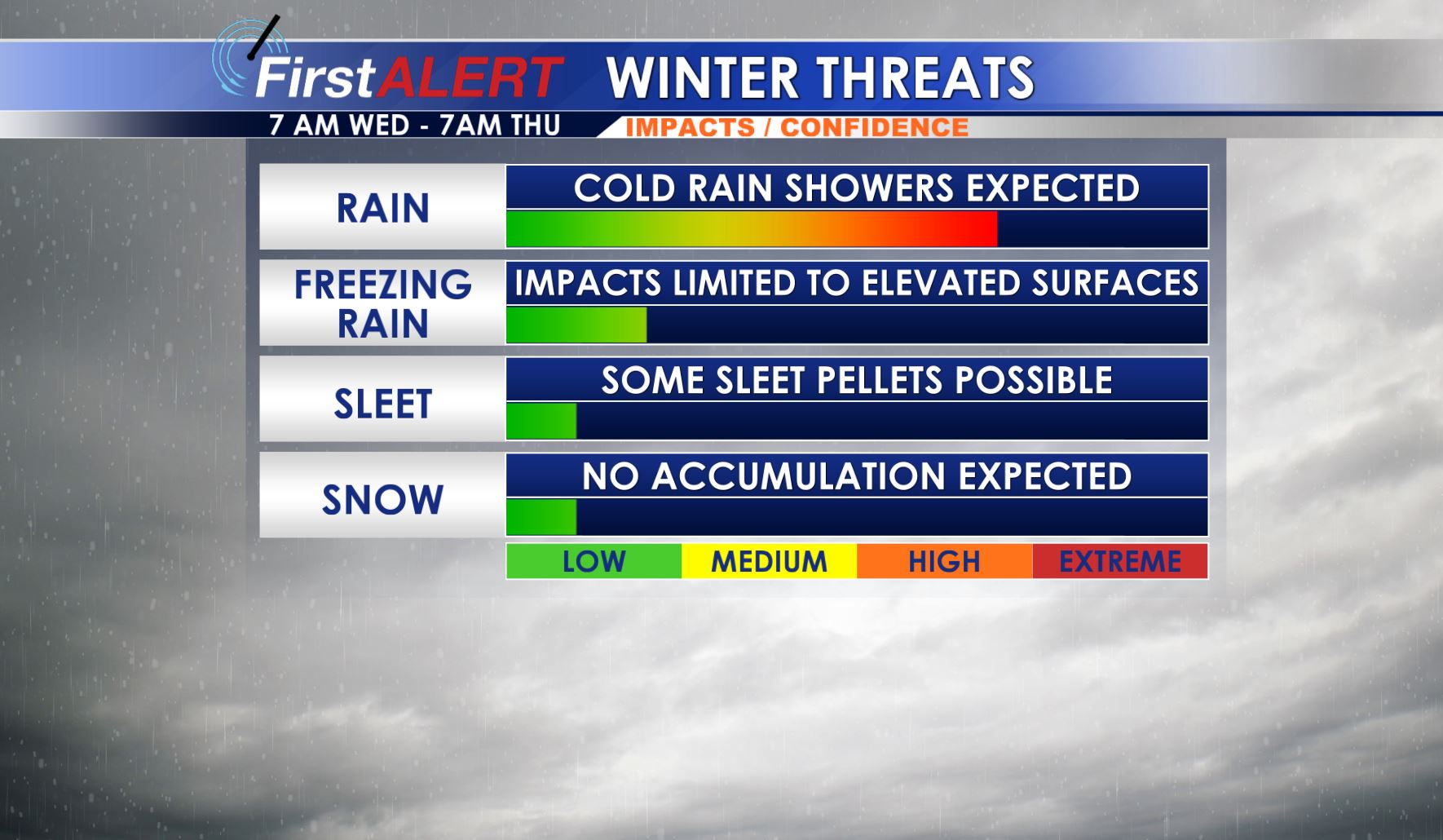
WEDNESDAY: We’ll see showers move into the area mainly in the form of rain along the US 45 corridor by 7AM. Some very isolated pockets of wintry mix are possible along and west of the Natchez Trace. As the showers move north and west, some transition to a wintry mix is possible, but no accumulation of snow/ice are expected, and impacts will remain limited to elevated surfaces. A few slick spots can’t be ruled out on bridges and less traveled roads, particularly in areas under the winter weather advisory. Highs will be in the 30s during the day.
WEDNESDAY NIGHT: As temperatures drop, areas could see a little wintry mix in spots, but impacts will be light. Look for most of it to stay as rain with a few flakes mixing in. Some elevated surfaces and bridges may have some slick spots. Temperatures take a tumble Wednesday Night into the upper 20s and low 30s. Frost is expected.
THURSDAY: Look for temperatures to only reach the mid 40s with any showers/wintry mix expected to move out of the area by early morning. Look for a mix of sun and clouds. Lows Thursday Night fall into the upper 20s and low 30s.
FRIDAY – WEEKEND: Sunshine and warmth returns, we’ll enjoy some upper 50s and low 60s across the area.
FOLLOW @WCBIWEATHER ON FACEBOOK, INSTAGRAM, SNAPCHAT AND TWITTER FOR THE LATEST WEATHER INFORMATION. VISIT WCBI.COM/WEATHER FOR FORECAST UPDATES.


Leave a Reply