Warm & Stormy Pattern Developing

Stormy Days Ahead
SEVERE WEATHER IS POSSIBLE WEDNESDAY NIGHT, FRIDAY AFTERNOON & EVENING, AND SUNDAY
TUESDAY NIGHT: Clear and quiet conditions will be the general rule. Look for lows in the mid 50s.
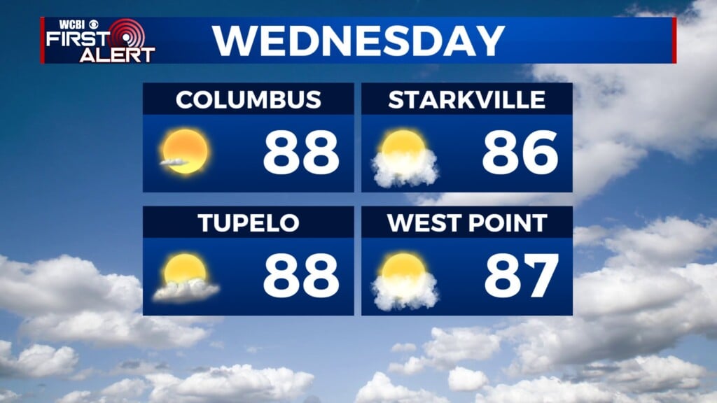
WEDNESDAY: Another mostly sunny and warm day is on track. Highs should be in the mid 80s. Strong southerly winds between 10 and 25 mph will develop and some gusts may be over 30 mph.
WEDNESDAY EVENING/NIGHT: A line of strong storms is expected to cross the WCBI coverage area between about 9 p.m. and 3 a.m. The main severe threats are damaging wind gusts and hail but a spin up tornado or two can’t be ruled out. Lows will be in the 50s.
THURSDAY: A pretty nice day is on tap! We should have plenty of sunshine and comfortable highs in the mid to upper 70s.
FRIDAY: Warmer upper 80s return as southerly winds develop. A few storms are possible during the afternoon and evening hours, especially north of US 82. A few of them may become strong to severe.
SATURDAY: Look for a warm and humid day with daytime highs around 90°.
SUNDAY: We continue to watch for the possibility of a big outbreak of severe weather here in the Deep South. All modes of severe weather will be possible in addition to flooding rains. Details and timing are going to be fine tuned during the coming days so be sure to check back for updates.


Leave a Reply