A sunny but cold start to the new work week
SUMMARY: It’s certainly feeling more like winter as we begin a new work week. We’ll be dry and sunny for the next few days before rain chances return once again for Thursday and Friday. As of now, the weekend is looking sunny and pleasant.
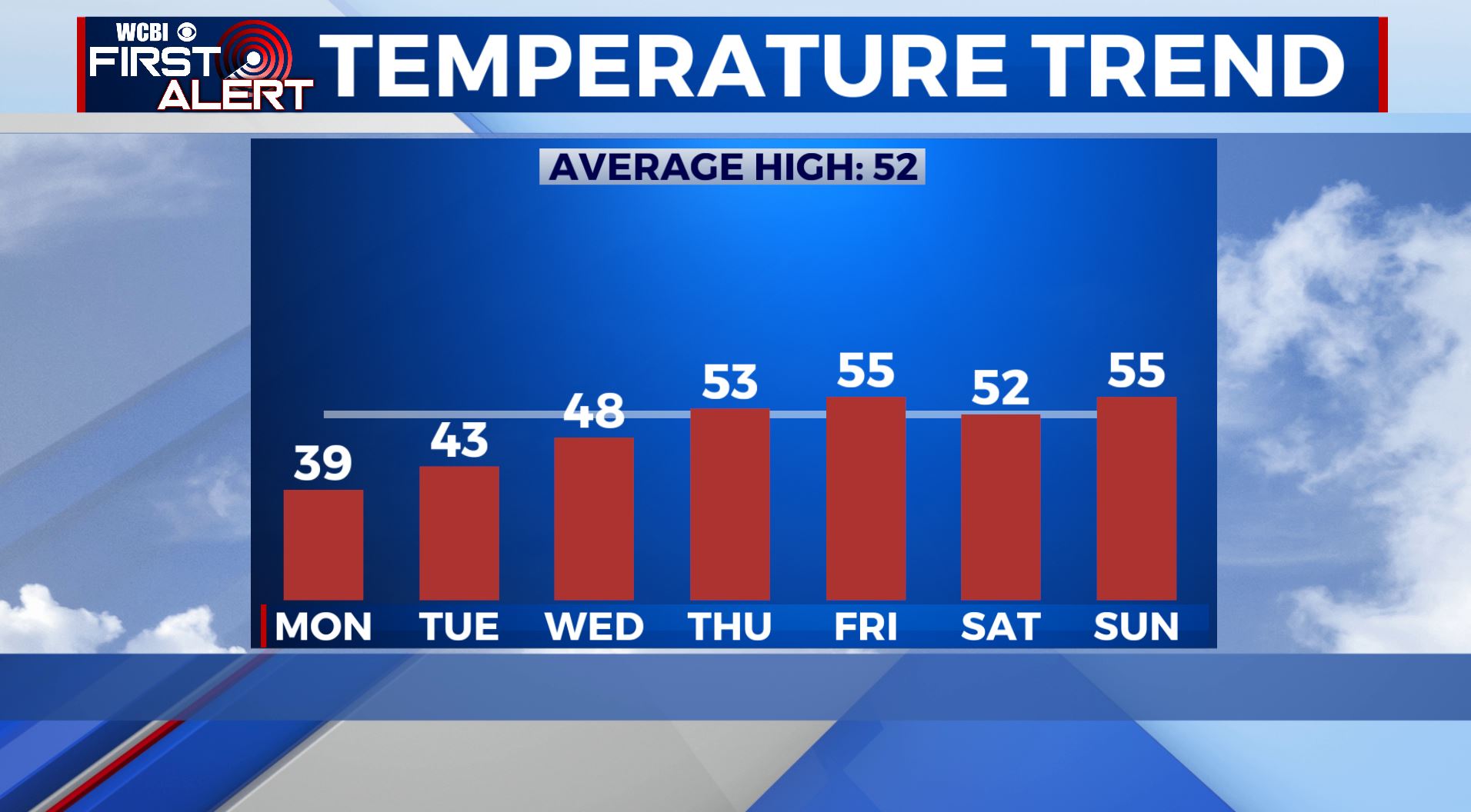
MONDAY: The cold and sunny weather will continue with highs in the upper 30s. Not as windy with NW winds 5-10 mph.
MONDAY NIGHT: Mostly clear skies with morning lows on Tuesday in the upper teens and low 20s.
TUESDAY: Highs on Tuesday will be just a touch higher as we get into the low 40s in the afternoon, but it’ll still be cold. Lots of sunshine.
WEDNESDAY: Clouds will increase through the day on Wednesday as our next storm system approaches. Morning lows will be in the low 20s with temperatures reaching the upper 40s by the afternoon.
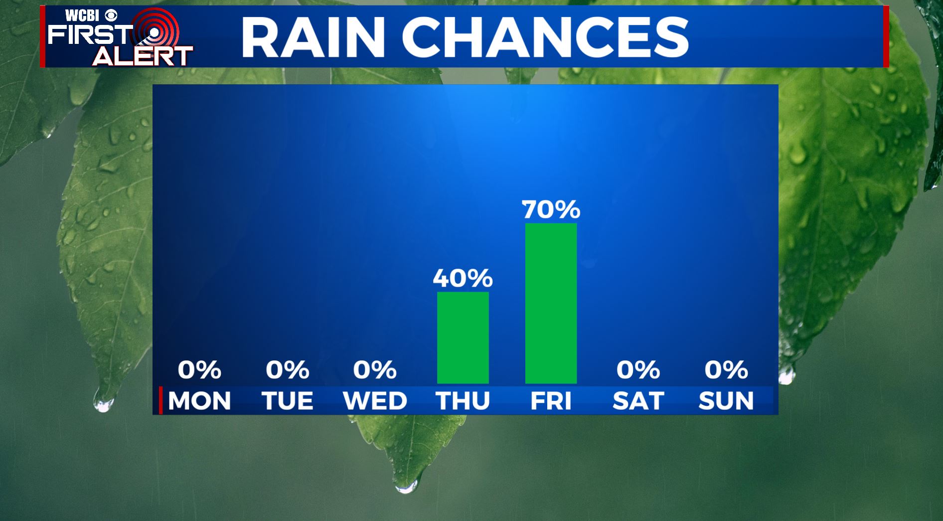
THURSDAY-FRIDAY: Thursday will start off dry, but areas of rain will develop through the afternoon and evening. It’s looking like the best chance for rain will be overnight Thursday, but it’s likely that we see some showers linger into Friday. While some of us could hear a rumble of thunder or two, we’re not expecting any strong to severe storms and rainfall amounts should generally be under an inch. Highs will be in the lower to mid 50s.
THIS WEEKEND: As of now, it looks like any rain and storm activity will exit by Saturday, but a few clouds could linger. A sunny but chilly weekend is ahead with temperatures near average with highs in the 50s and overnight lows in the 30s.
FOLLOW @WCBIWEATHER ON FACEBOOK, INSTAGRAM, TWITTER AND ON THE WCBI MOBILE APP.


Leave a Reply