Active weather pattern picks up as rain returns for Tuesday
SUMMARY: Rain & thunderstorms return to the forecast Tuesday and last into Thursday. The heaviest rain and storm activity is likely on Wednesday with 1-3 inches of rain possible. Some storms on Wednesday also could be on the strong side. Temperatures in the lower 70s before we cool down to the 50s late week.

TUESDAY: Mostly cloudy with rain chances moving in. Mild with highs around 70. Breezy with southerly winds between 10 and 15 mph, gusting up to 20-25.
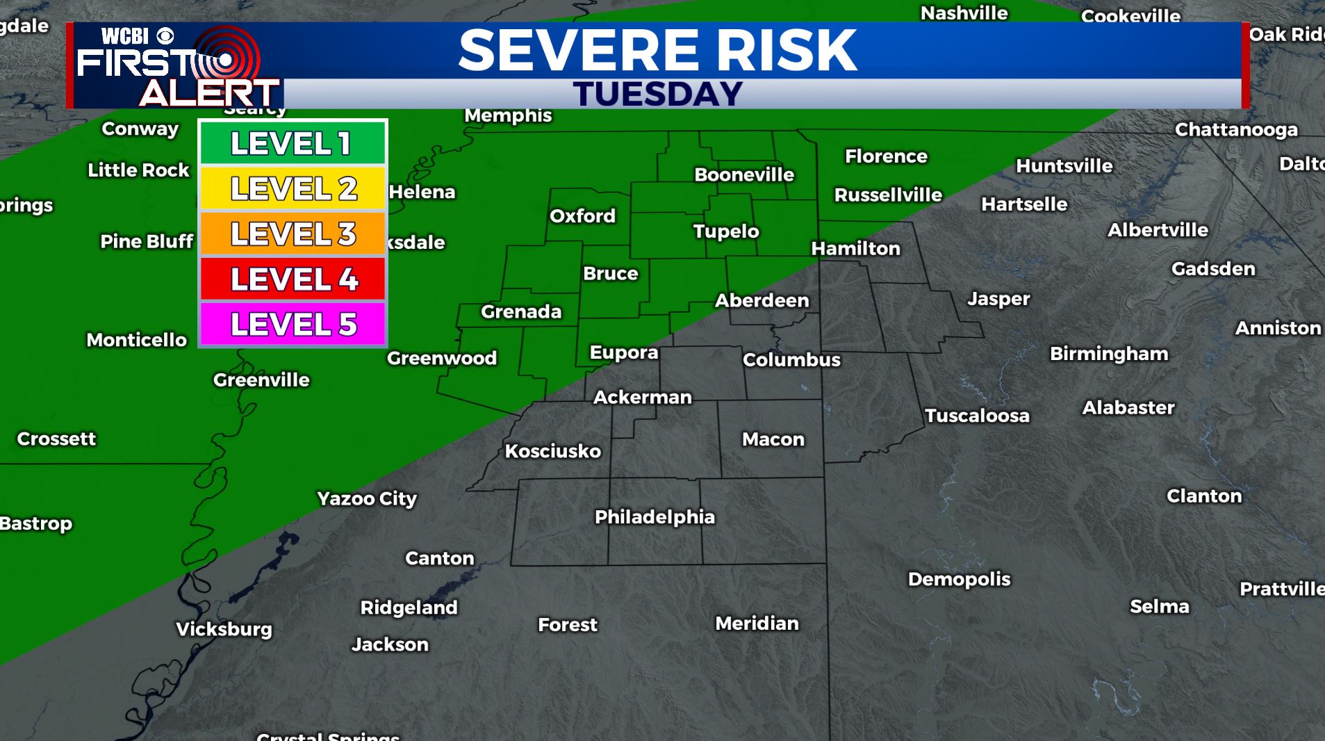
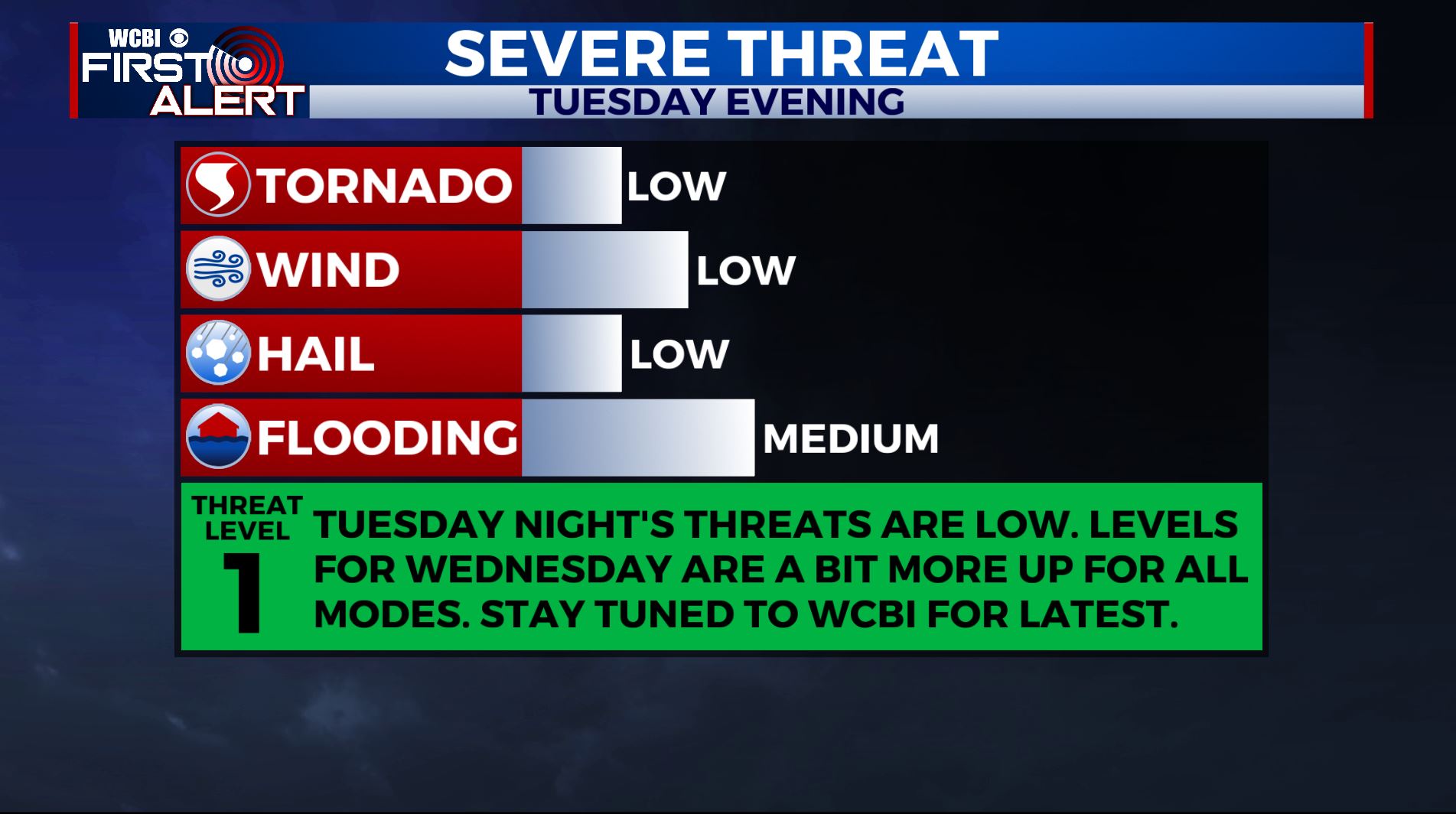
TUESDAY NIGHT: Mild overnight lows in the lower 60s. Scattered showers and storms are possible. While a strong storm can’t be ruled out near I-55 most locations will likely not have any intense activity to worry about.
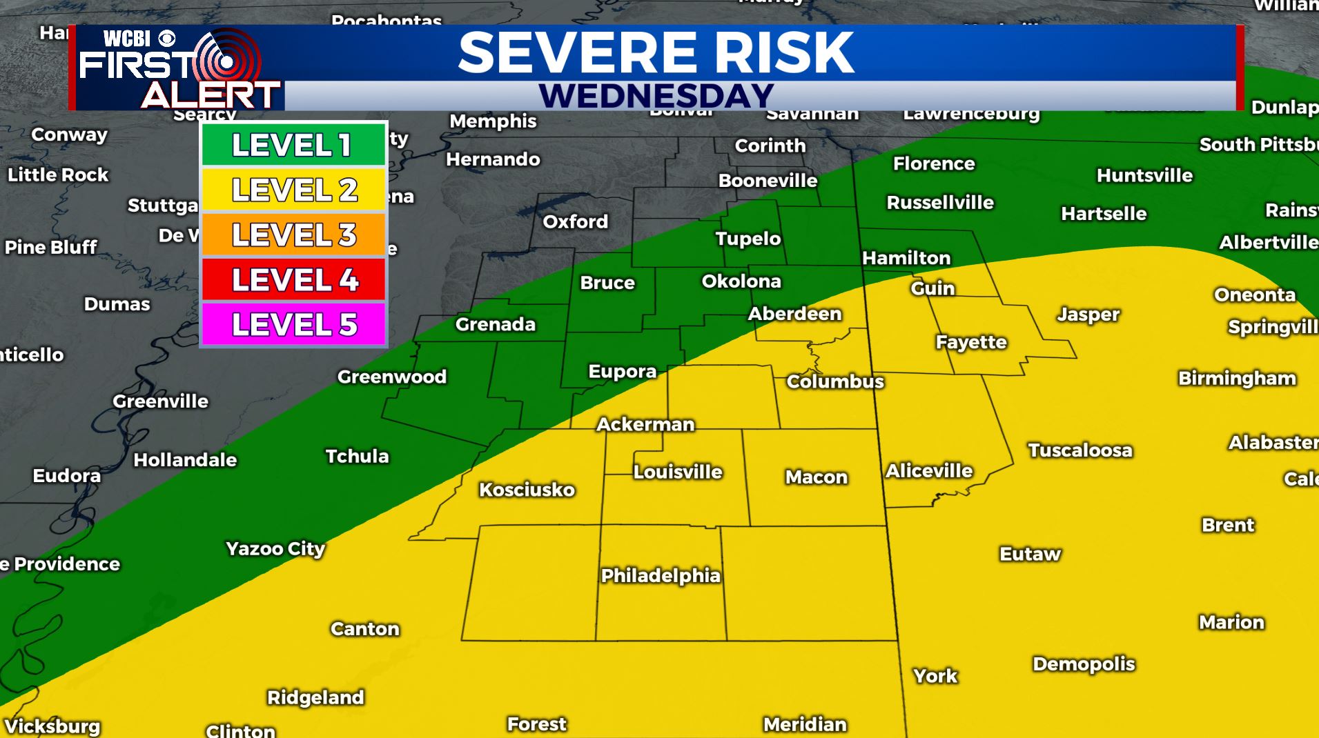
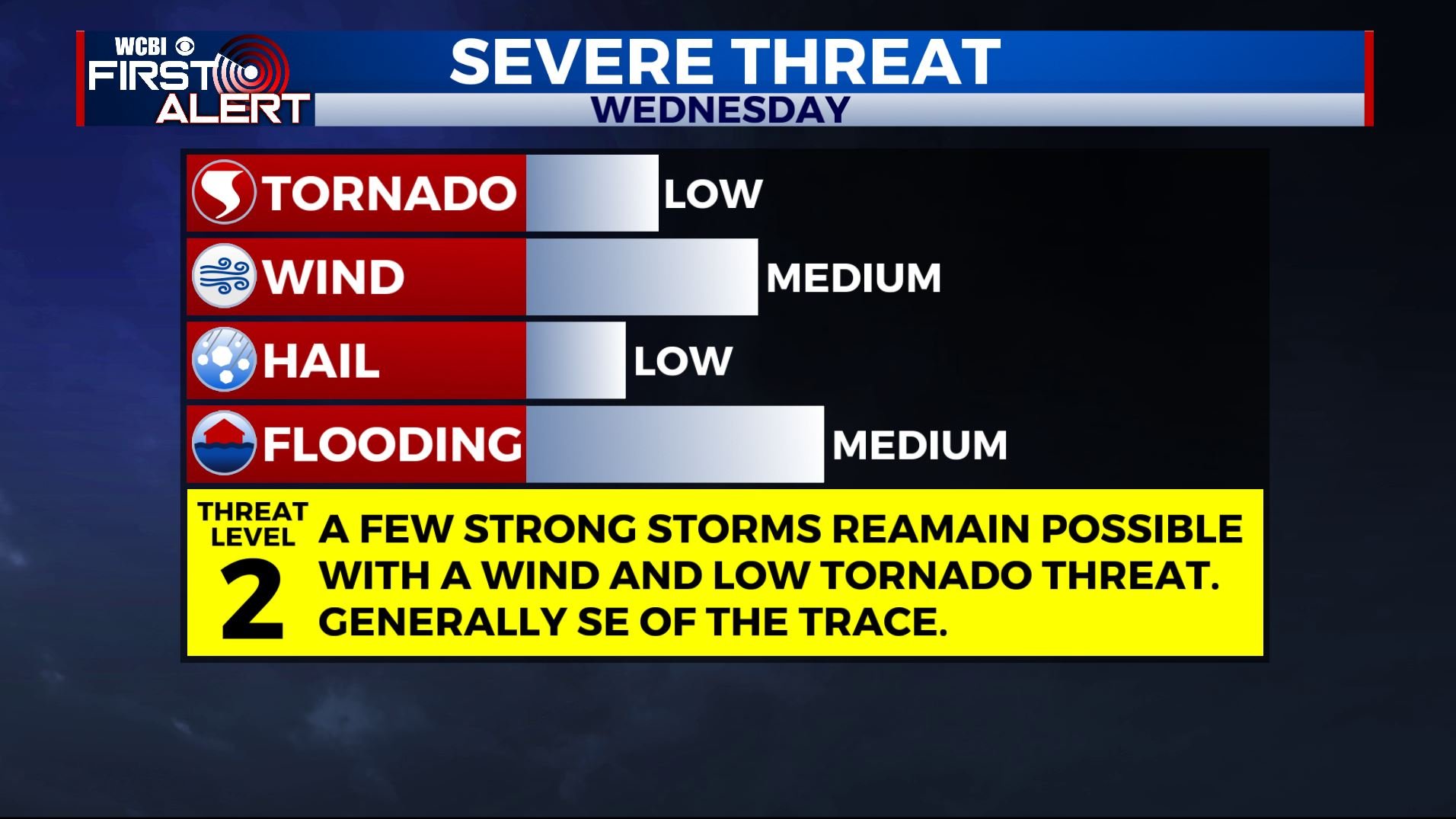
WEDNESDAY: Areas of rain and storms. We’re under a Level 1-2 threat as some storms could be strong with gusty winds and heavy rain being the primary threats. An isolated tornado can’t be ruled out depending how things set up. A big wild card will be whether or not a coastal storm complex develops. If they do then strong/severe storms this far north would be unlikely. However, if they don’t then we’ll have to watch the situation a little more closely. Highs remain in the 60s to lower 70s.
WEDNESDAY NIGHT: Lingering showers. Lows in the upper 40s.
THURSDAY: Mostly cloudy with lingering showers. Afternoon temperatures mainly in the 40s to around 50.
THURSDAY NIGHT: Variably cloudy and colder. Lows in the low 30s.
FRIDAY: A mix of sun and clouds. Highs in the 50s.
FRIDAY NIGHT: Not as cold with lows around 40. Clouds thicken with a few showers possible by Saturday morning.
SATURDAY: Mostly cloudy with a chance of showers. Highs in the lower 50s. Mid 30s for lows Saturday night.
SUNDAY: Partly cloudy. Highs in the upper 50s to low 60s.
MONDAY: Mostly cloudy with another chance of showers. Highs in the mid 60s.
STAY CONNECTED WITH @WCBIWEATHER ON FACEBOOK, INSTAGRAM AND TWITTER AND THROUGH THE WCBI MOBILE APP.


Leave a Reply