Another active weather day for Wednesday
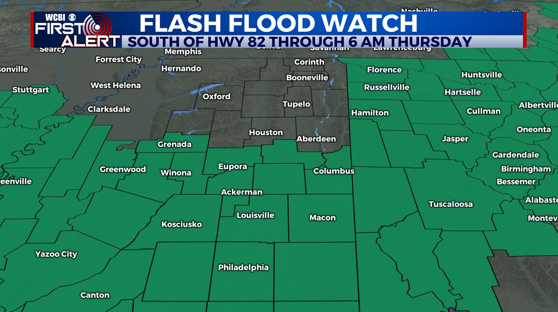
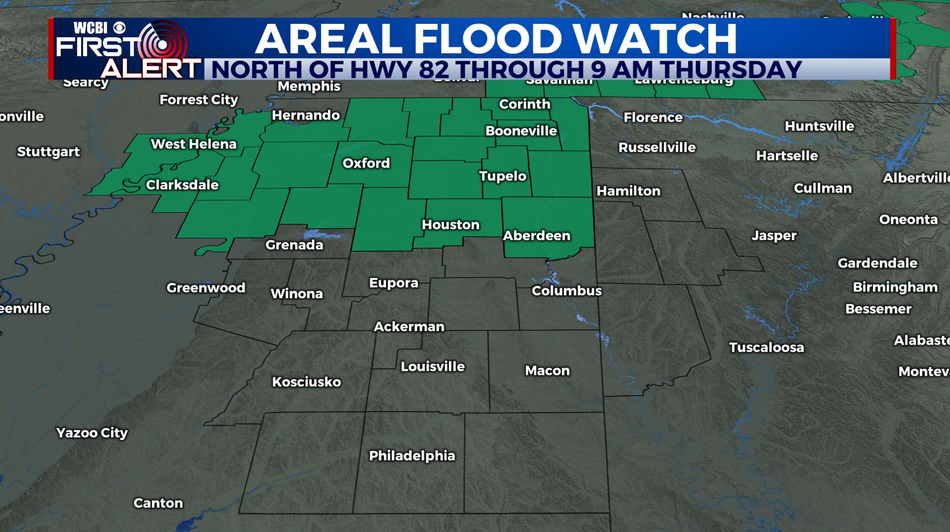
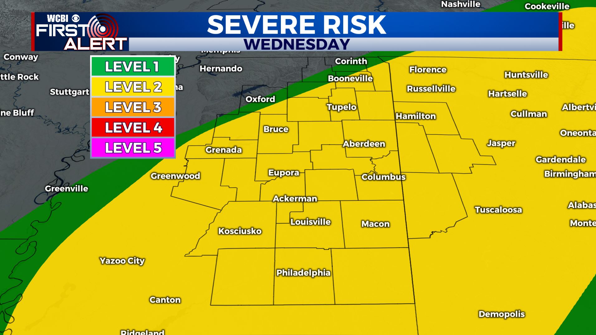
SUMMARY: Flash Flood & Areal Flood Watches remain in effect through Thursday morning. An additional 1-3 inches is expected over the next 24 hours. Heavy rain will continue to pose a flooding threat through Wednesday night. Strong to severe storms are possible Wednesday afternoon and evening. Cooler and drier air is slated to return for the end of the week before wet weather returns by Saturday night and Sunday.
WEDNESDAY: A few showers will be around north Mississippi Wednesday morning but they will exit to the north by midday. Warmer high temperatures in the 60s to lower 70s as a warm front lifts north. The trade off will be a risk for strong to severe storms during the afternoon and evening. We’re right now under a Level 2 Risk. Storms are possible by mid to late afternoon west of the Trace and they’ll march eastward during the evening as a strong cold front pushes through. Damaging wind gusts, heavy rain, and isolated tornadoes will remain possible. SE winds 10-20 mph, gusts up to 30-35.
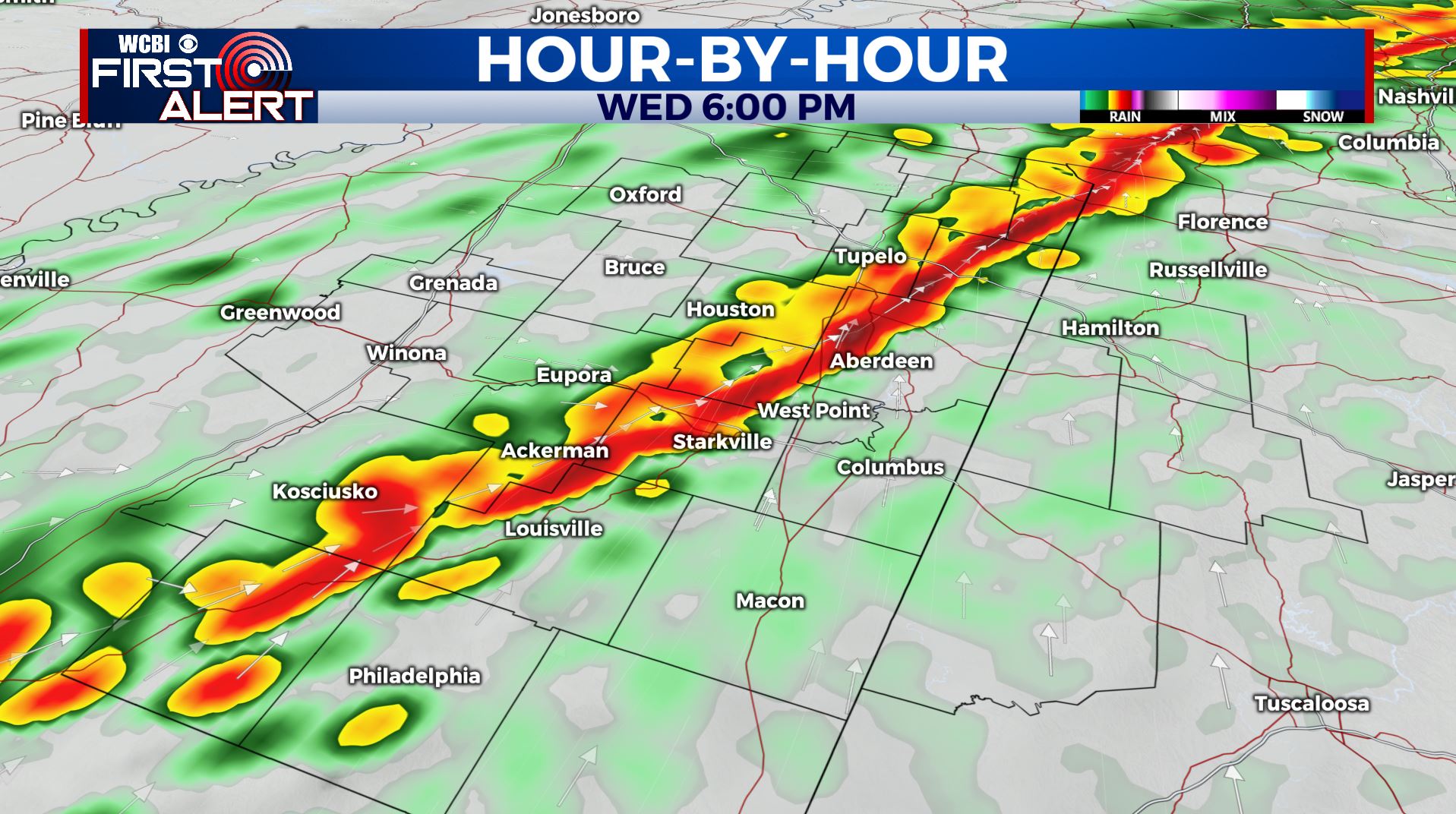
WEDNESDAY NIGHT: Areas of rain and storms. More heavy rain is likely. Lows upper 40s to near 50. S wind 10-20 mph.
THURSDAY: Morning rain followed by drier conditions with a mix of sun & clouds. Highs cooler in the low to mid 50s. NW winds 5-10 mph.
THURSDAY NIGHT: Clearing. Much colder lows around 30.
FRIDAY: Sunny and cool. Highs only in the mid to upper 40s.
FRIDAY NIGHT: Clear and chilly. Lows in the 20s.
SATURDAY: A nice start with clouds increasing during the afternoon. A few showers are possible late in the evening but most of the day looks dry. Highs in the mid to upper 50s.
SUNDAY-EARLY NEXT WEEK: Areas of rain and thunder. Highs in the 60s.
Follow @WCBIWEATHER on Facebook, Twitter, Instagram, and the WCBI News App.


Leave a Reply