A drier and nice day ahead for Tuesday
SUMMARY: Happy Fat Tuesday! After a rainy Monday, a much drier day is ahead with our weather with a mix of sun and clouds. Highs will be in the lower 60s. If you’re heading to in New Orleans tonight, it will be mostly cloudy with temps in the upper 50s. Less active but cooler temperatures are in the forecast for the rest of the week. Areas of light showers are possible Wednesday, but no widespread heavy rain or severe weather is likely through next Monday.

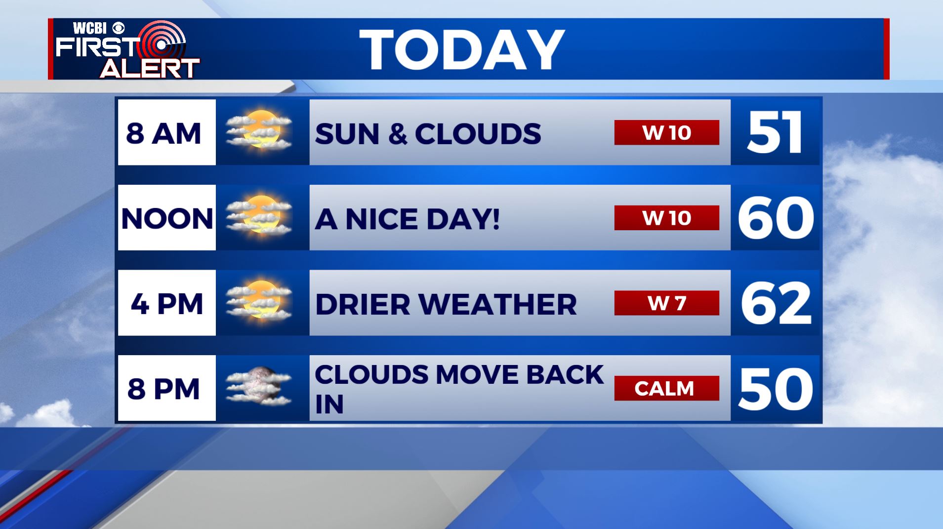
TUESDAY: A mix of clouds and sun. Highs in the lower 60s. Winds W at 5-10 mph.
TUESDAY NIGHT: Mostly cloudy with some showers possible overnight into Wednesday morning. Overnight lows in the lower 40s.
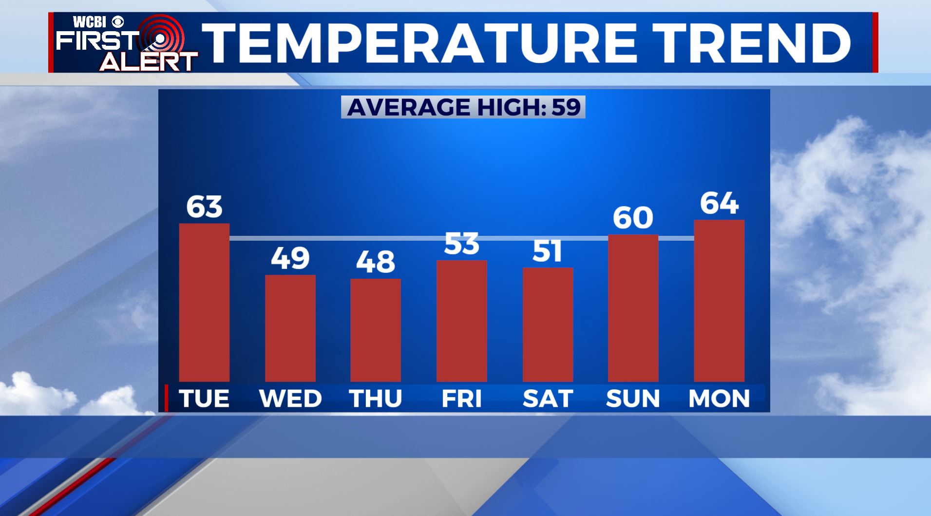
WEDNESDAY: Mostly cloudy and cooler. We have a chance of light showers, but not looking to be a big deal. Highs in the mid to upper 40s.
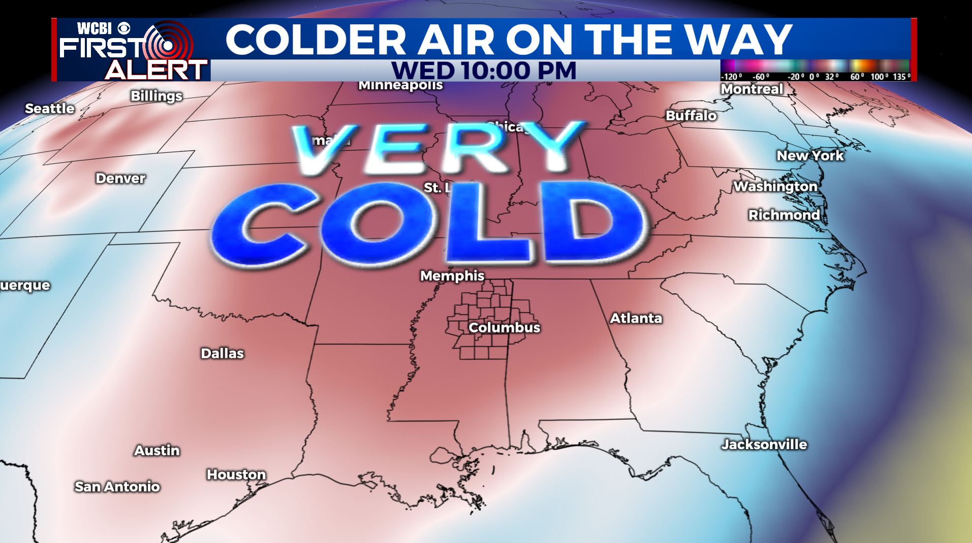
WEDNESDAY NIGHT: Gradual clearing. Much colder lows in the upper 20s to around 30.
THURSDAY-FRIDAY: We’ll have sunny skies as we wrap up the work week. High temperatures will only go up to the upper 40s to lower 50s. Overnight lows in the upper 20s to lower 30s. A weak system could produce some light rain mixed with some flakes Friday night so stay tuned for updates on that.
WEEKEND: Mostly sunny on Saturday with a few clouds moving in by Sunday. Highs in the 50s Saturday before warming to near 60 by Sunday. Overnight lows in the 30s to 40s.
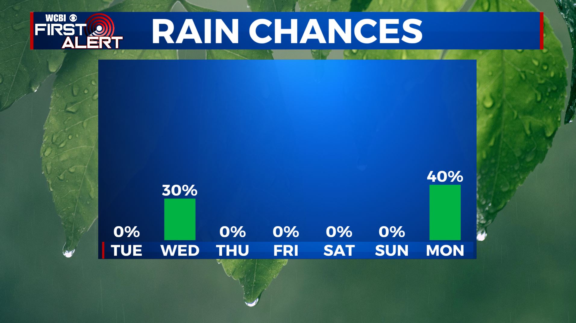
EARLY NEXT WEEK: Temperatures will warm up to the lower to mid 60s by Monday out ahead of the next system to come our way. Some showers may develop on Monday but better odds of rain and storms are likely to exist Tuesday into Wednesday. We’ll have to keep watching the potential for strong to severe storms along with more heavy rain.
Follow @WCBIWEATHER on Facebook, Twitter, Instagram, and the WCBI News App


Leave a Reply