Showers then cooler temperatures for your Tuesday
SUMMARY: A quick moving system will give us showers & some storms this morning. While a few stronger storms are possible with hail & gusty winds can’t be totally ruled out across our southern counties, the odds of severe weather are much higher along and south of I-20. Wednesday and Thursday look to be the best days this week cooler temperatures and mostly sunny skies. There some slight chances of rain in the forecast for Friday into early next week.
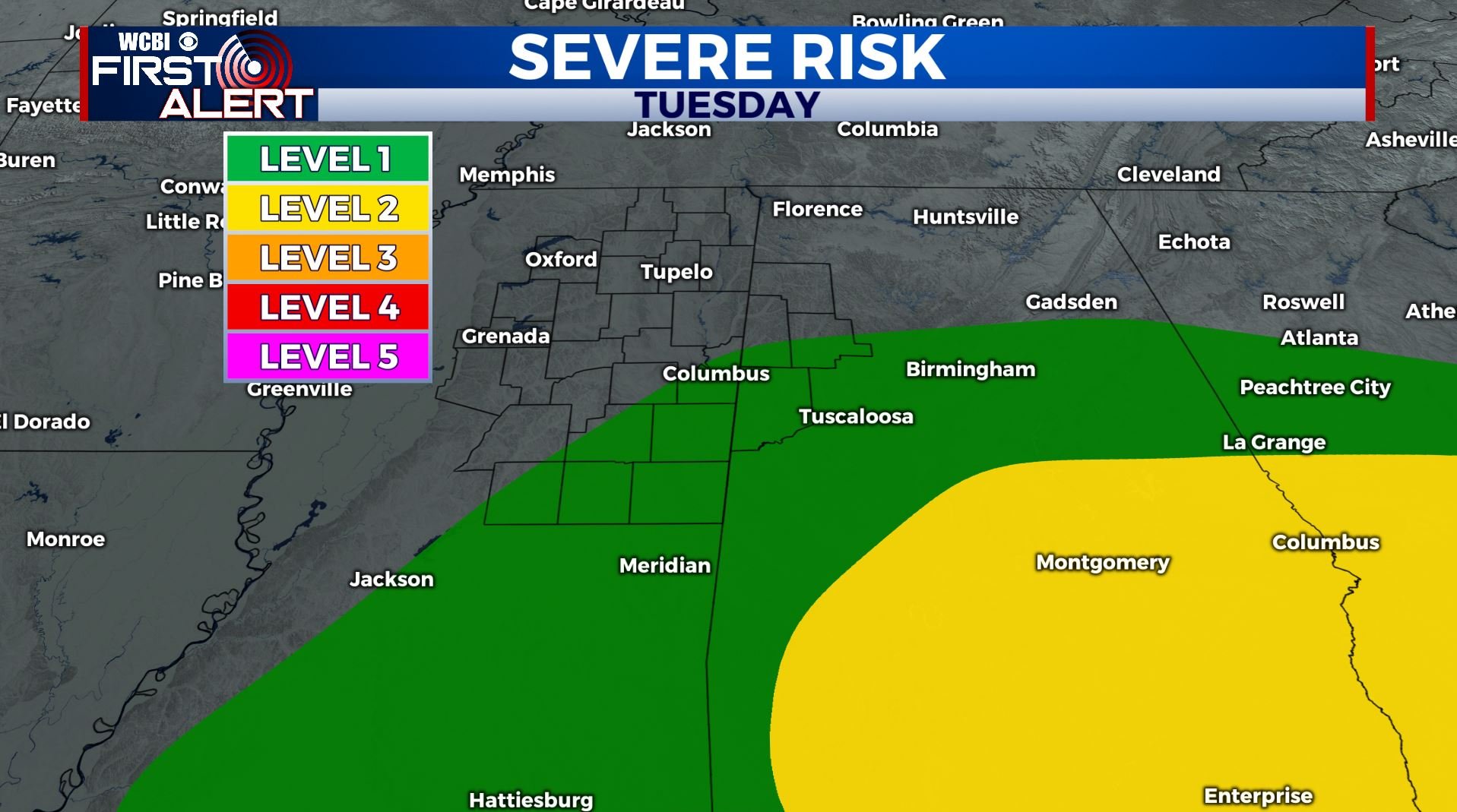
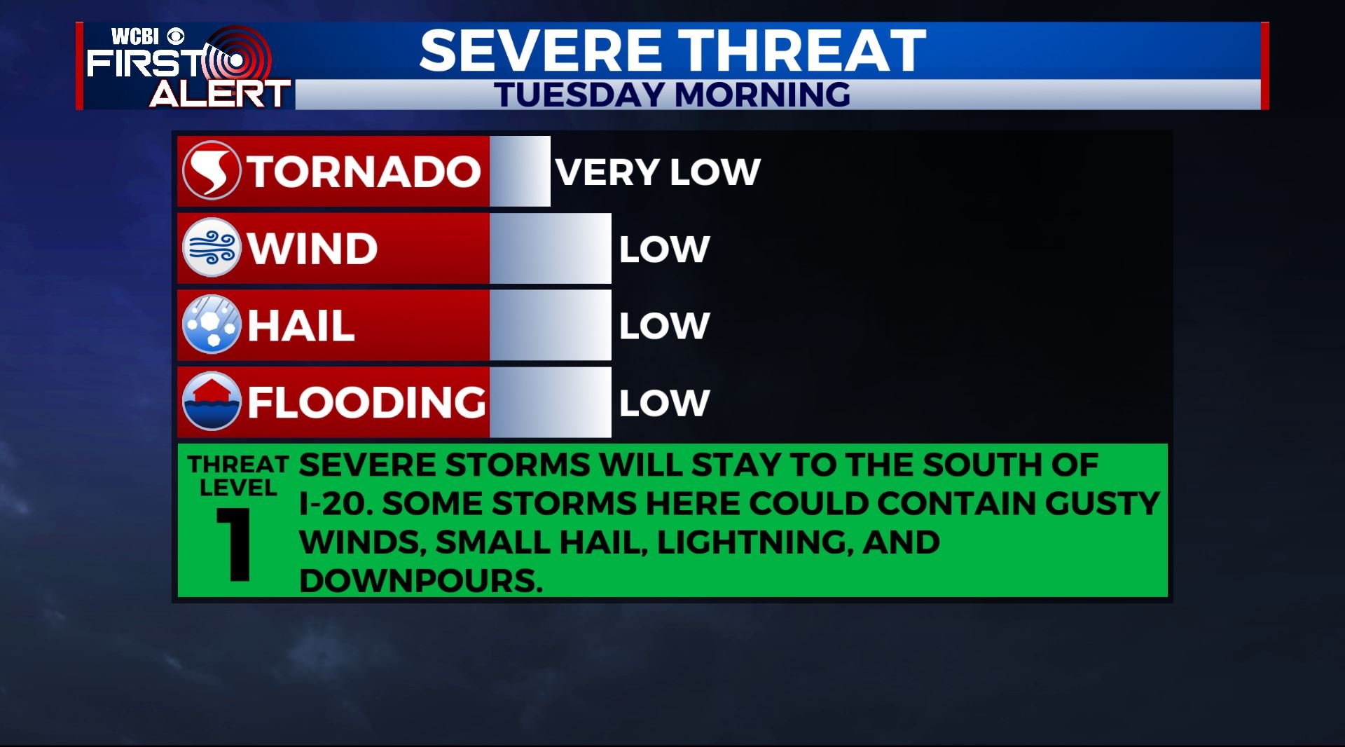
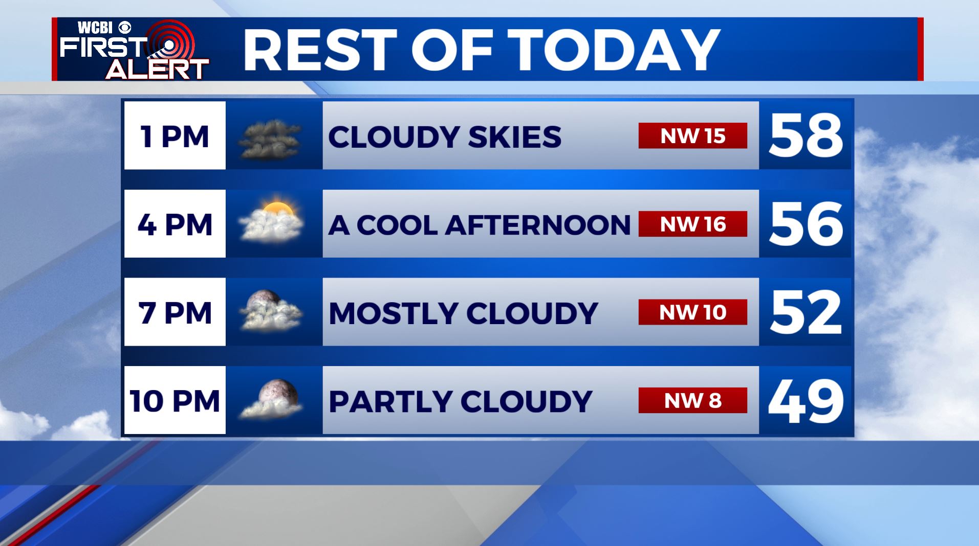
TUESDAY: Rain and storms likely, especially before noon. Severe weather is not a major concern as the warm front will be south of us from the I-20 corridor and south. Temperatures increasing to only the upper 50s by the afternoon as rain exits. Mostly cloudy and breezy. Winds NE to NW 10-15 mph with gusts up to 20. Total rainfall may range from 1/4″ to over 2″.
TUESDAY NIGHT: Mainly clear and cool. Lows in the lower 40s. Some upper 30s are also possible.
WEDNESDAY: Lots of sunshine expected. Highs in the mid 60s. Light N wind 5-10 mph.
WEDNESDAY NIGHT: Mainly clear and cool. Lows in the low 40s.
THURSDAY: Mostly sunny and pleasant. Highs in the lower 70s. Upper 40s to near 50 degrees for lows Thursday night.
FRIDAY: A mix of sun & clouds. Just a slight chance of a shower. Highs in the lower to mid 70s. Lows in the 50s Friday night.
SATURDAY: Partly cloudy and mild with some scattered showers possible. Highs in the mid to upper 70s.
SUNDAY: Mostly cloudy with a few more showers possible. Highs in the mid to upper 70s.
MONDAY: Mostly cloudy with scattered showers still possible. Highs in the upper 70s.
Stay connected with @WCBIWEATHER on Facebook, Twitter, Instagram, and the WCBI News App


Leave a Reply