A sunny, cooler & windy day for Wednesday
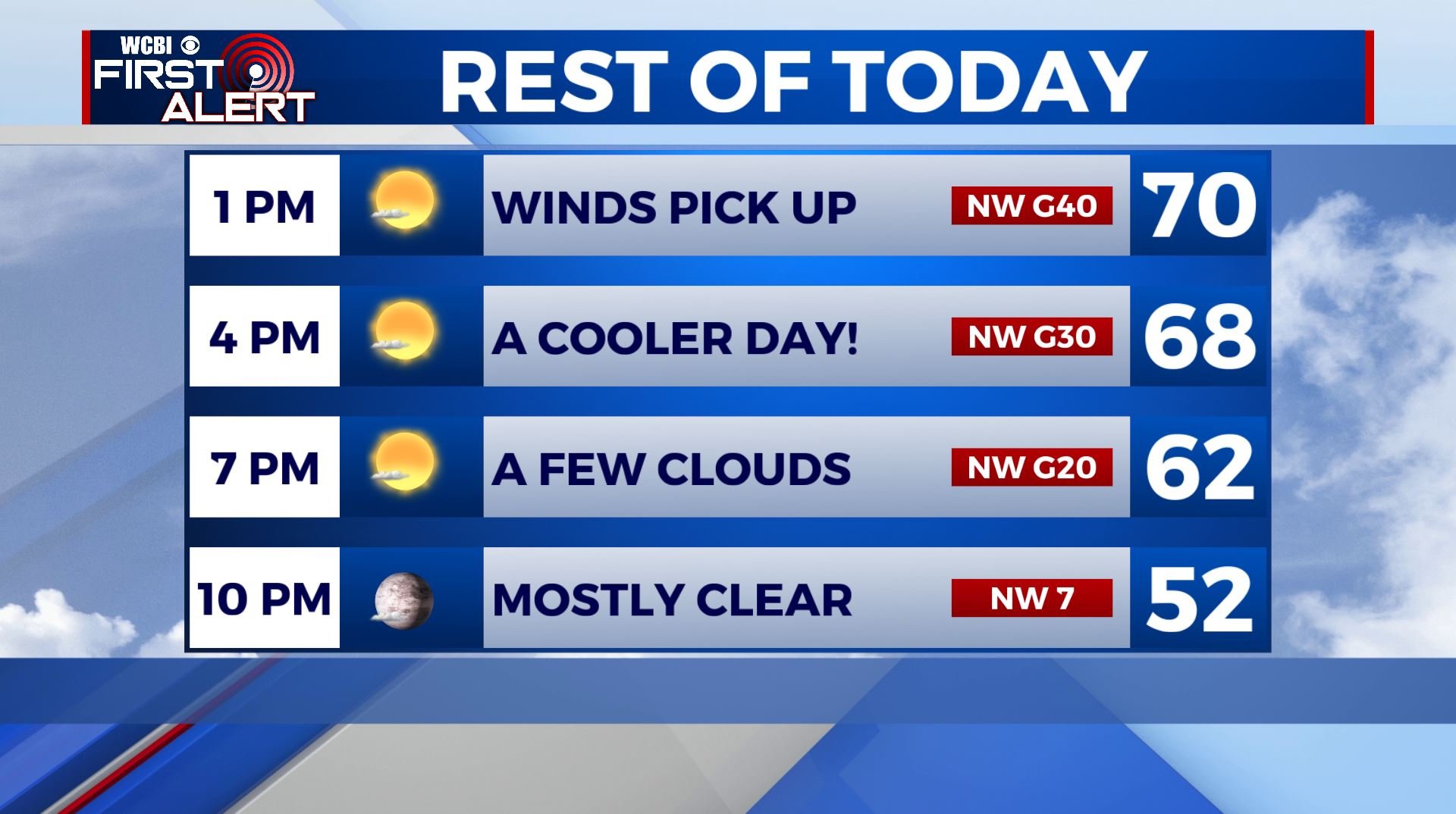
SUMMARY: The second half of the week will be unseasonably cool but sunny. A Wind Advisory is in effect from 10am to 7pm Wednesday for parts of the WCBI Viewing Area due to NW winds picking up throughout the day 20-30 mph, gusts up to 35-40 mph. The one exception of the nice & quiet weather pattern will come Friday when areas of rain and thunder will push across the region with a cold front. Mother’s Day weekend will be cooler but pleasant.
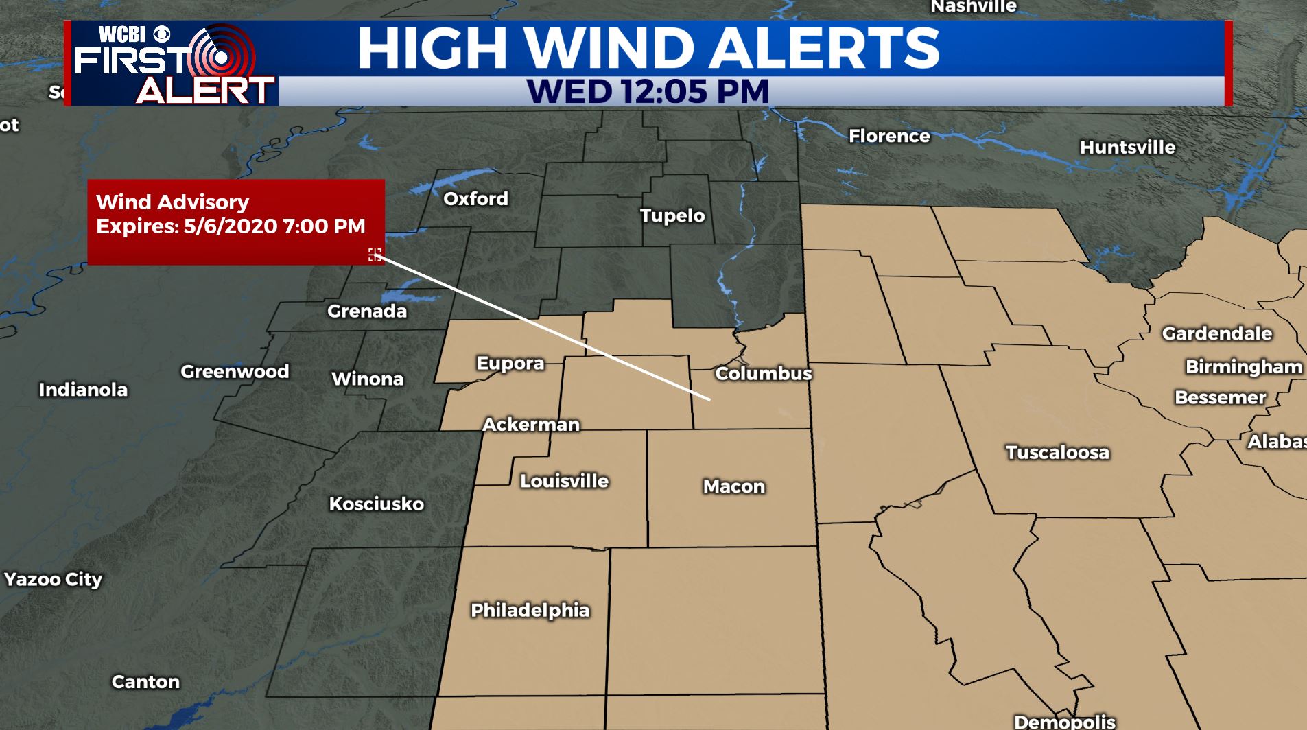
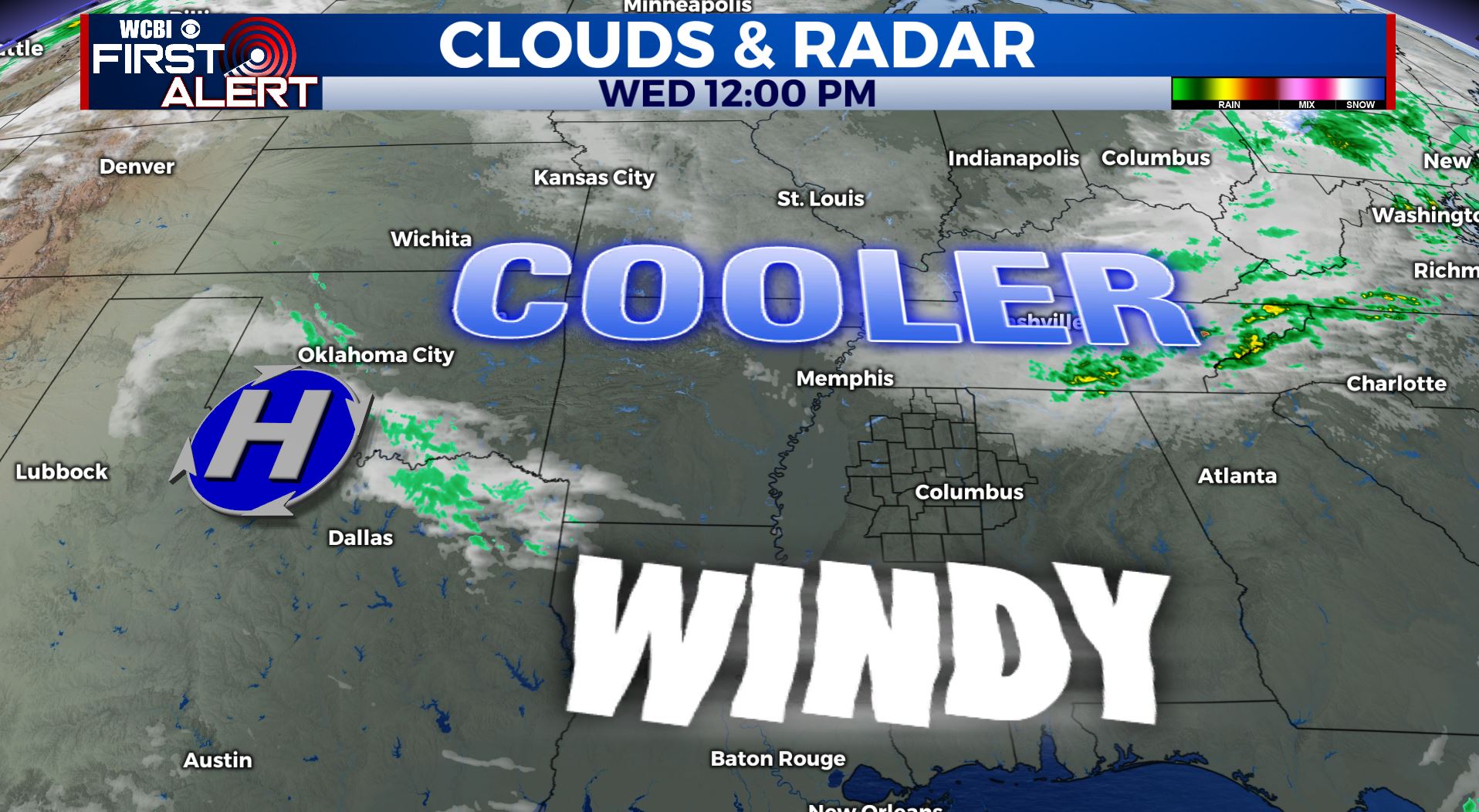
WEDNESDAY: Mostly sunny and cooler as high pressure builds in. Highs ranging from the upper 60s near 70. Breezy NW winds 20-30 mph with 35-40 mph gusts.
WEDNESDAY NIGHT: Mainly clear and cool. Lows in the lower to mid 40s.
THURSDAY: Mostly sunny to partly sunny. Highs back up into the lower 70s.
THURSDAY NIGHT: Increasing clouds. Lows in the 50s.
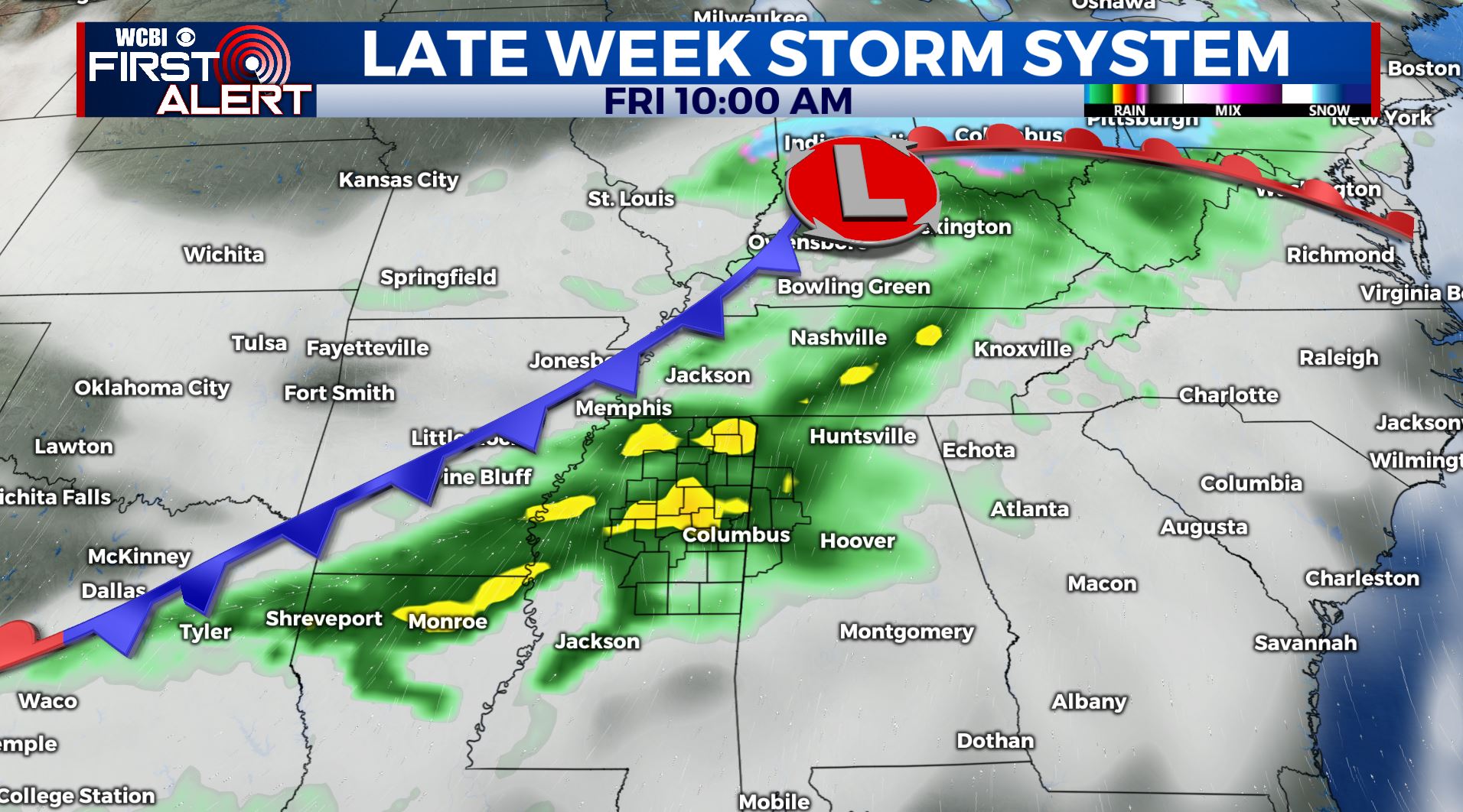
FRIDAY: Cloudy with areas of rain and thunder as out next cold front pushes through. Rainfall during the day may range from 1/2″ to 1 1/2″. Highs top out in the upper 60s.
FRIDAY NIGHT: Clearing skies. Lows in the low 40s. We may get very close to some old record lows again.
SATURDAY: Sunny and quite cool for mid May. Highs mainly in the mid to upper 60s.
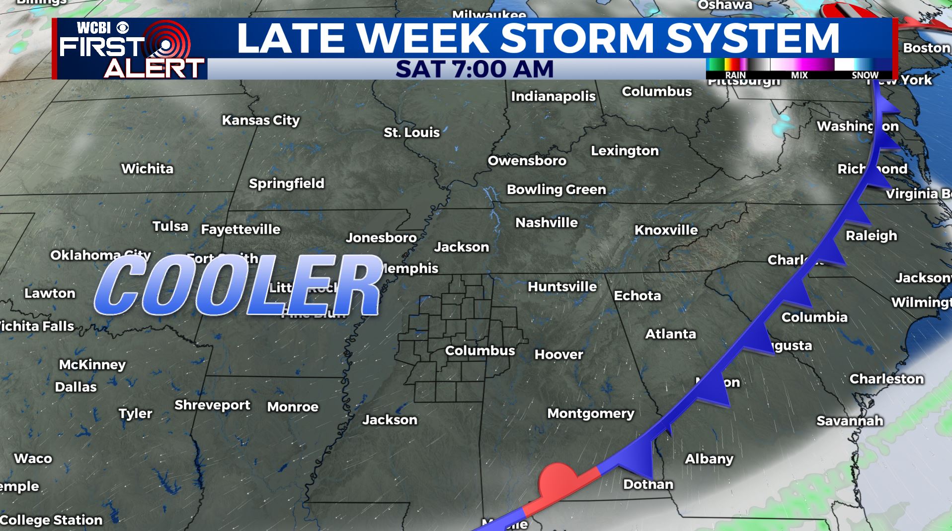
SATURDAY NIGHT: Clear and chilly. Lows in the upper 30s to around 40. New record lows could be established.
SUNDAY: Lots of sunshine for Mother’s Day. Pleasant. Highs in the lower 70s.
EARLY NEXT WEEK: Staying quiet as we begin a new week. Sunny skies on Monday followed by partly sunny skies on Tuesday. Temperatures slowly warming back up to the mid 70s.
Stay connected with @WCBIWEATHER on Facebook, Twitter, Instagram, and the WCBI News App


Leave a Reply