A cooler but windy Friday ahead
SUMMARY: Here’s your top weather headlines as we head into our Friday and the weekend. Expect cooler and windy conditions today through Saturday. Mild temperatures will make a comeback along with the return of rain chances next week.
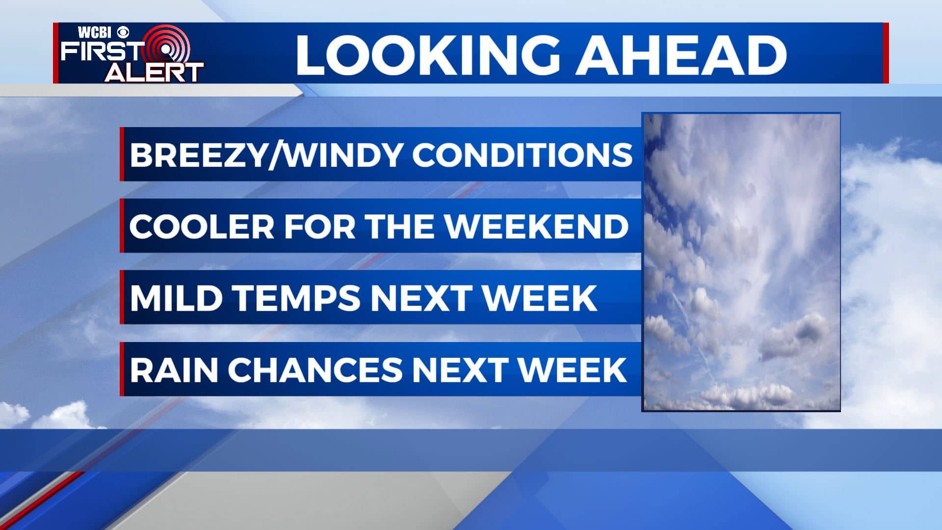
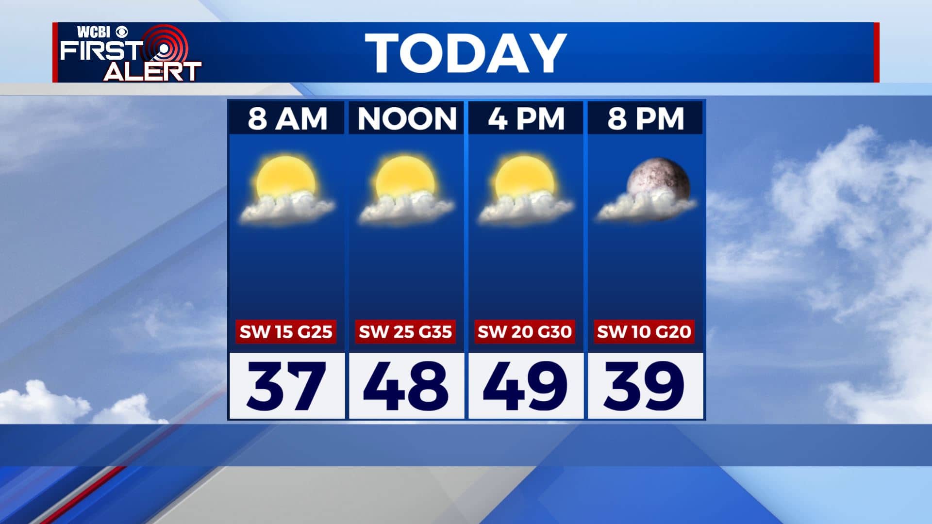
FRIDAY: Our cold front has pushed through so expect a mix of sun & clouds today for our Friday. Temperatures will be cooler with highs only near 50 degrees. It will be a windy day as well as those SW winds will pick up 15-25 mph with gusts 30-35 mph.
FRIDAY NIGHT: Partly cloudy skies, maybe a few snow flurries in near the TN/MS line as a storm system pushes through the Tennessee Valley region. Cold overnight lows in the upper 20s Friday night.
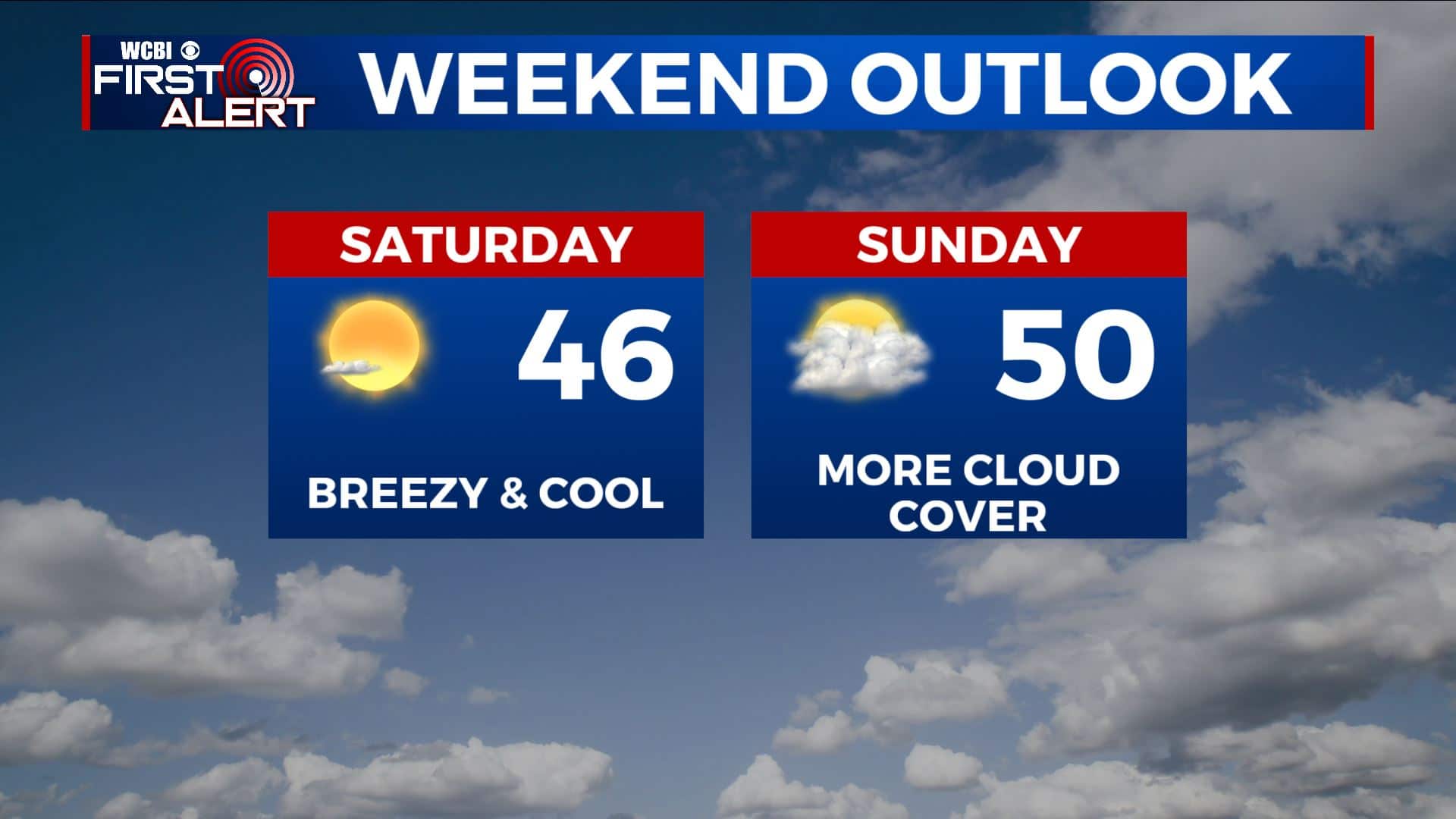
SATURDAY: Staying quiet with a mix of sun & clouds. Highs remaining cool and below average in the mid to upper 40s. Overnight lows around 30 Saturday night.
SUNDAY: Partly to mostly cloudy. Highs in the upper 40s to near 50 degrees. Lows around 30 Sunday night.
MONDAY: Mostly sunny skies to start off the new workweek. Highs in the low 50s. Lows near freezing Monday night.
TUESDAY: Mostly cloudy. A few isolated showers are possible. Highs in the mid 50s. Milder 40s for lows Tuesday night.
WEDNESDAY: Areas of rain. Highs in the upper 50s to near 60 degrees. Overnight lows in the upper 40s to low 50s Wednesday night.
THURSDAY: Cloudy with a chance of rain. Highs in the lower 60s.
Stay connected with @WCBIWEATHER on Facebook, Twitter, Instagram, and the WCBI News App


Leave a Reply