A sunny Monday before storms return midweek
SUMMARY: Enjoy the sunshine & clear blue skies as we begin the new workweek for your Monday because showers & storm chances will return midweek. Some storms could be on the strong side. Looking cooler, but pleasant for the end of the workweek with temperatures warming up into the Easter holiday weekend.
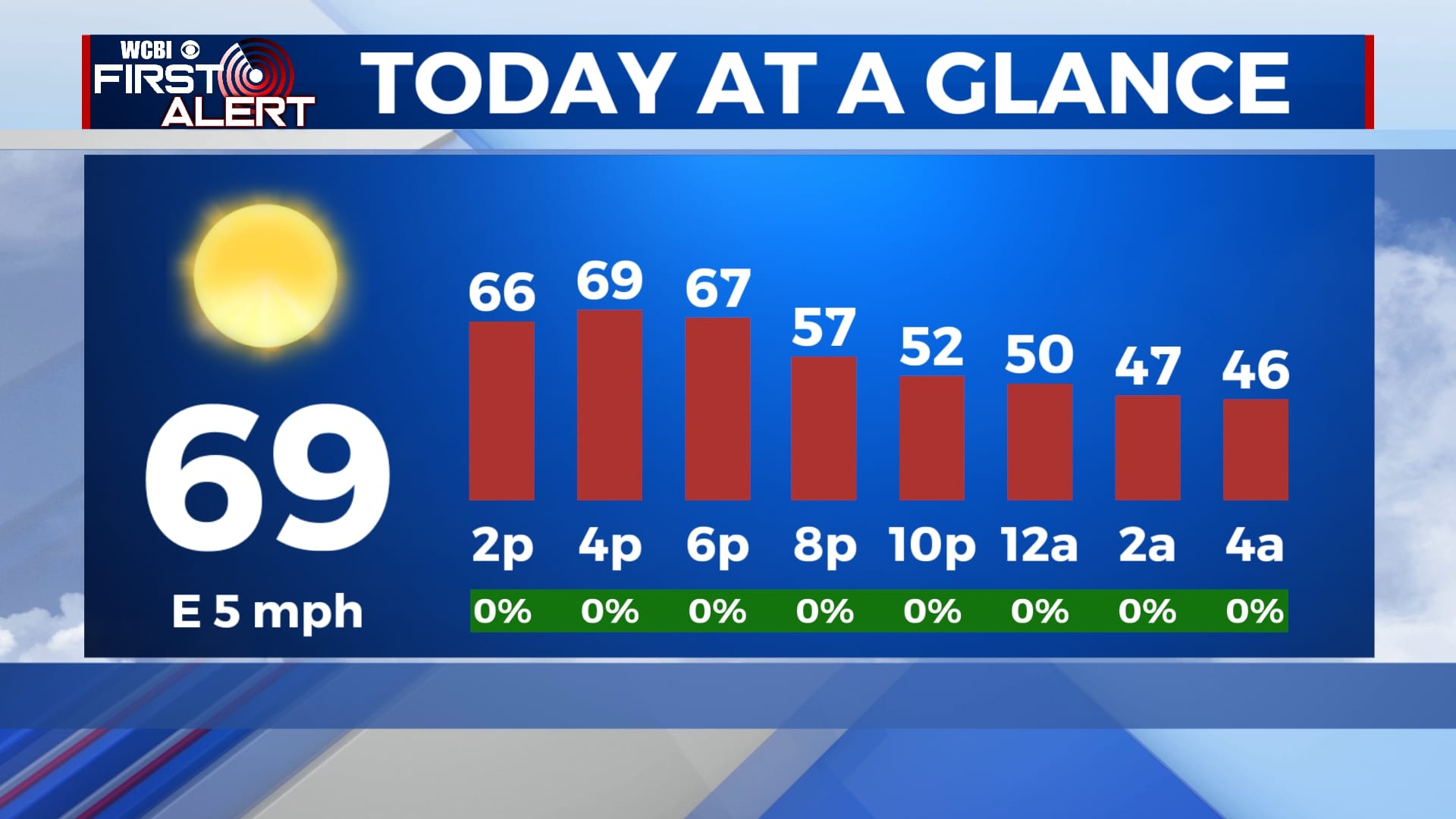
MONDAY: After a clear and chilly start. expect lots of bright sunshine with clear blue skies as we begin the new workweek. Highs in the upper 60s to near 70 degrees. Light SE winds.
MONDAY NIGHT: Mostly clear skies. Overnight lows not as chilly in the mid 40s.
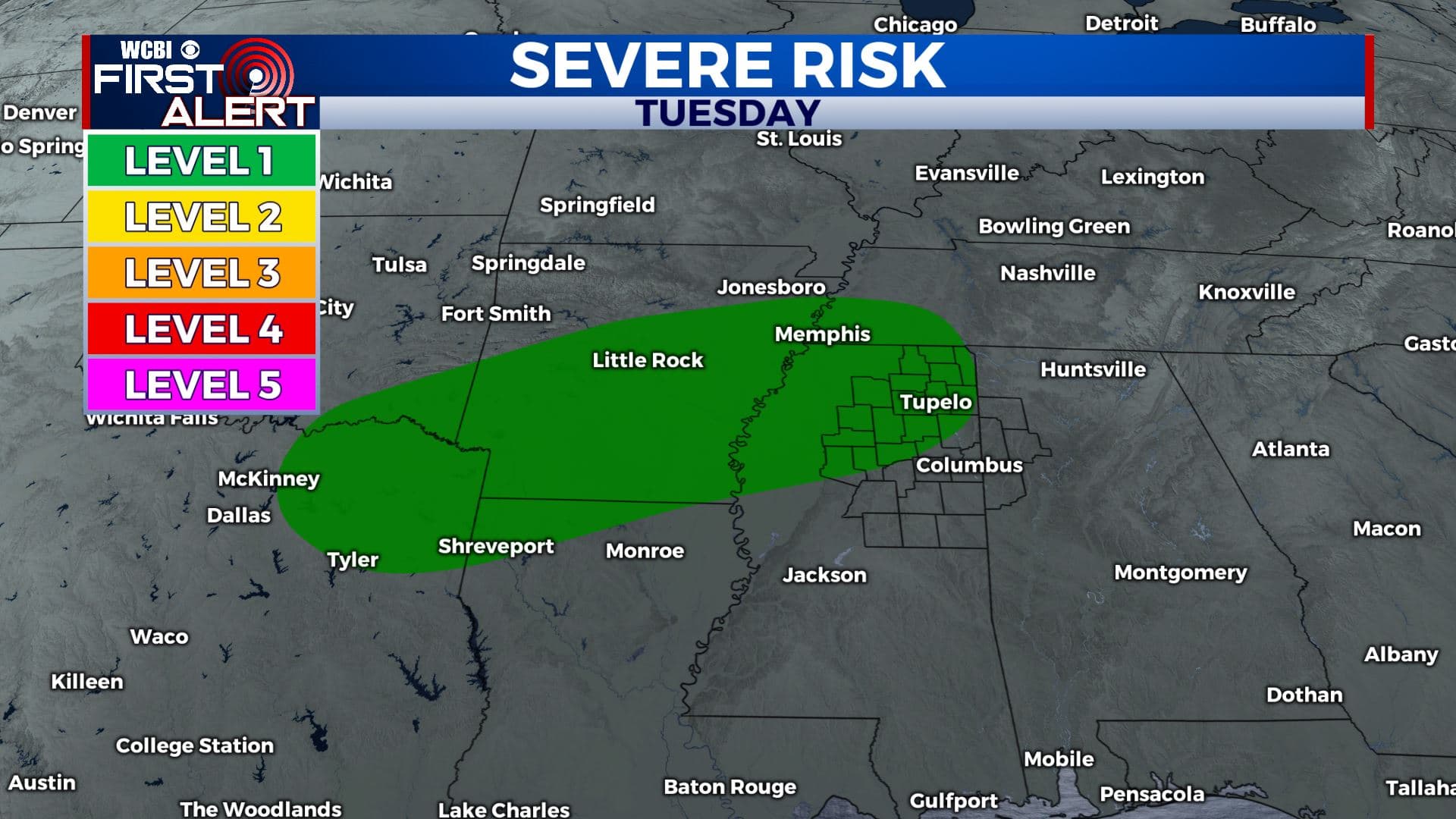
TUESDAY: Clouds will increase throughout the day. An afternoon thunderstorm in spots. Rain and storm chances expected to increase into the evening and overnight hours. Some could be on the strong side with with some hail and gusty winds. Highs will reach the lower to mid 70s. Overnight lows Tuesday night will be in the upper 50s.
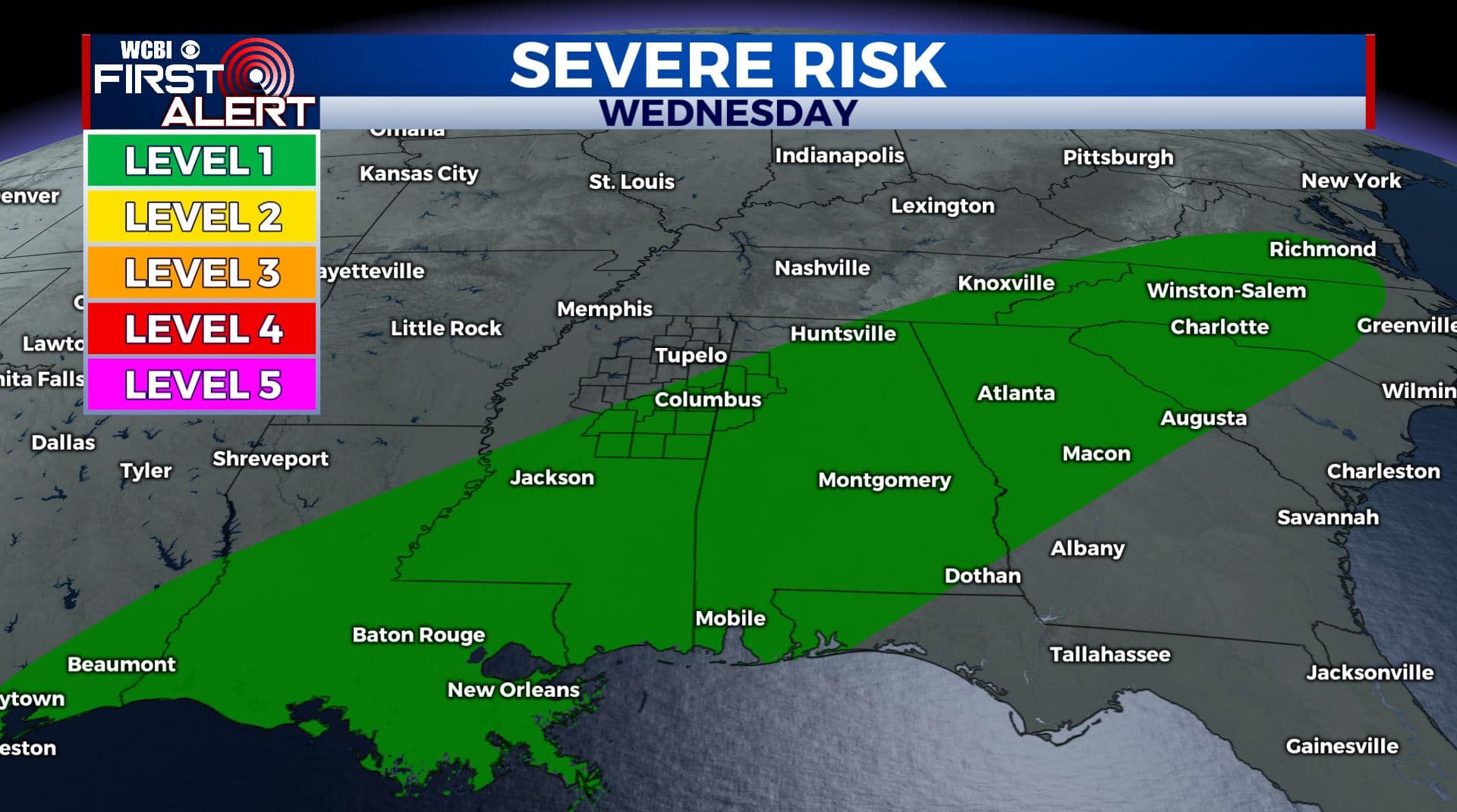
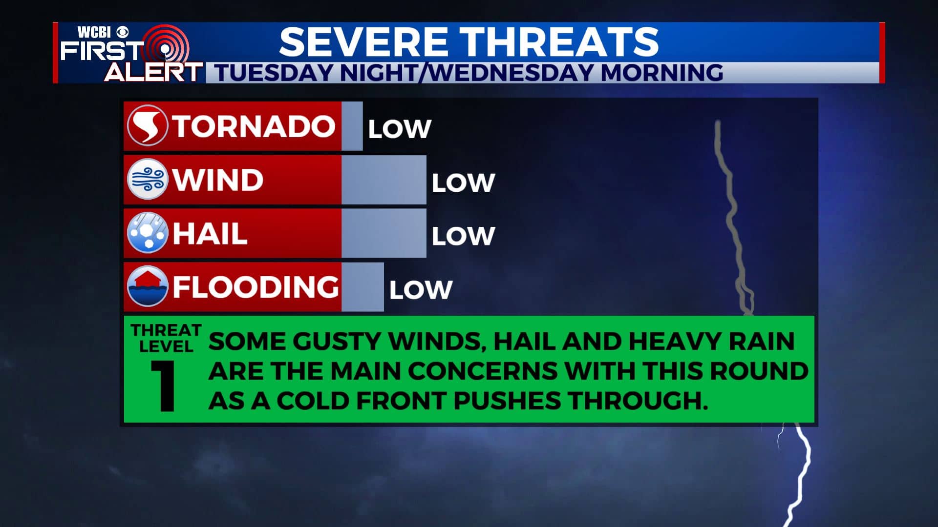
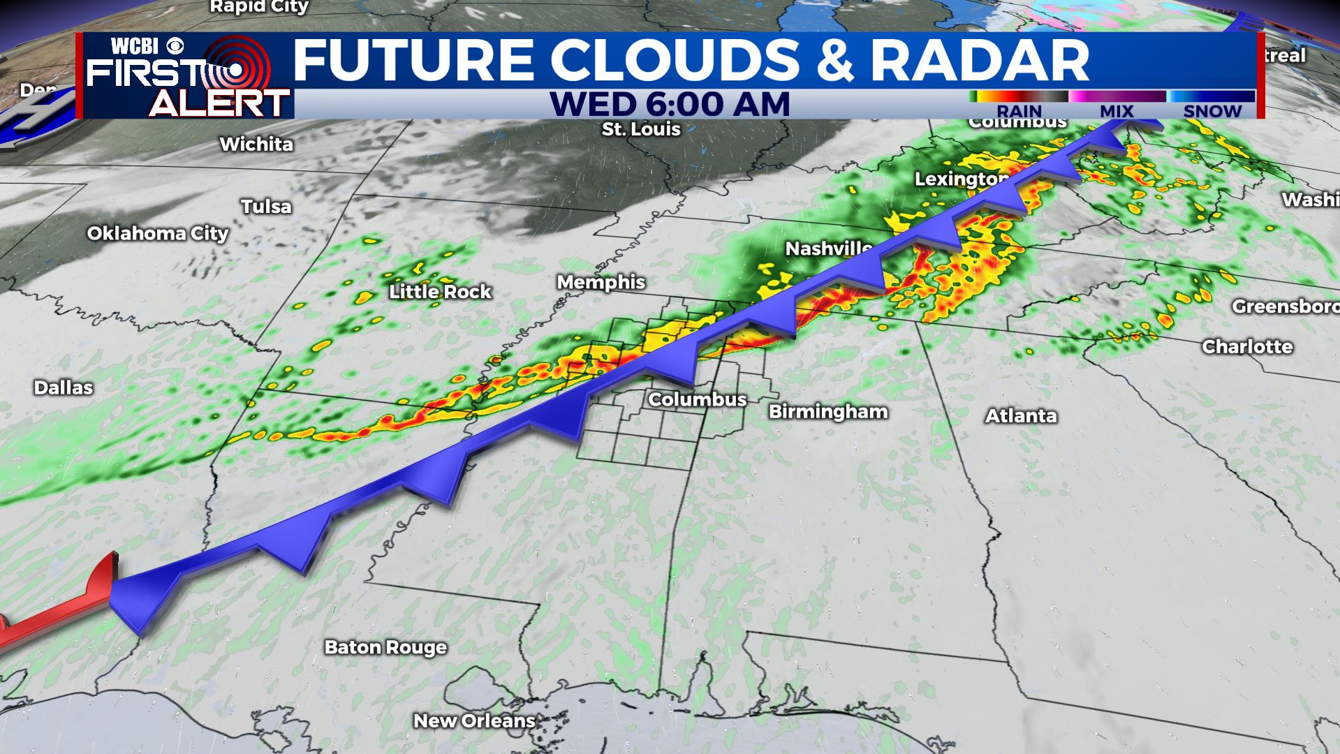
WEDNESDAY: Mostly cloudy skies with showers and possible thunderstorms in the morning as a cold front pushes through with highs in the mid 60s. Partly cloudy skies overnight with lows in the upper 30s.
THURSDAY: A bit cooler but an overall beautiful day with lots of sunshine and high temperatures in the upper 50s. Overnight lows will near the mid 30s.
FRIDAY: Warm and sunny day with highs in the mid 60s and lows in the low 40s.
SATURDAY: A mix of sun and clouds for most of the day. Highs near the mid 60s.
EASTER SUNDAY: Sunshine sticks around and a bit warmer with highs in the lower to mid 70s. Overnight lows will be in the 30s and 40s.
Stay connected with @WCBIWEATHER on Facebook, Twitter, Instagram, and the WCBI News App.


Leave a Reply