A warmer & beautiful next few days
SUMMARY: The 60s are making a comeback over the next several days as warmer air filters back in to our area for the second half of the workweek, along with lots of sunshine. Rain is still likely in the forecast for Friday night into Saturday before another cool down returns next week.
WEDNESDAY: Some of us are waking up to some low level clouds moving in along with some mist or fog this Wednesday morning. Take it easy out on the roads if you encounter low visibility. A beautiful day is on tap with lots of sunshine, clear blue skies and warmer temperatures in the 60s. SW winds 5-10 mph.
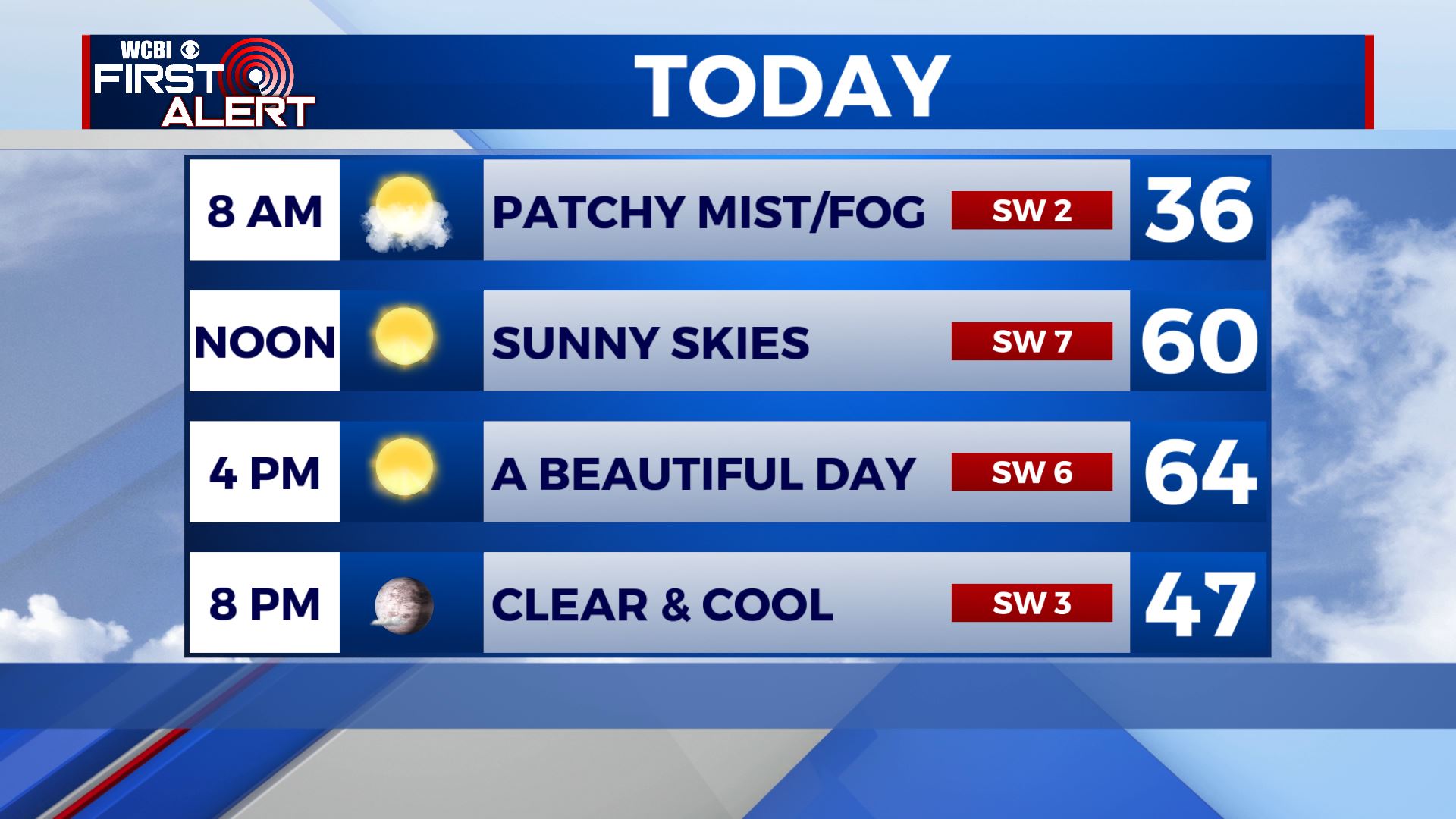
WEDNESDAY NIGHT: Mostly clear skies and another calm night ahead. Overnight lows a bit chilly as temperatures fall to the mid 30s.
THURSDAY: We’ll continue to see lots of sunshine and clear blue skies. High temperatures in the mid and upper 60s. Overnight lows in the lower 40s.
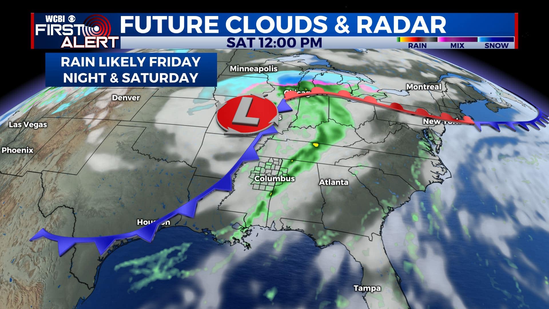
FRIDAY-SATURDAY: Cloudy skies and rain chances will return to the region by Friday and into the weekend as our next cold front approaches us. Most of the day Friday looks to remain dry with a mix of sun & clouds, but showers are possible by the evening hours. We’ll likely see more rain chances Friday night into the first half of the day on Saturday. High temperatures will remain in the 60s for Friday and Saturday.
SUNDAY: Cooler air will filter in on Sunday. Highs will be back down into the lower 50s with overnight lows in the 30s. There are some indications that we could see some isolated showers on Sunday, but we’ll see a mix of sun & clouds for the most part.
EARLY NEXT WEEK: We’ll see a few clouds on Monday before the sunny skies return on Tuesday. Staying cool with highs in the lower 50s. We could once again go down into the 20s for overnight lows Monday night into Tuesday morning.


Leave a Reply