An active start to the work week, more strong storms for Tuesday
SUMMARY: Showers and thunderstorms pushing through this morning now through 8am. We’ll also be watching some strong to severe storms on Tuesday. Some storms could produce quick downpours, some small hail and gusty winds. Fortunately, there will be some decent weather mixed in midweek. Temperatures will go back up to above average with highs in the 80s by the end of the week. More rain & storms chances this weekend.
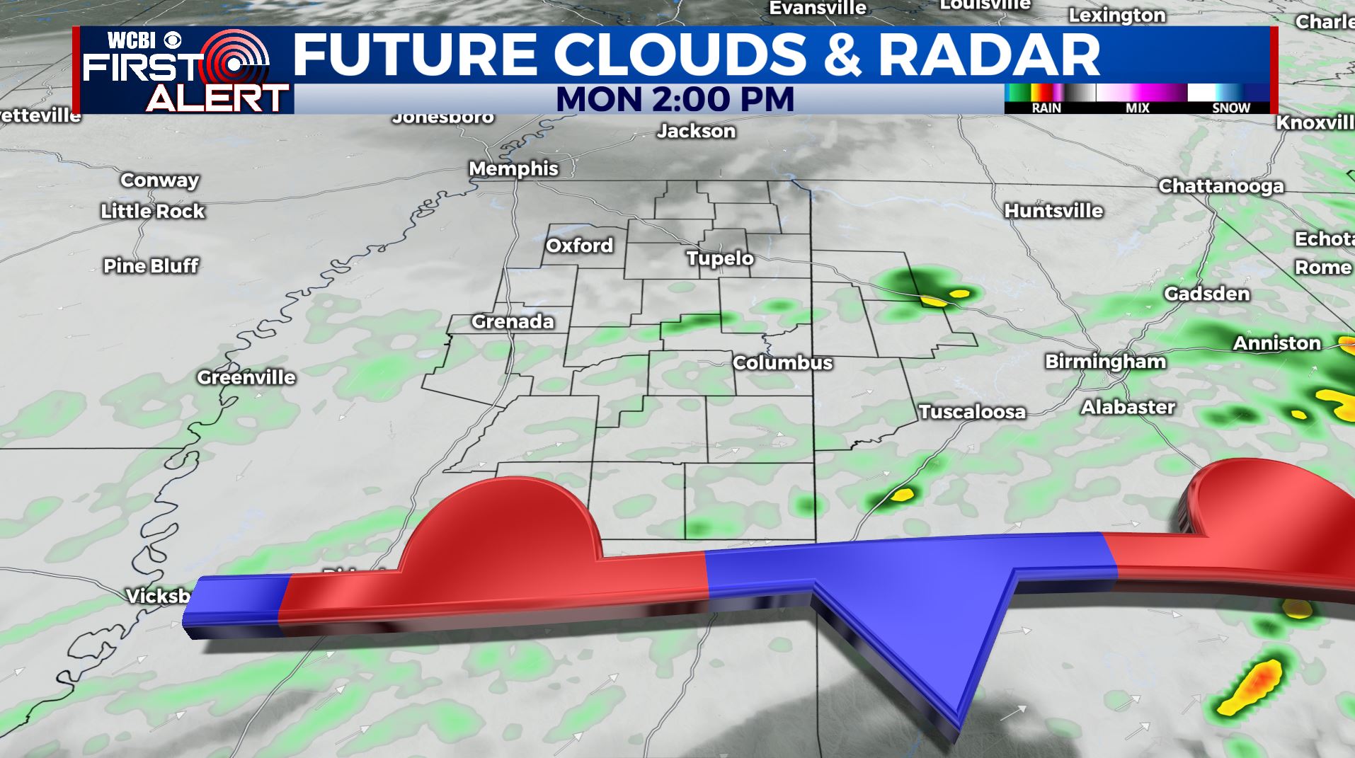
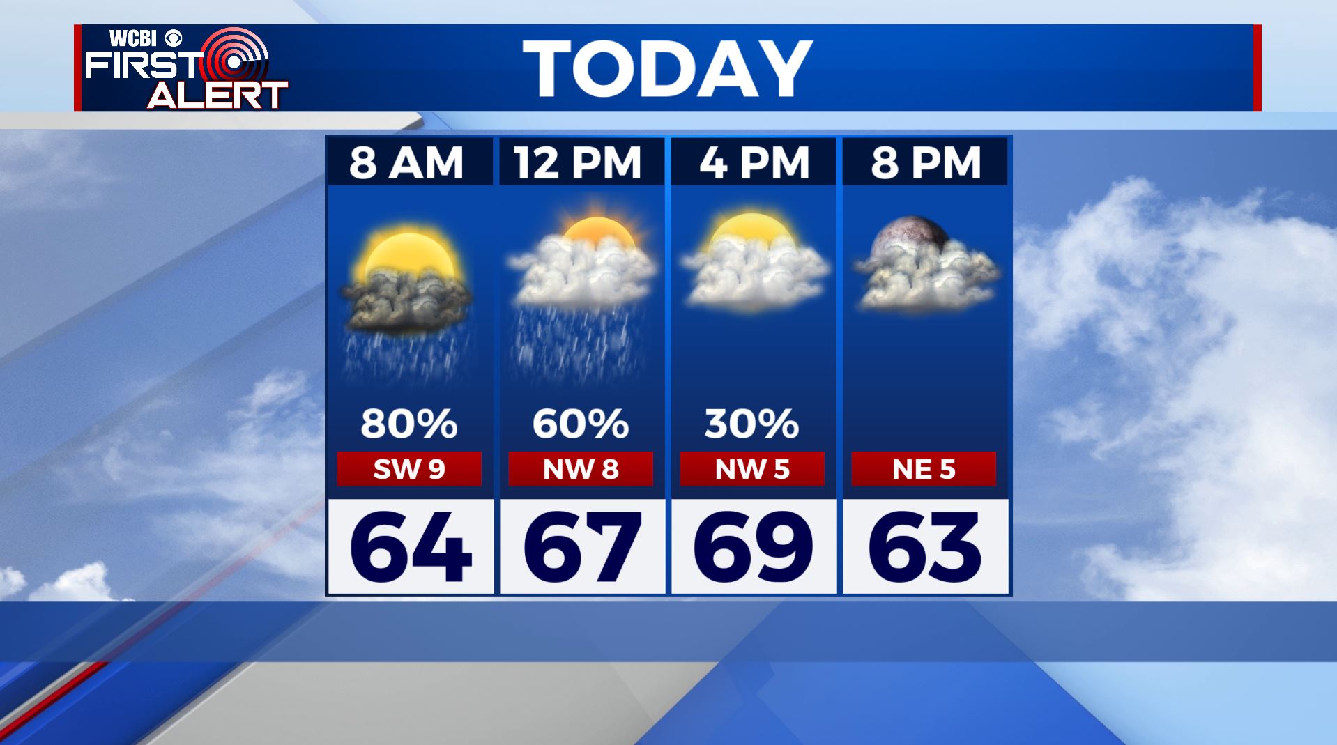
MONDAY: Rain and thunder will remain possible through lunchtime as a stationary front slowly pushes south, but most of the day should be dry with mostly cloudy skies in the afternoon. Highs will be in the upper 60s with northwesterly winds.
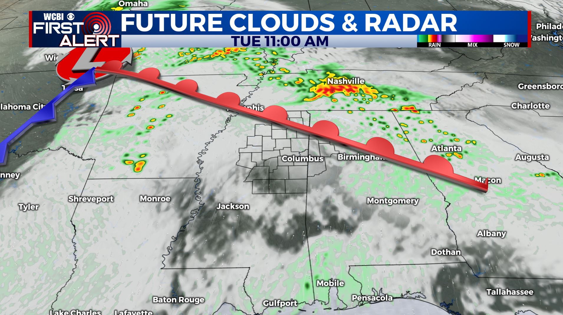
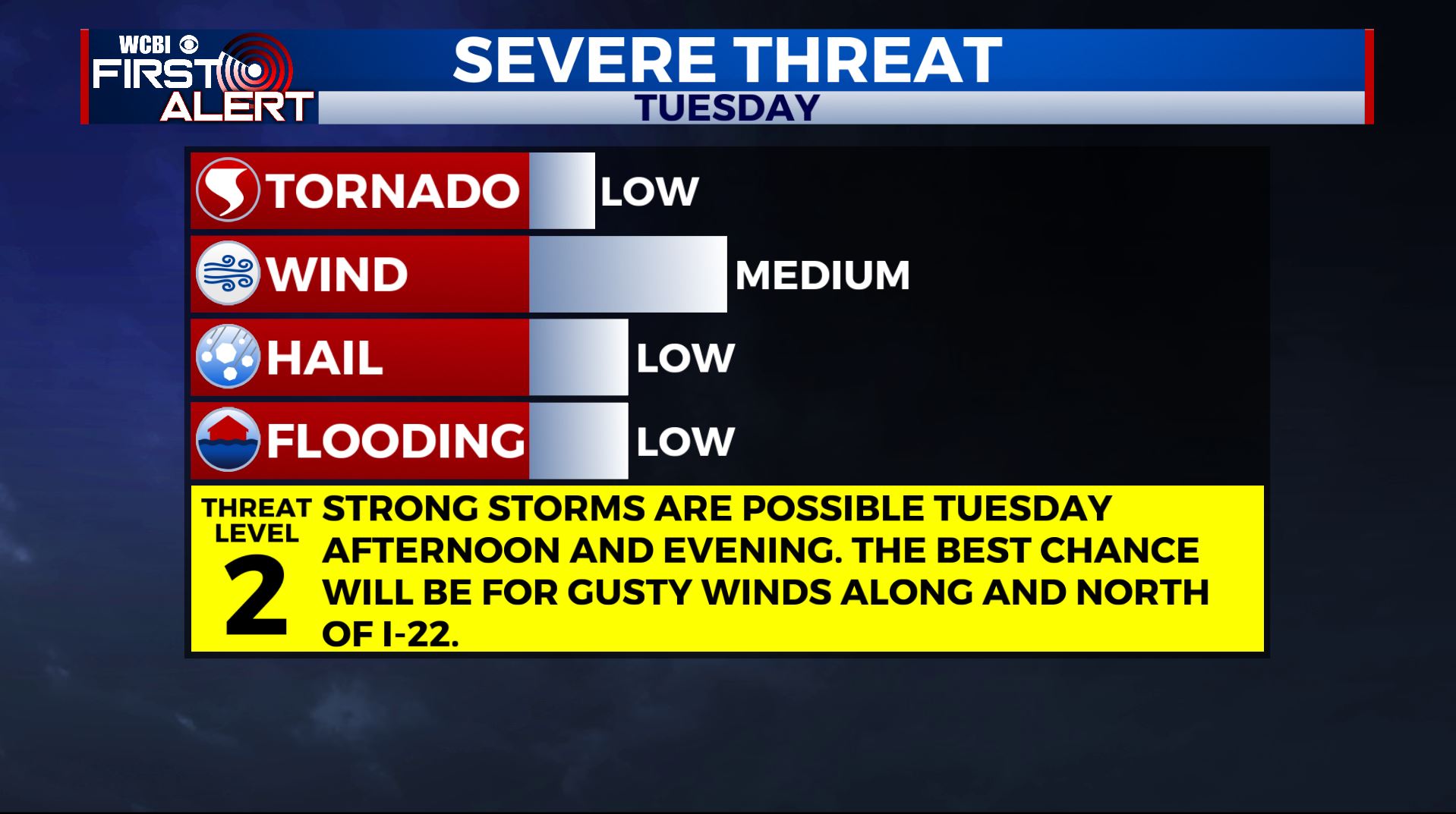
TUESDAY: Although most of the day will be dry, an approaching storm system will again bring the chance for storms late in the day on Tuesday. At this time, a Level 1-2 risk for severe weather is in effect for areas, especially along and north of I-22. Widespread severe weather is not likely, but some storms could produce gusty winds. The threat for tornadoes appears to be very low in our area, but a brief tornado can never be ruled completely out. The best chance for storms will be between 1pm and 10pm. We’ll continue to monitor and make changes as necessary. Temperatures will rise to the upper 70s in the afternoon.
WEDNESDAY-THURSDAY: Rain will exit the area by Wednesday morning, leaving us dry for the middle portion of the week. We’ll see a mix of some sun and clouds on Wednesday and Thursday with highs in the upper 70s to lower 80s. Overnight lows will be in the 50s.
FRIDAY-SATURDAY: Rain chances return to the forecast for Friday and Saturday, with some storms possible on Saturday Highs will be in the 80s on Friday & Saturday.
SUNDAY: Sunday looks to be dry and mostly cloudy with scattered rain chances. Highs in the mid 70s.
Stay connected with @WCBIWEATHER on Facebook, Twitter, Instagram, and the WCBI News App


Leave a Reply