Active summertime pattern is sticking around
SUMMARY: A stationary front across the Deep South will help keep our weather a bit unsettled as we head into the middle part of the workweek. We’ll have those daily chances of afternoon showers & storms. We’ll have better chances Wednesday & Thursday. It will remain hot & humid with highs in the upper 80s to lower 90s.
TUESDAY: We’re waking up to quiet but mild conditions this Tuesday morning. We’ll have another chance of afternoon showers and storms. Highs will still be in the upper 80s to near 90. NW winds 5-10 mph.
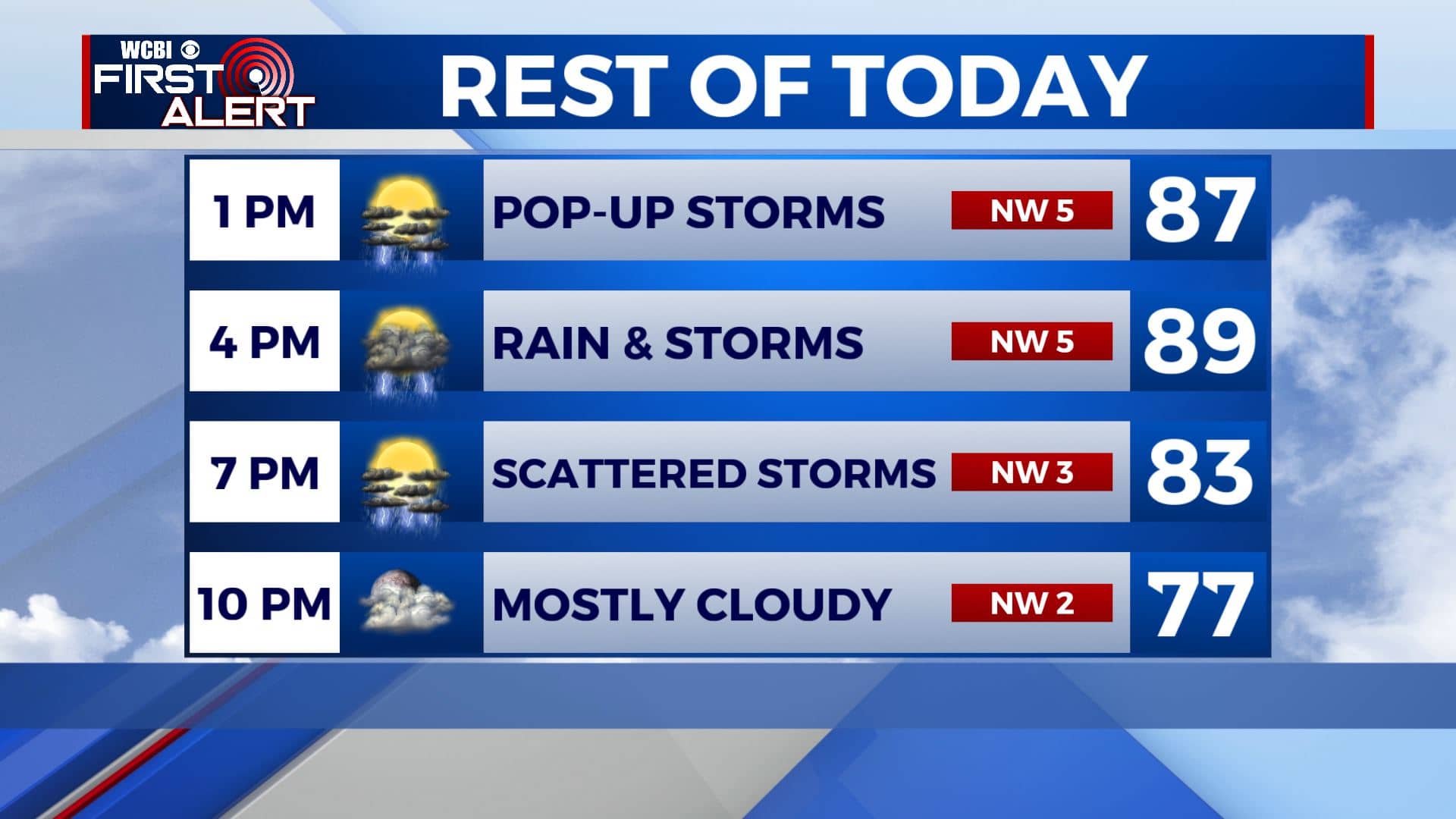
TUESDAY NIGHT: We’ll have mostly cloudy skies after showers and storms end early in the evening. Overnight lows in the low 70s.
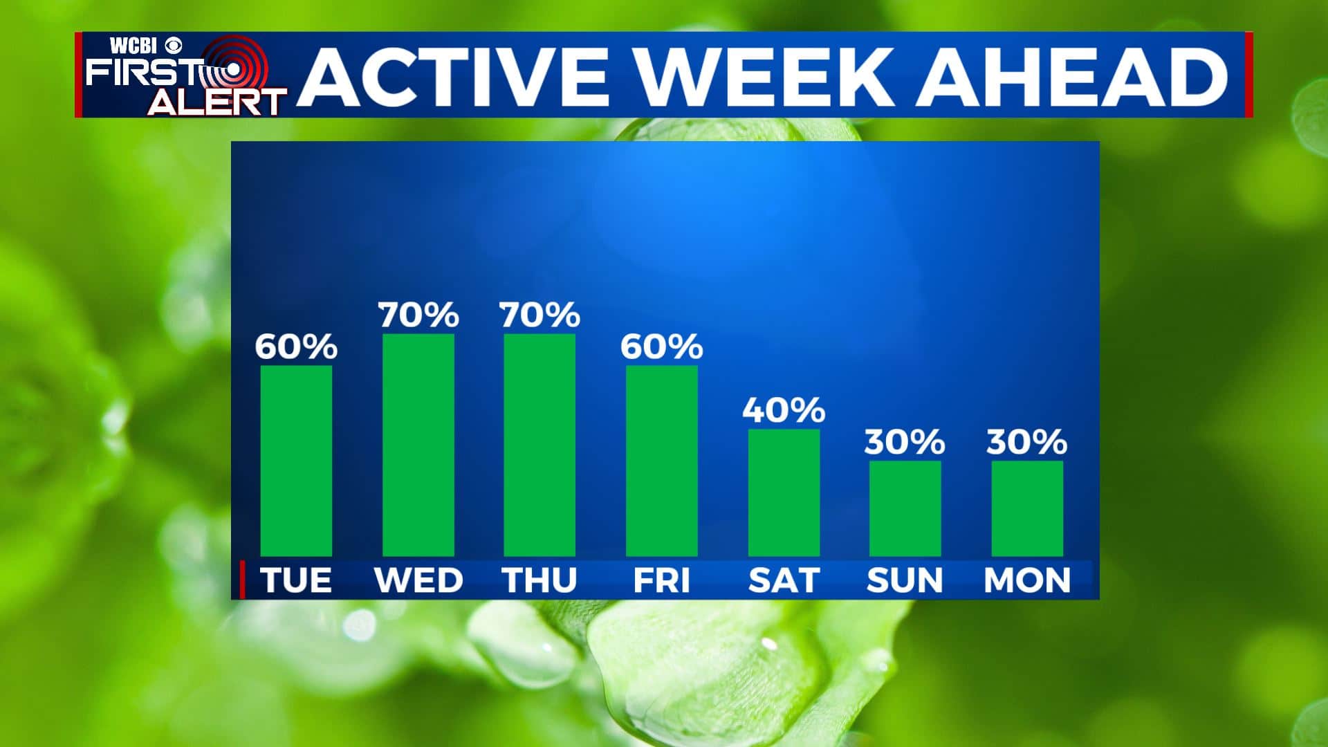
WEDNESDAY-FRIDAY: Better likely chances for showers and storms for the middle of the workweek as we bump rain chances up to 60%-70%. Some storms could produce heavy rain, which could lead to more flooding concerns and gusty winds. Remaining warm & humid. High temperatures in the upper 80s to lower 90s with overnight lows in the 70s.
WEEKEND-MONDAY: Rain & storm chances with decrease heading into the weekend. Still expect scattered pop-up chances during the peak daytime heating in the later afternoon/early evening hours. Otherwise, we’ll still be hot and humid with highs back into the lower 90s.
Stay connected with @WCBIWEATHER on Facebook, Twitter, Instagram, and the WCBI News App


Leave a Reply