Active weather pattern to continue
SUMMARY: Rain showers are likely during the night into our Friday morning with drier conditions returning Friday afternoon. An additional 0.10″ to over 1/2″ of rain is possible through Friday. Another weather maker will spread rain our way Sunday and Monday. it has the potential to produce even heavier rain in our area along with some storms too.
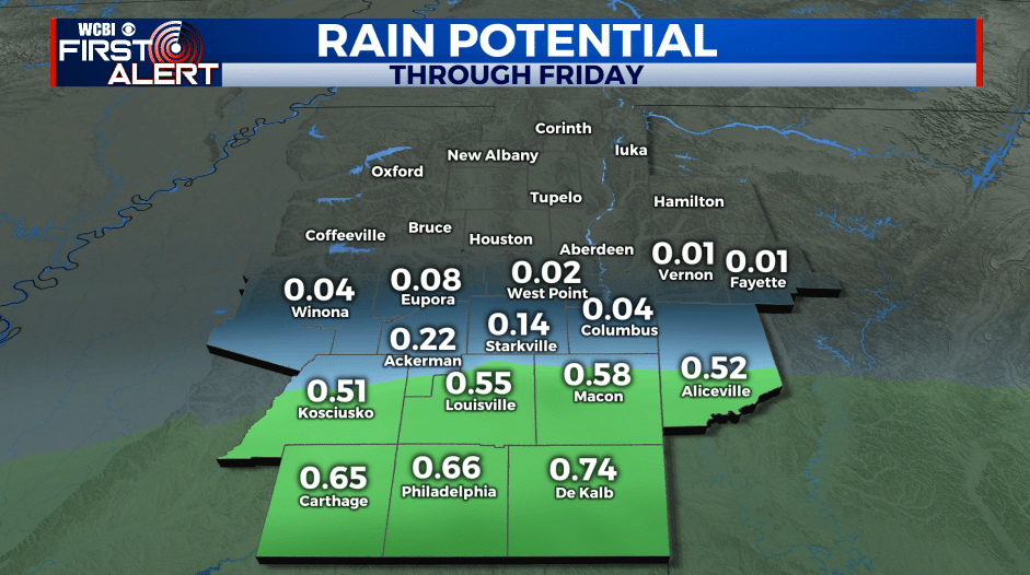
THURSDAY NIGHT: Cloudy with areas of rain. The heaviest rain in the region will likely be along and south of I-20. Lows in the 40s. Winds N 0-5 mph.
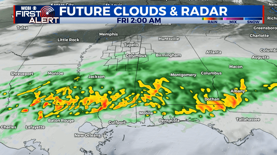
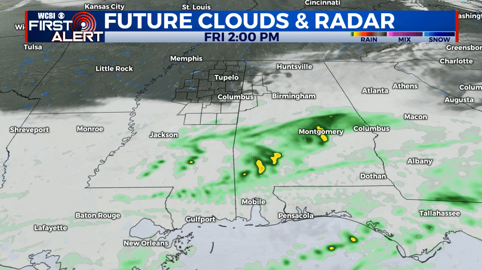
FRIDAY: Areas of rain during the morning with drier conditions taking over during the afternoon and evening. Highs in the low to mid 50s. Winds NNE 5-10 mph.
FRIDAY NIGHT: Variably cloudy and colder. Lows in the low 30s.
SATURDAY: Sun & clouds. Highs in the mid 50s.
SATURDAY NIGHT: Increasing clouds. Lows around 40.
SUNDAY & MONDAY: Areas of rain Sunday with more rain and thunder on Monday. Anywhere from 1/2” to over 2” of additional rainfall is possible. Highs in the upper 50s Sunday with milder upper 60s to around 70 on Monday.
TUESDAY: Sun & clouds. Highs in the upper 50s.
WEDNESDAY: Mostly cloudy with rain likely. Highs in the upper 50s.
THURSDAY: Mostly sunny. Highs in the mid 50s.
Follow @WCBIWEATHER on Facebook, Twitter, Instagram, and the WCBI News App


Leave a Reply