An unsettled weather pattern to start the new workweek
SUMMARY: A pretty soggy workweek is ahead for us here in north Mississippi and west Alabama as we’ll have scattered to widespread chances for showers & storms almost everyday. Temperatures much cooler in the 80s a cold front pushes through Monday into Tuesday.
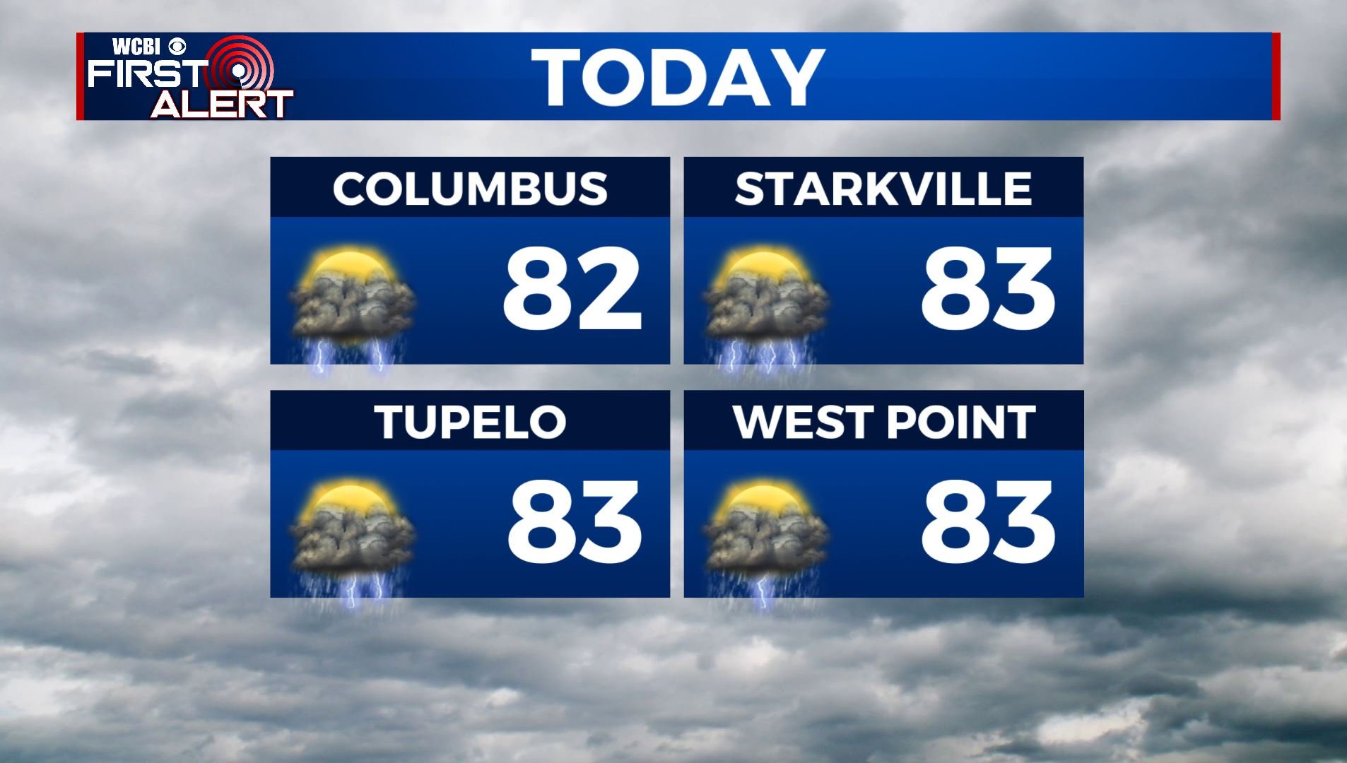
MONDAY: We have been dealing with shower & some thundershowers overnight into early this morning. Another unsettled day with our weather is ahead for us as we are expecting scattered to widespread chances of rain & storms as the cold front continues to stay in the region. The cloud cover & showers will keep those high temperatures below average in the lower 80s.
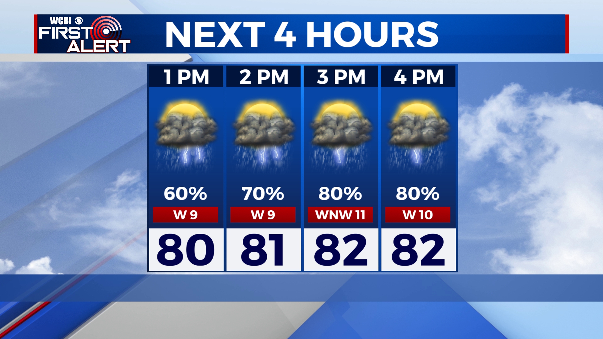
MONDAY NIGHT: Chances of showers & storms still possible overnight. Mostly cloudy skies with lows mild around 70 degrees.
TUESDAY -THURSDAY: Scattered showers and thunderstorms chances continue through midweek. Temperatures will start to warm back up to the mid to upper 80s. Overnight will be fairly humid thanks to the clouds that will stick around. Lows in the 70s.
THE WEEKEND: We may see a break from the rain Saturday and Sunday! A few isolated showers or storms remain possible. Temperatures back up to near average with highs in the lower 90s.
Stay connected with @WCBIWEATHER on Facebook, Twitter, Instagram and the WCBI News App


Leave a Reply