Another cold front pushing through for Thursday
SUMMARY: Mostly sunny and dry fall weather is going to remain for at least the next week as we begin the month of October. Another cold front will bring in another shot of cooler air for Friday. The only chance for rain is Sunday when there could be a few more clouds and showers.
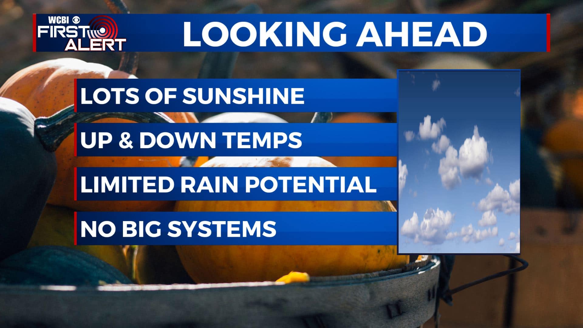
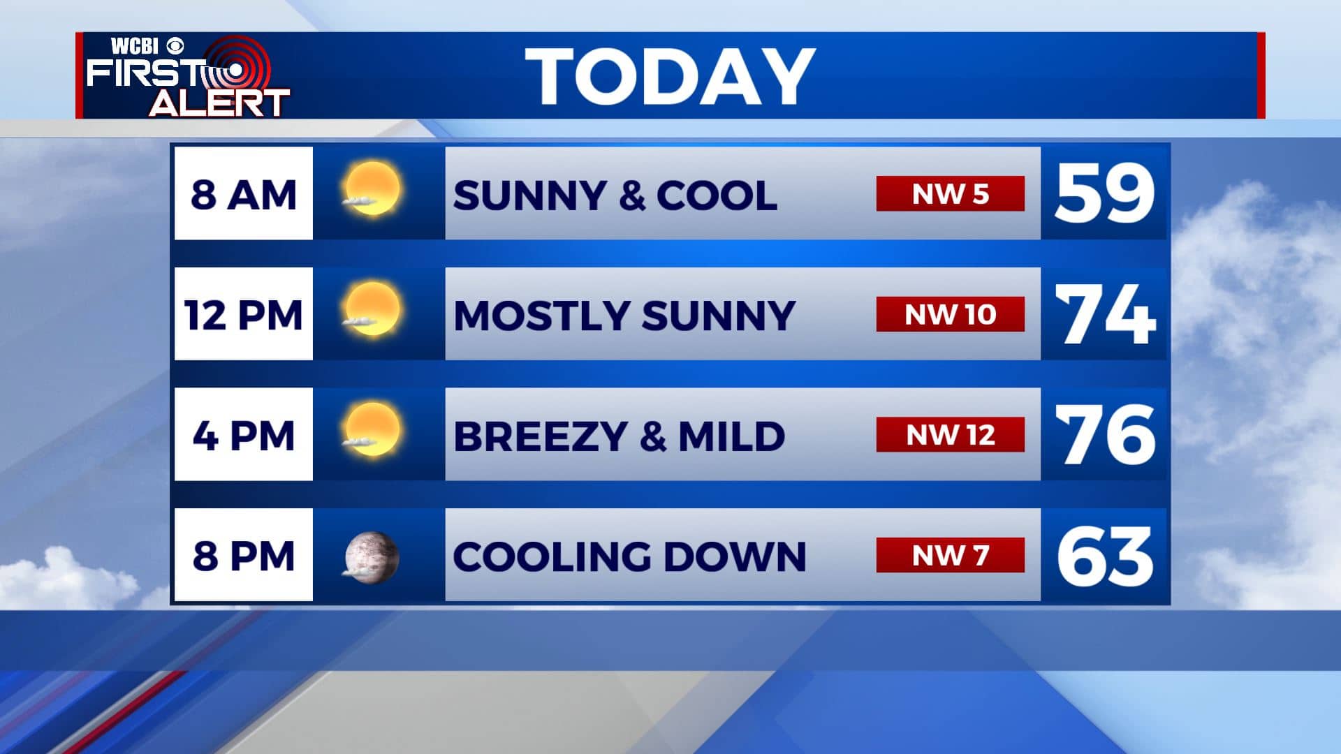
THURSDAY: Our second cold front of the week is right on our doorstep this Thursday morning. Mostly sunny and mild ahead of it. Highs in the mid 70s. It will be on the breezy side as out winds will switch up to the NW 10-15 mph.
THURSDAY NIGHT: Clear skies and chilly once again. Overnight lows in the mid to upper 40s.
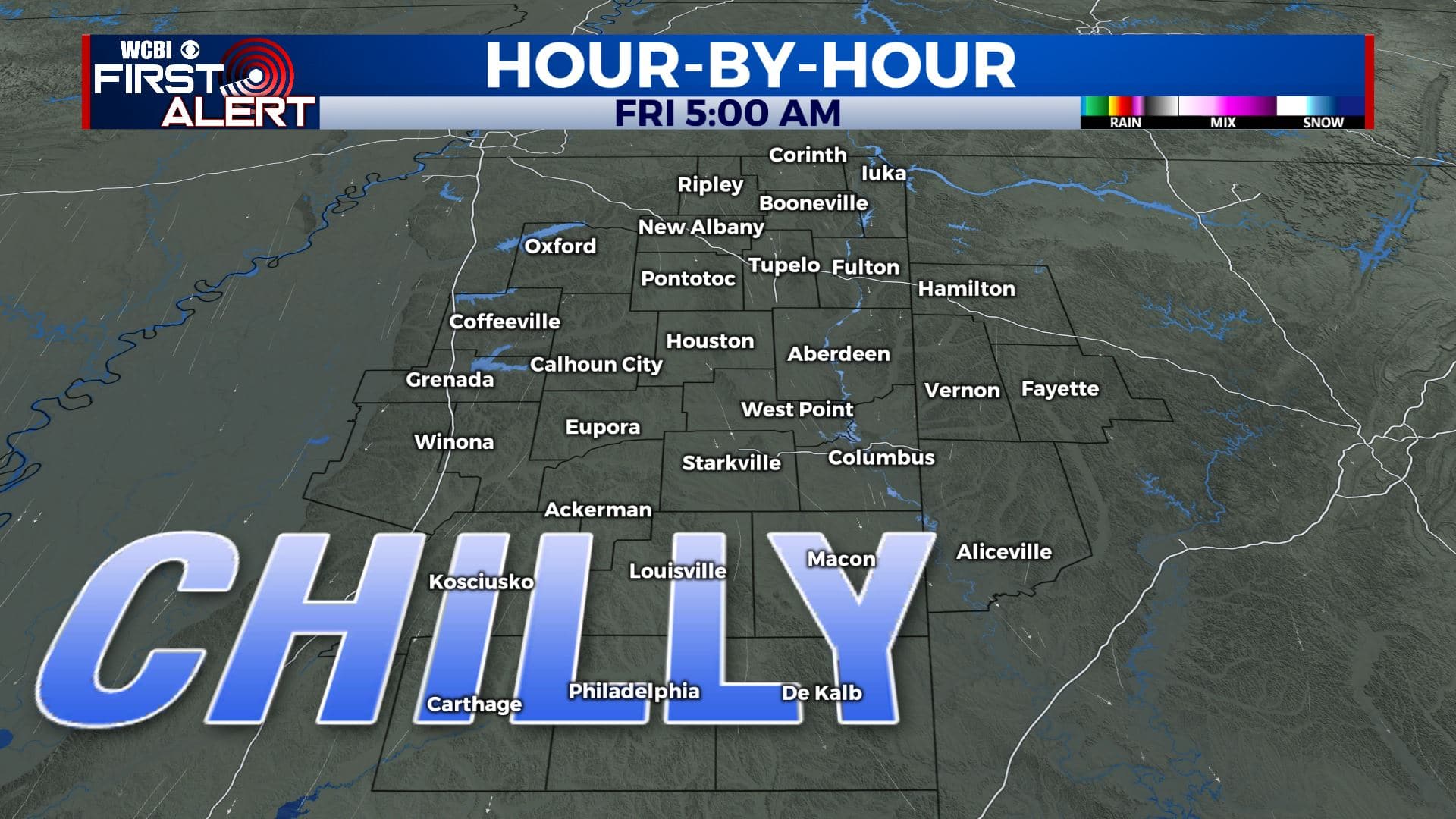
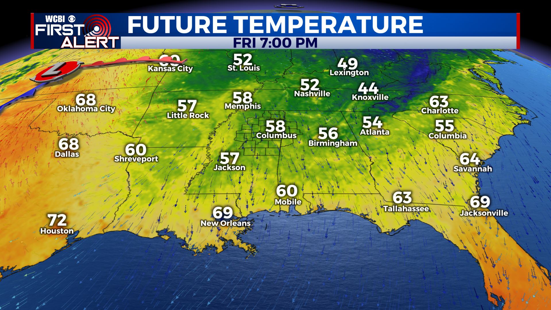
FRIDAY: Mostly sunny and cooler as we end the workweek. Highs in the upper 60s. High school football weather will be great, but you’ll need jackets as you head out to the games.
FRIDAY NIGHT: Clear skies, quiet, and remaining a but chilly. Overnight lows in the mid to low 40s.
SATURDAY: Staying mostly sunny and pleasant. Highs back up in the lower 70s. No issues are expected for the college games in Starkville and Tuscaloosa.
SATURDAY NIGHT: Partly cloudy. Overnight lows near 50 degrees.
SUNDAY: A mix of sun & clouds. A few showers are possible. Highs in the mid 70s.
EARLY NEXT WEEK: Mostly sunny skies to start off the new workweek. Plan on mild days with highs in the 70s and low 80s. Cool nights with overnight lows in the 50s continue.
Stay connected with @WCBIWEATHER on Facebook, Twitter, Instagram, and the WCBI News App


Leave a Reply