Areas of rain Thursday night
SUMMARY: Our next cold front will lead to rain late Thursday and Thursday night. Temperatures will remain seasonable into early next week… but much colder air could still invade the region by the middle to end of next week. It’s something we’ll keep watching.
WEDNESDAY NIGHT: Mainly clear during the evening with increasing clouds by sunrise. Lows in the mid 30s. Light SE winds increase late.
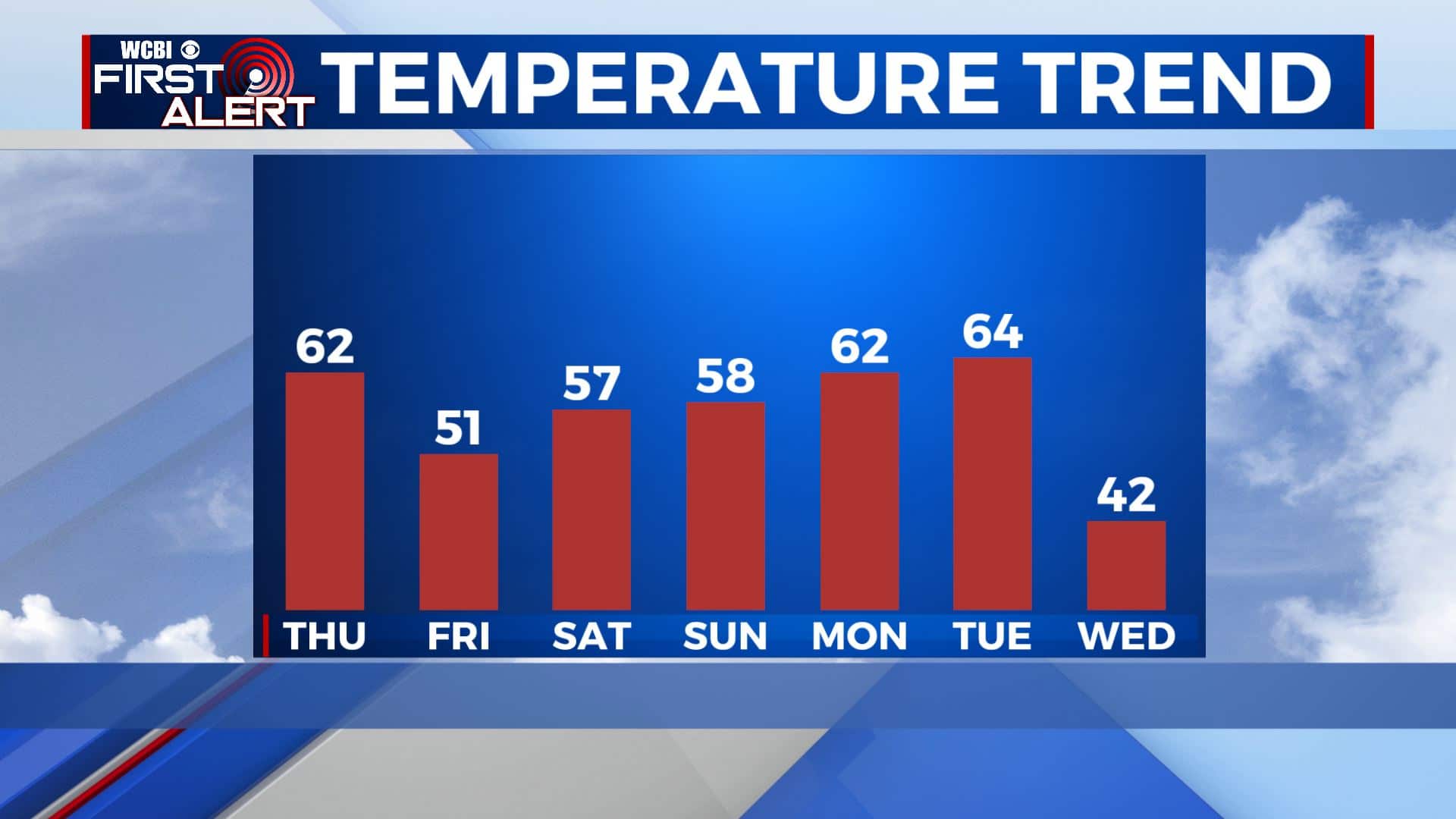
THURSDAY: Mostly cloudy and breezy. Winds SSE 10-25 mph with higher gusts developing during the day. Milder highs the low 60s. Most of the daylight hours should remain dry but some showers could develop by late in the afternoon.
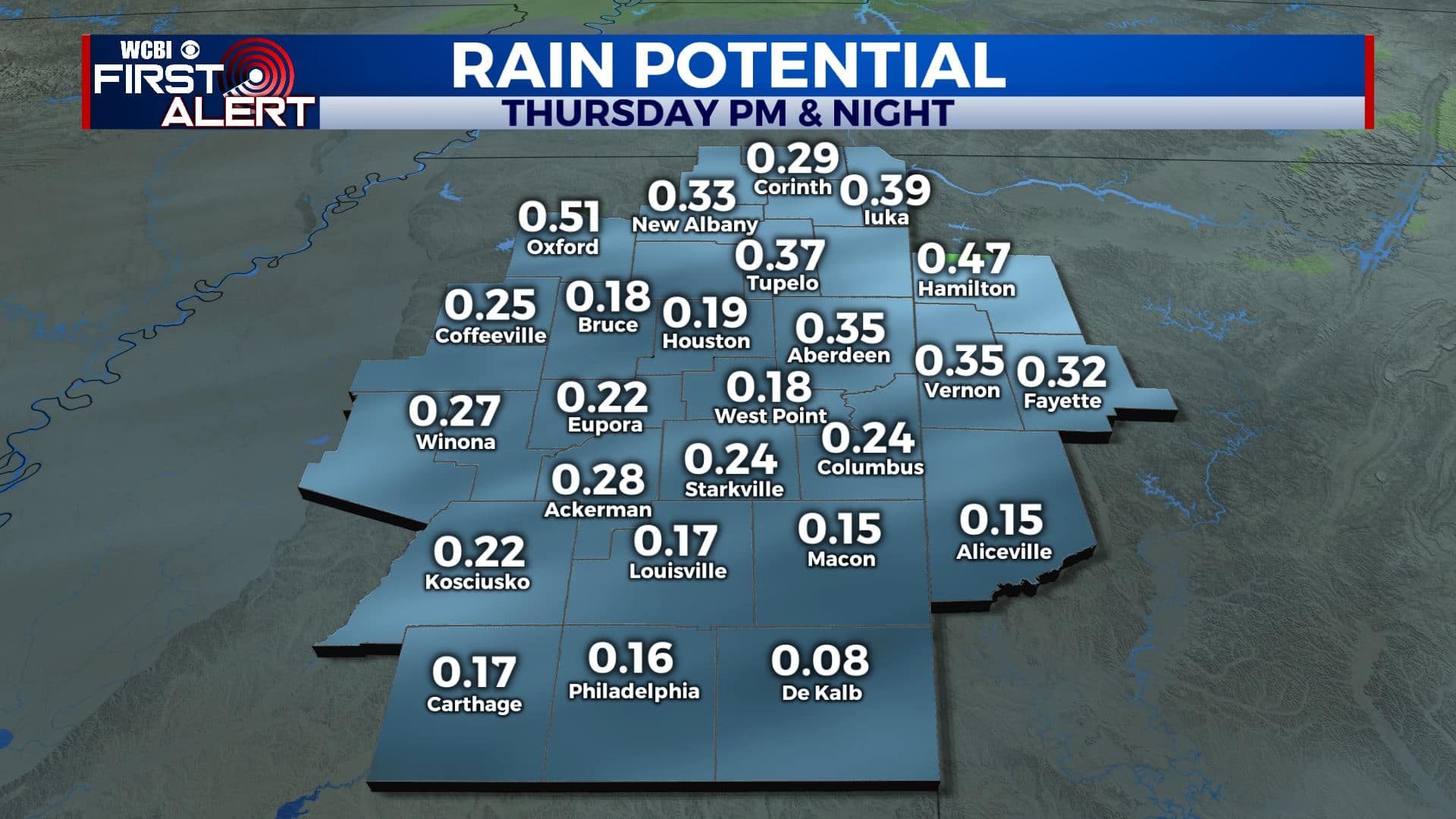
THURSDAY NIGHT: Cloudy with areas of rain. Most if not all of the rain will clear out of the area by sunrise Friday. Lows in the mid 30s. Total rainfall generally less than 1/2”.
FRIDAY: Partly cloudy. Highs in the low 50s. Winds NW 5-15 mph.
FRIDAY NIGHT: Mostly clear and cold. Lows in the upper 20s to around 30.
SATURDAY: A mix of sun & clouds. Highs in the mid 50s.
SATURDAY NIGHT: Variably cloudy. A slight chance of a shower. Lows in the mid 30s.
SUNDAY: Sun & clouds. Seasonable temperatures mainly in the 50s.
SUNDAY NIGHT: Partly cloudy. Lows in the mid 30s.
MONDAY: Increasing clouds with showers possible. Mild highs in the low 60s.
MONDAY NIGHT: Mostly cloudy. Mild lows around 50. Some showers could linger.
TUESDAY: Mostly cloudy. Showers possible. Continued mild with highs in the 60s.
Follow @WCBIWEATHER on Facebook, Twitter, Instagram, and the WCBI News App


Leave a Reply