Changes are coming…
SUMMARY: We’re watching 2 cold fronts over the next 7 days, one on Thursday and one early next week. The best rain potential over the next week will come Thursday but no severe weather will come with it. Temperatures may be quite chilly going into early next week behind the second front.
TUESDAY NIGHT: Mainly clear and quiet. Lows in the low 40s. Light wind.
WEDNESDAY: Mostly sunny and pleasant. Highs in the upper 60s and lower 70s.
WEDNESDAY NIGHT: Variably cloudy. Lows in the upper 40s to lower 50s.
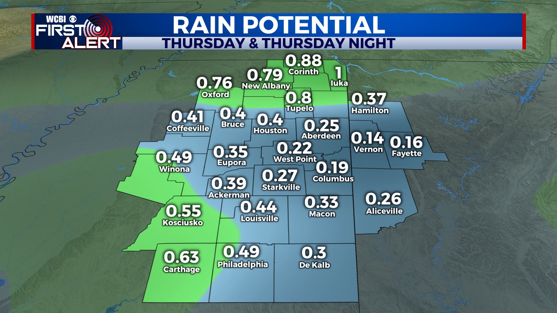
THURSDAY: Becoming cloudy with areas of rain developing. The chance of precipitation is 60-80%, especially during the afternoon and evening. Total rainfall accumulation between 1/4” and 1/2”. Highs will be in the 60s.
FRIDAY: Breezy and cooler with highs in the upper 40s to lower 50s. No issues are expected for high school football but it will be chilly after sunset. Low 30s and upper 20s are likely Friday night.
SATURDAY: Sunny and cool. Highs in the low to mid 50s. Expect lows around freezing Saturday night.
SUNDAY: Mostly sunny. Highs in the low 60s.
NEXT WEEK: The coldest air of the season thus far is expected to settle into the region for a few days. Highs may only top out in the 40s with overnight lows getting well down into the 20s.
Follow @WCBIWEATHER on Facebook, Twitter, Instagram, and the WCBI News app


Leave a Reply