Clouds build in Thursday ahead of Saturday’s severe weather event
SUMMARY: Clouds move back into the area for our Thursday with a breezy SE wind that will allow warm, moist air from the Gulf of Mexico to move in to not only warm up our temperatures for the end of the work week but to also set the stage for our potential severe weather event this weekend. We’re right now under a Level 2 to Level 3 risk for severe weather on Saturday. Stay tuned to WCBI as we’ll continue to keep you updated as we near the event.
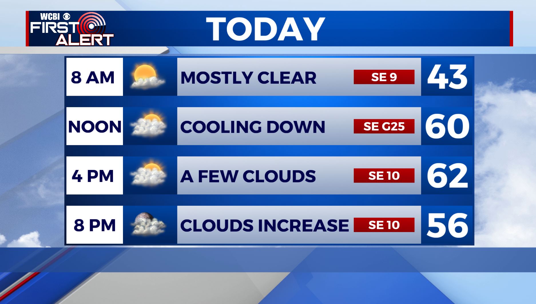
THURSDAY: Look for a mostly cloudy sky and temperatures rising into the lower 60s. Winds will be breezy out of the SE 10-20, gusting up to 25 to 30 mph.
THURSDAY NIGHT: Cloudy skies with showers moving in after midnight. SE winds 10-20 mph with overnight lows in the mid 50s.
FRIDAY: We’ll see temperatures rising into the upper 60s with breezy SE winds 10-20, gusting up to 25 mph. Cloudy skies with some showers and thunderstorms, though it looks like we’ll hold off on strong storms in the area during the day.
FRIDAY NIGHT: A line of storms will build out to our west and approach us and bring us the chance for storms as early as late Friday Night, but more than likely into the early morning hours on Saturday. Overnight lows in the 60s.
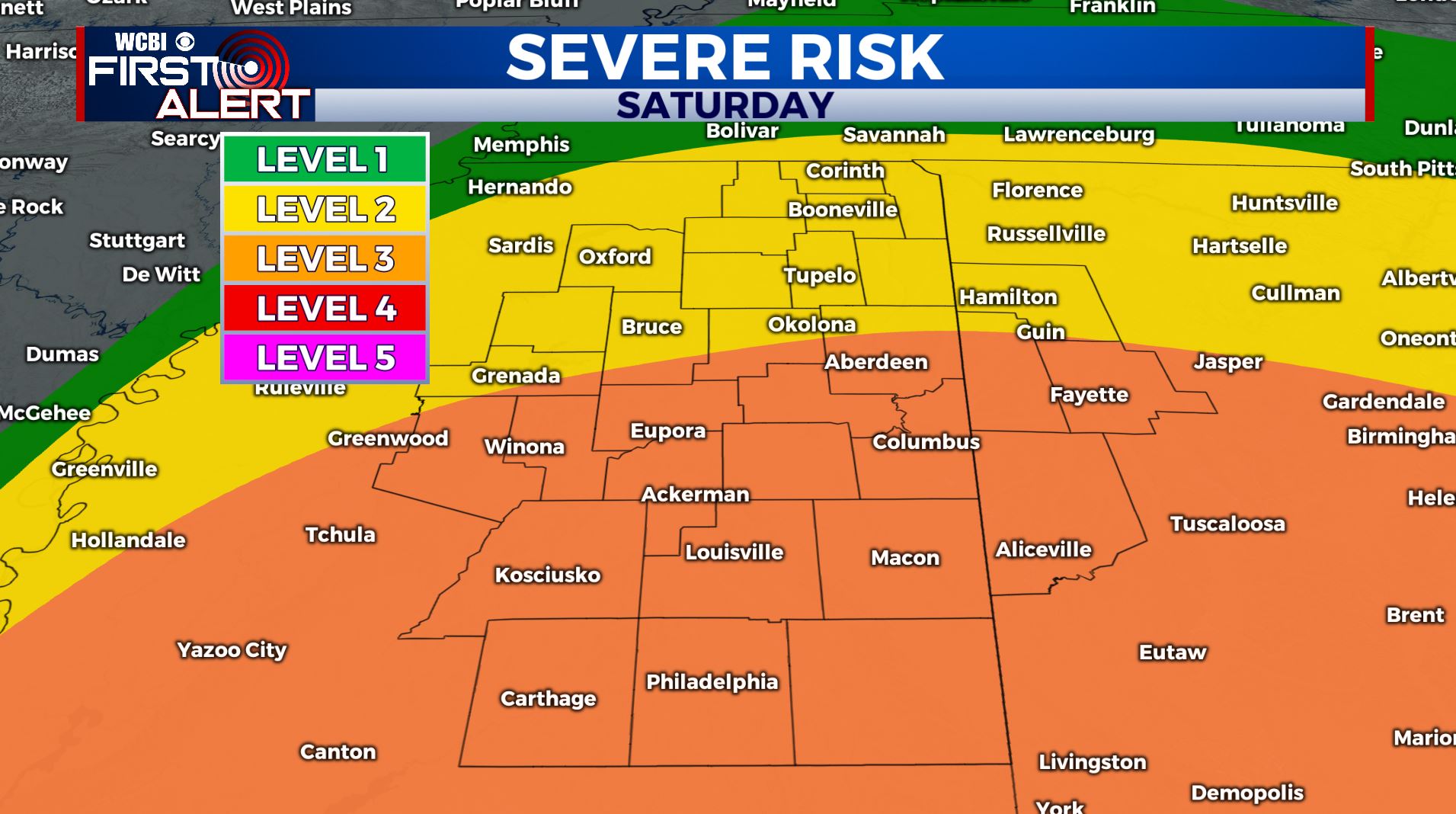
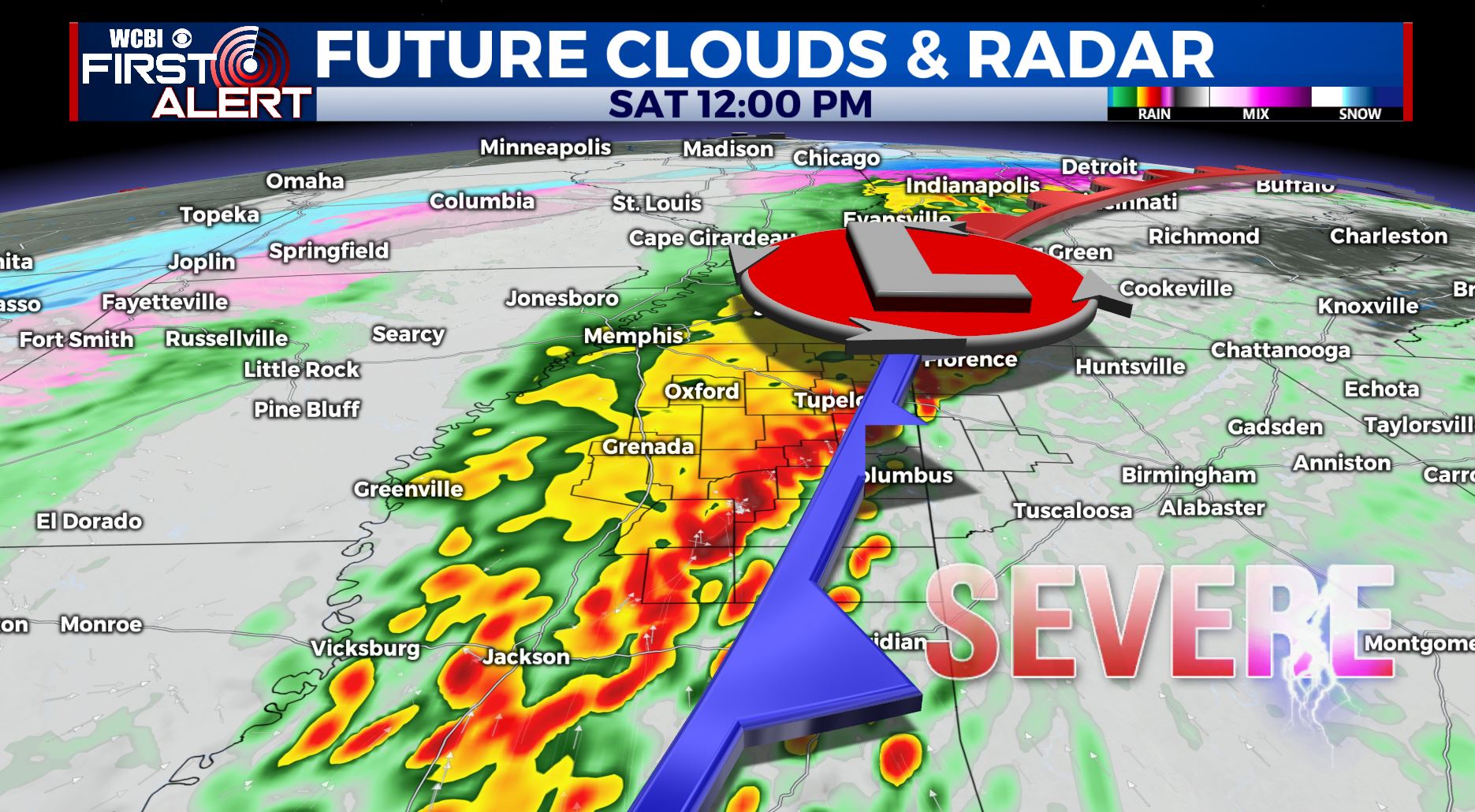
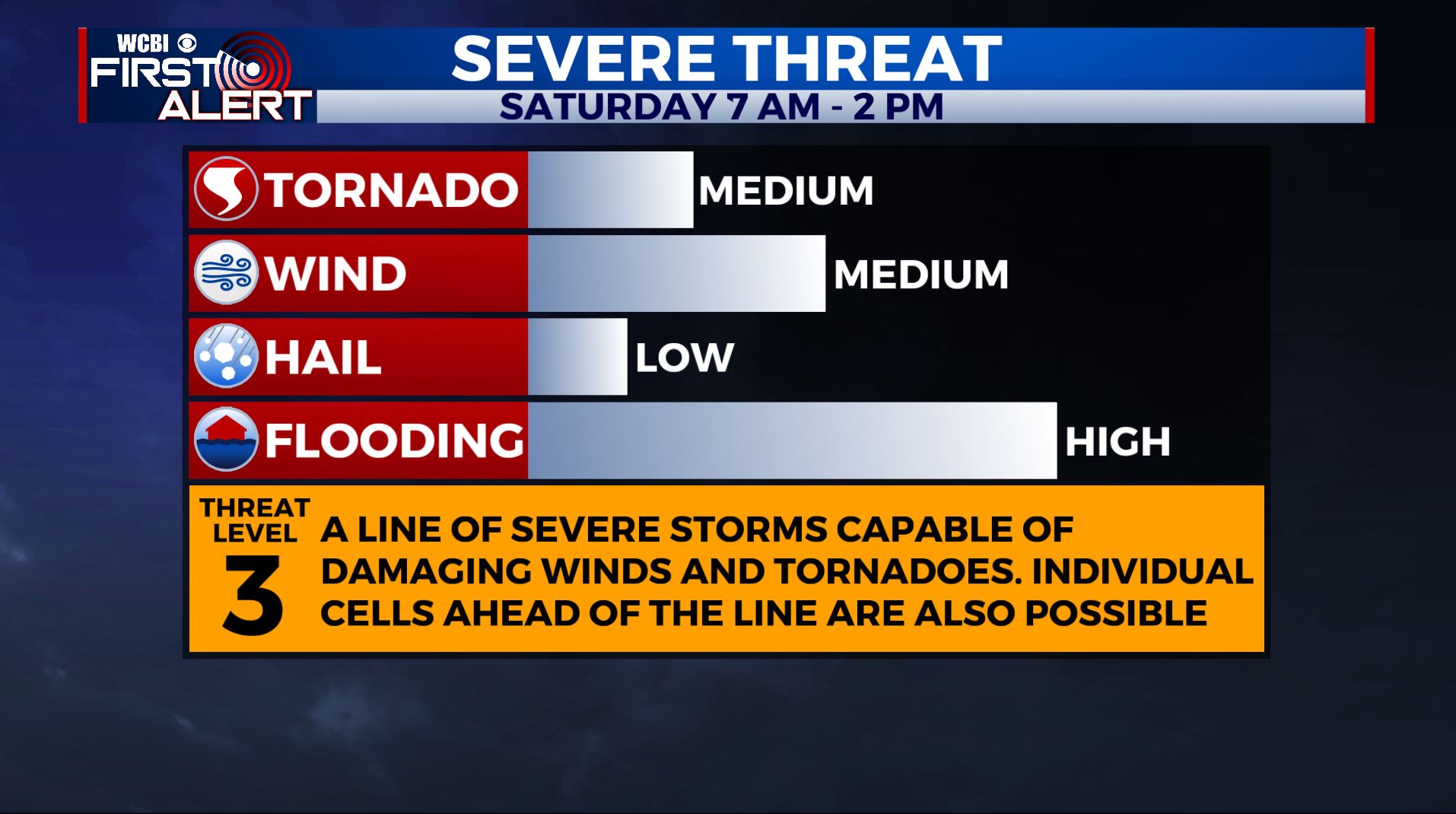
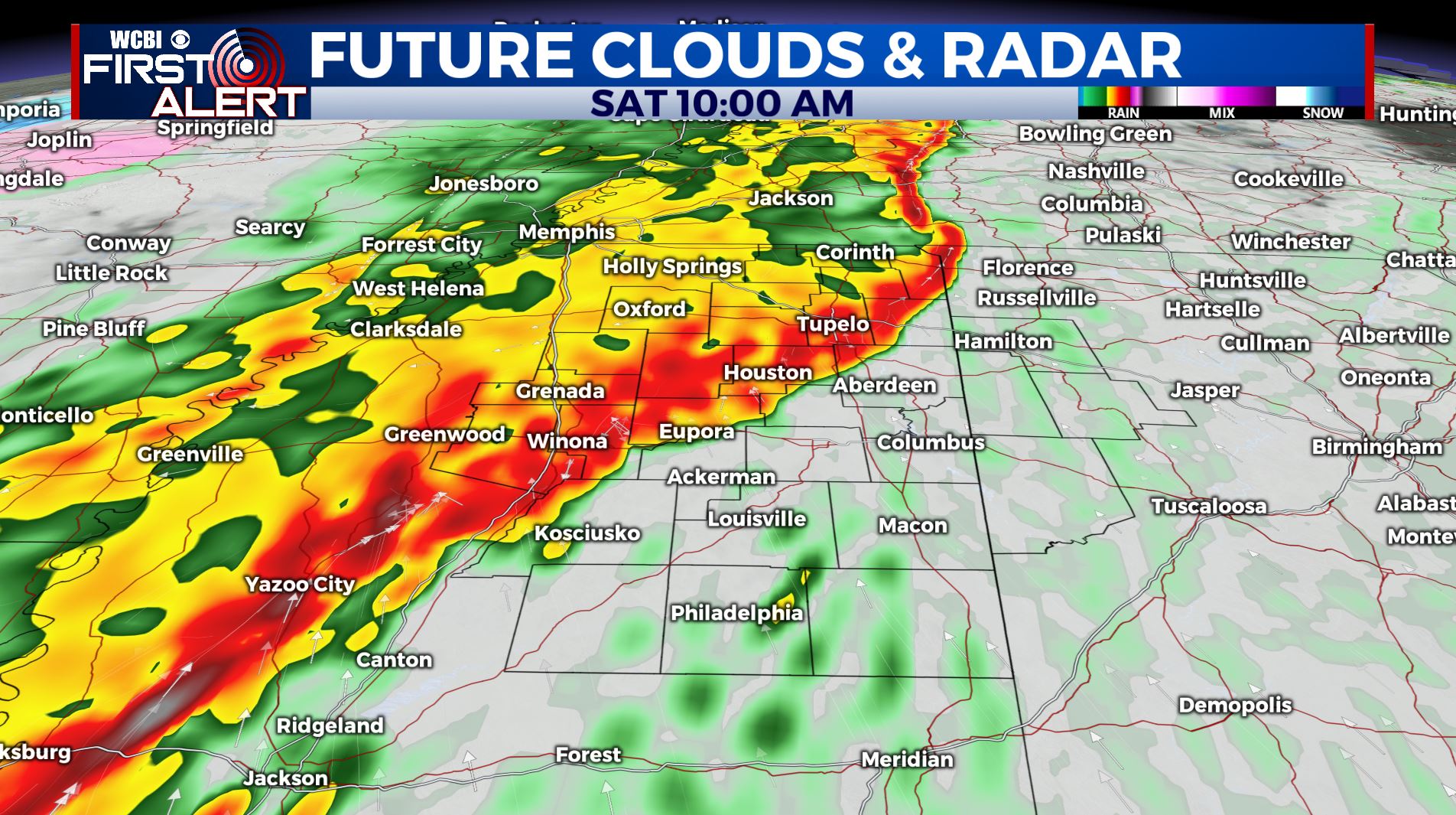
SATURDAY: A line of strong to severe storms approaches the area early Saturday morning. Everyone is expected to see rain and storms, with the potential there for severe weather across the region. As of right now, we are under a Level 2 to Level 3 Risk. The main threats will be damaging winds as high as 70 mph and flooding rains, though a few tornadoes look probable embedded in a line of storms. We’ll have to watch and see if any isolated storms form ahead of the line, something that would enhance the severe potential even higher. Timing looks to be from 7AM to 2PM.
SUNDAY: Right now we anticipate storms to roll out of the area by Saturday Night meaning we’ll trend dry with a mix of sun and clouds on Sunday. Highs much cooler in the upper 50s. Some more showers are expected heading into late Sunday night.
MONDAY – WEDNESDAY: Another system looks to follow closely behind, bringing the chance for batches of storms to pass through the area, adding on to already high rainfall totals. Flooding will be a concern moving forth, and we can’t rule out severe weather at some point heading into next week. High temperatures in the 60s.
STAY WITH @WCBIWEATHER ON FACEBOOK, INSTAGRAM, TWITTER AND ON THE WCBI MOBILE APP.


Leave a Reply