Clouds & rain moving back in late week
SUMMARY: Clouds will increase Wednesday out ahead of our next storm system arriving Thursday. Another half an inch to over an inch of rain may fall but it certainly won’t be as heavy as the last few systems that have rolled on through the region. Rain chances quickly decrease Friday morning and that will set up a pretty nice and pleasant weekend. Dry & quiet weather continues early next week.
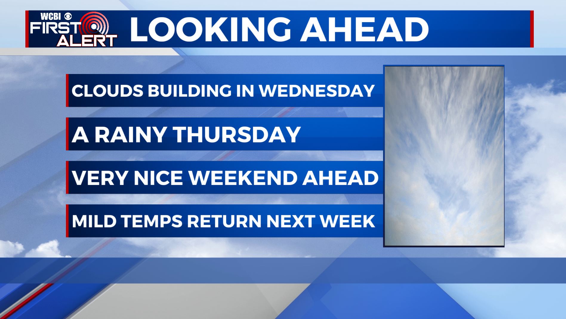
WEDNESDAY: Increasing clouds but dry. Highs top out in the mid to upper 40s. Light SE winds.
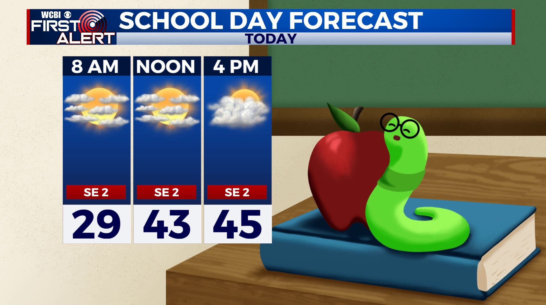
WEDNESDAY NIGHT: Mostly cloudy. Slight chance of a stray shower by morning. Lows in the mid 30s. Light SE winds.
THURSDAY: Cloudy skies with widespread rain chances. Highs in the upper 40s. Winds SE 5-10 mph.
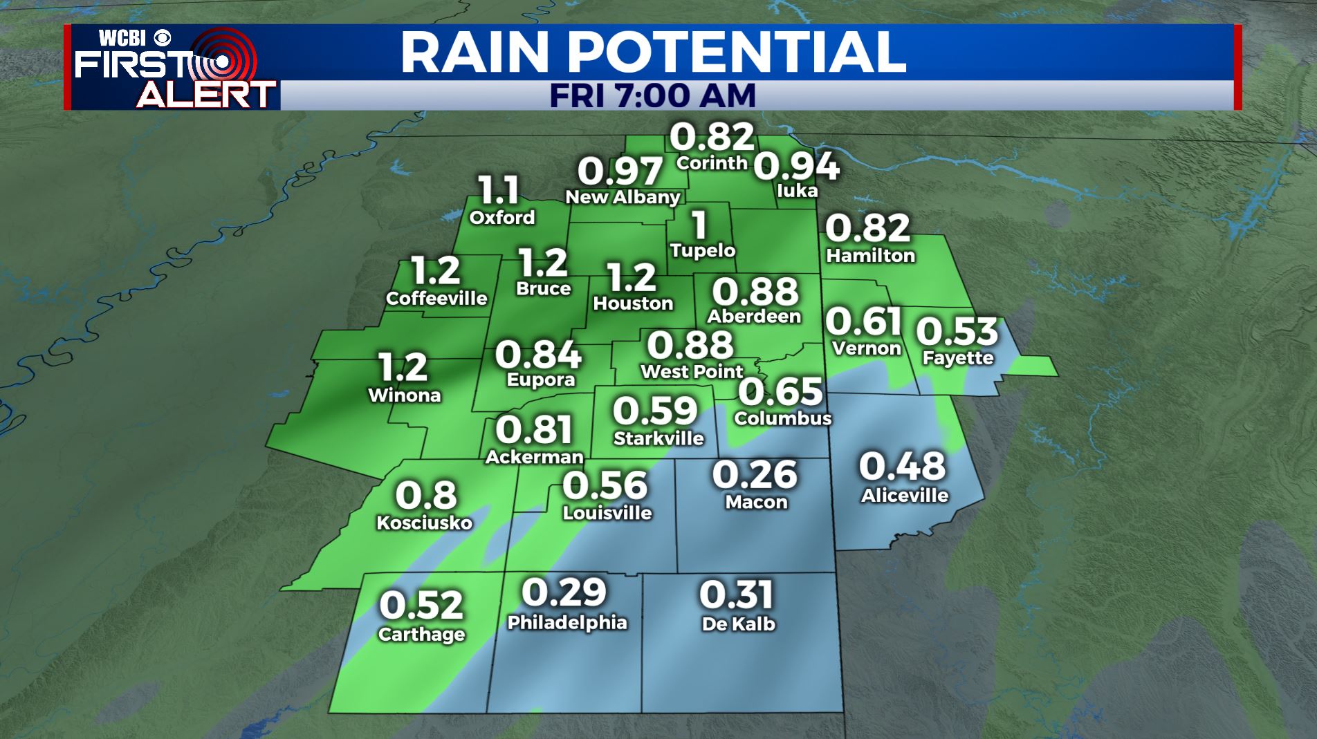
THURSDAY NIGHT: Areas of rain showers. Lows in the 40s.
FRIDAY: Morning cloudy skies are possible but most of the day is looking dry & clearing up. Look for highs in the lower 50s with west winds 5-10 mph.
FRIDAY NIGHT: Mostly cloudy. Lows in the mid 30s.
SATURDAY & SUNDAY: A mostly sunny and pleasant weekend is ahead with temperatures near average with highs in the 50s and overnight lows in the 30s.
MONDAY & TUESDAY: A mix of sun and clouds. Highs warming into the lower 60s by Tuesday with overnight lows moderating back into the upper 30s and 40s.
Stay connected with @WCBIWEATHER on Facebook, Twitter, Instagram and the WCBI News App


Leave a Reply