Cloudy Friday followed by rain chances returning for the weekend
SUMMARY: After a beautiful and warm Thursday, changes in our weather are moving in for our Friday and into the weekend. Expect the return of rain chances and cooler temperatures that will last through early next week.
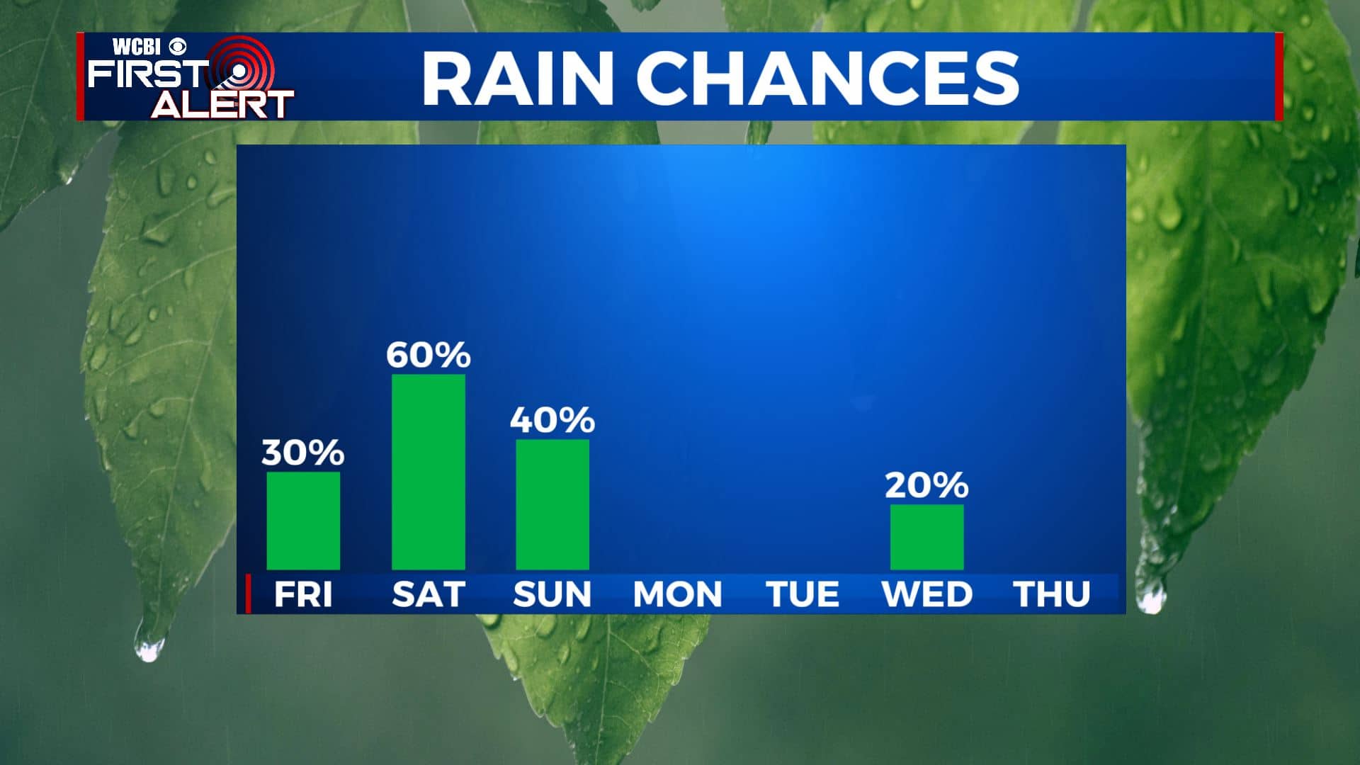
FRIDAY: We’re waking up to a mix of sun & clouds this Friday morning, but clouds will increase throughout the day ahead of our next storm system. Highs will be in the mid 60s with a south wind at 5-10 mph.
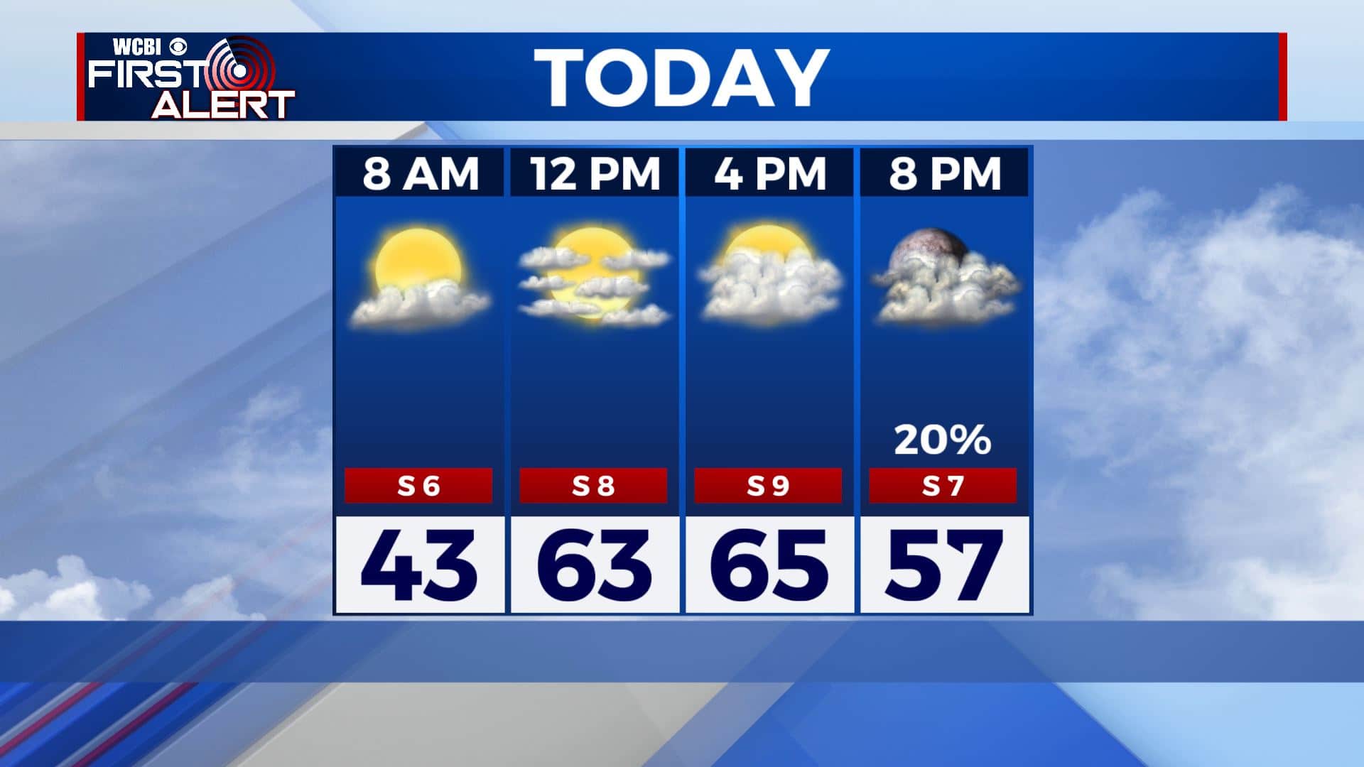
FRIDAY NIGHT: Rain chances will pick up after sunset into the overnight hours. Overnight lows in the 50s.
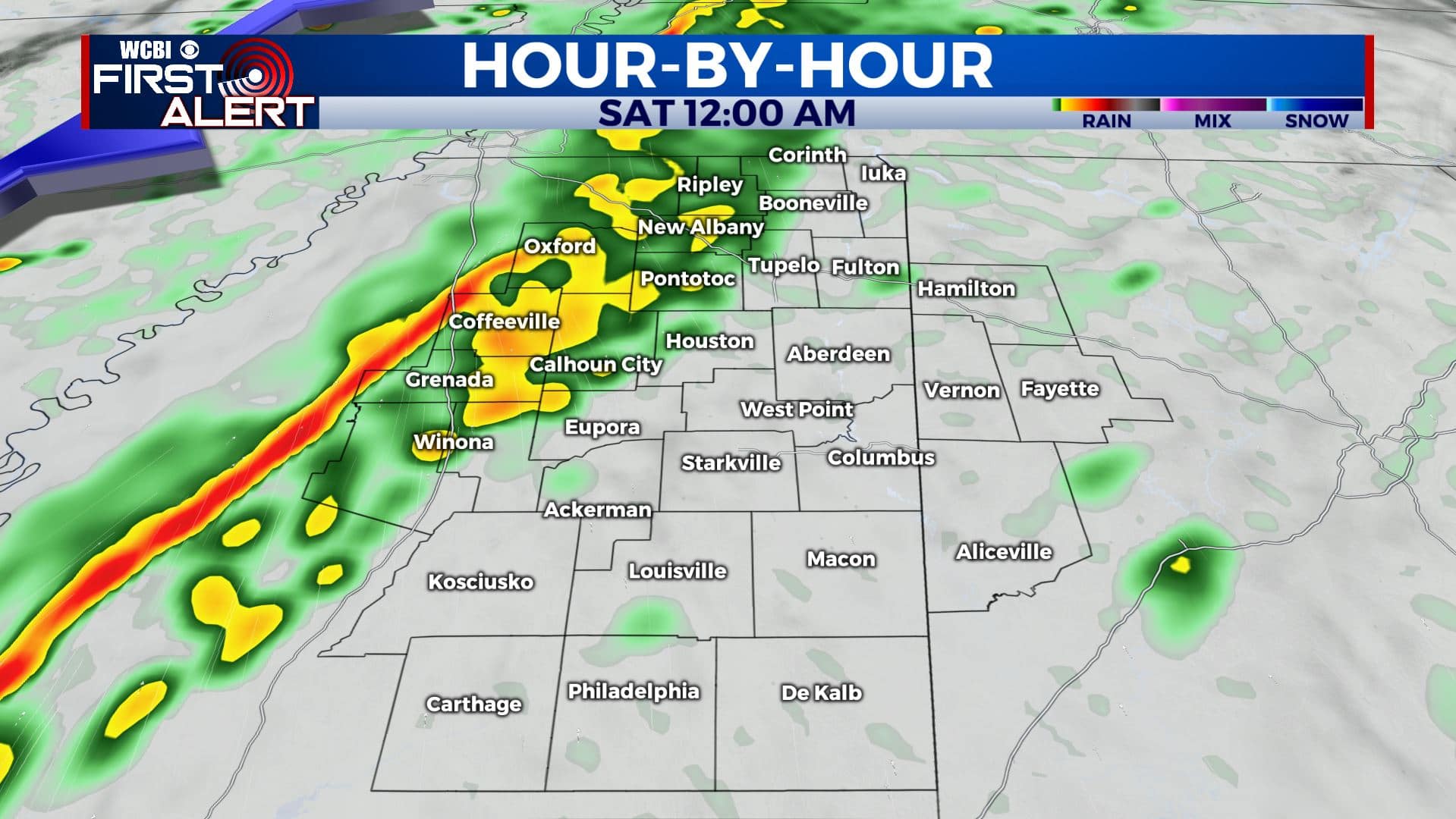
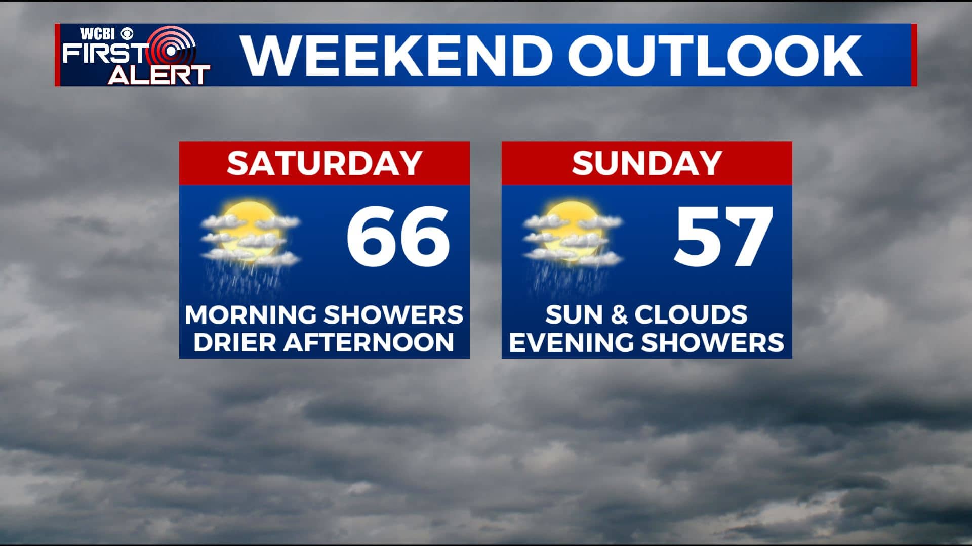
SATURDAY: We will be waking up to rain showers and perhaps a bit of thunder on Saturday morning. Good news is that no severe weather is expected. Rain will exit for the most part by lunchtime Saturday as a cold front pushes through, leaving us dry for the rest of the afternoon. Highs will be in the mid 60s with temperatures dropping in the afternoon and evening as cooler air filters in behind the front.
SATURDAY NIGHT: A few clouds overnight with chilly temperatures as lows fall into the 30s.
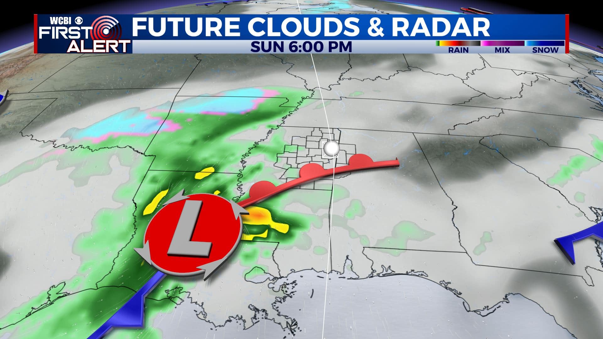
SUNDAY: Clouds will linger through the day on Sunday with another round of showers possible later Sunday afternoon into the evening. Temperatures will be cooler with highs in the 50s and overnight lows in the 30s.
NEXT WEEK: Monday will be drier with clouds moving out of the region. Tuesday looks mostly sunny, but some isolated showers are possible through the day on Wednesday. Temperatures will remain cool next week with highs in the upper 40s to lower 50s. Overnight lows in the upper 20s and 30s.
Stay connected with @WCBIWEATHER on Facebook, Twitter, Instagram, and the WCBI News App


Leave a Reply