Cloudy Friday makes way for a decent weekend
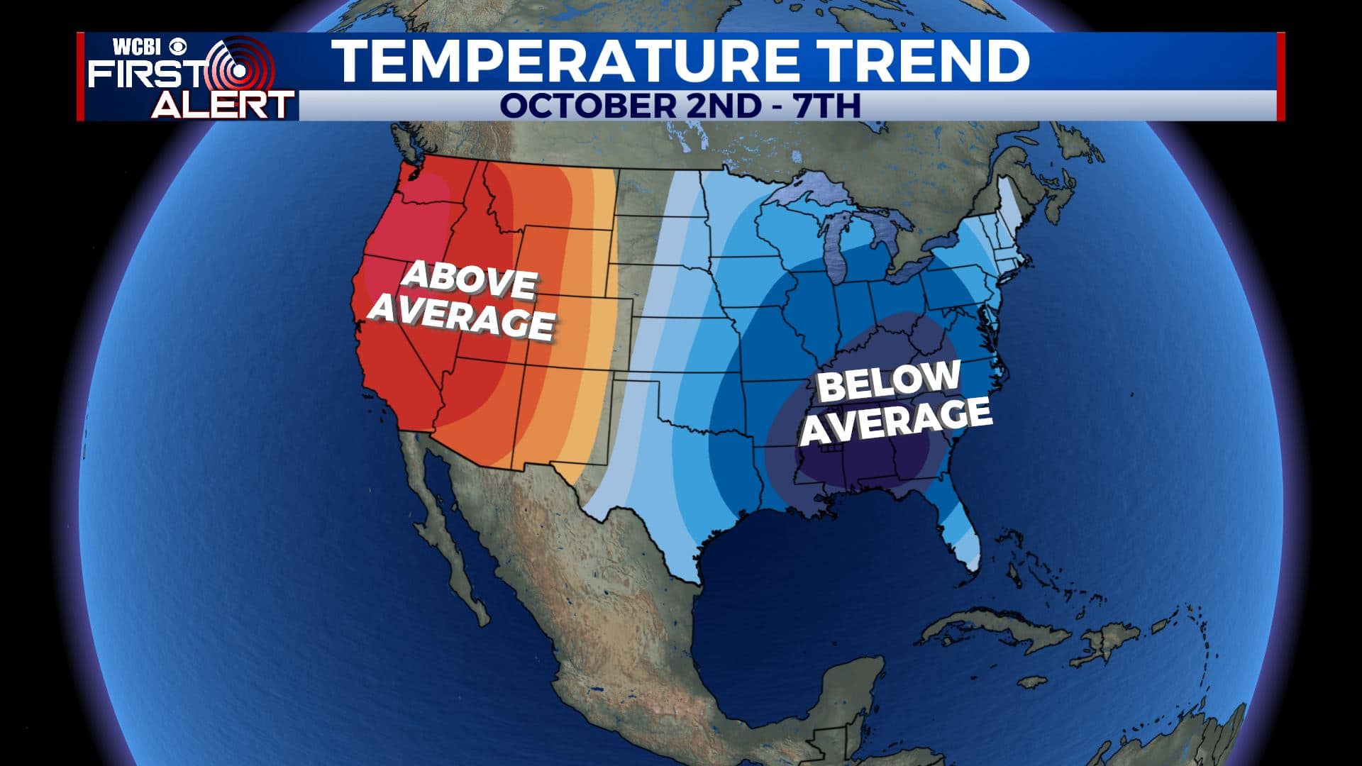
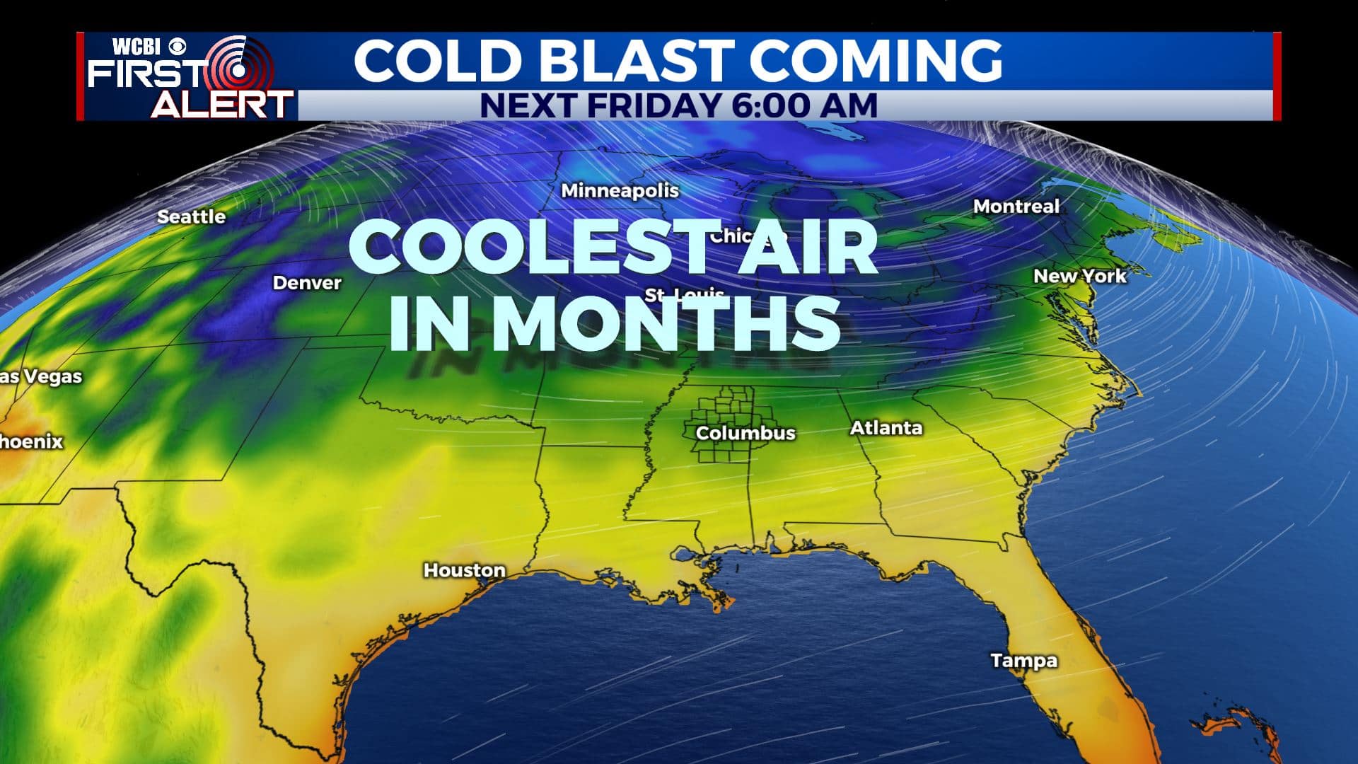
SUMMARY: We’ll be drying out a bit for Friday and heading into the weekend. A few showers are possible Sunday with some more widespread rain Monday as a cold front pushes through. Seasonable 80s are slated to return by Saturday afternoon and they should continue into Sunday before the 70s return on Monday. Another cool shot of air may return by the middle to end of next week, bringing behind it the coolest air of the season so far.
FRIDAY: We’re waking up to misty/foggy conditions this Friday morning. We’ll have the cloud cover with a few peaks of sun developing during the afternoon hours. Highs in mainly in the mid 70s with NW winds 5-10 mph.
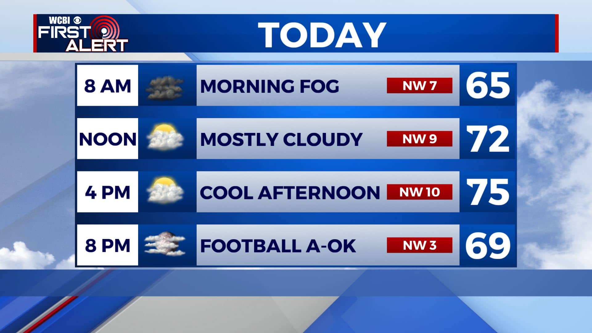
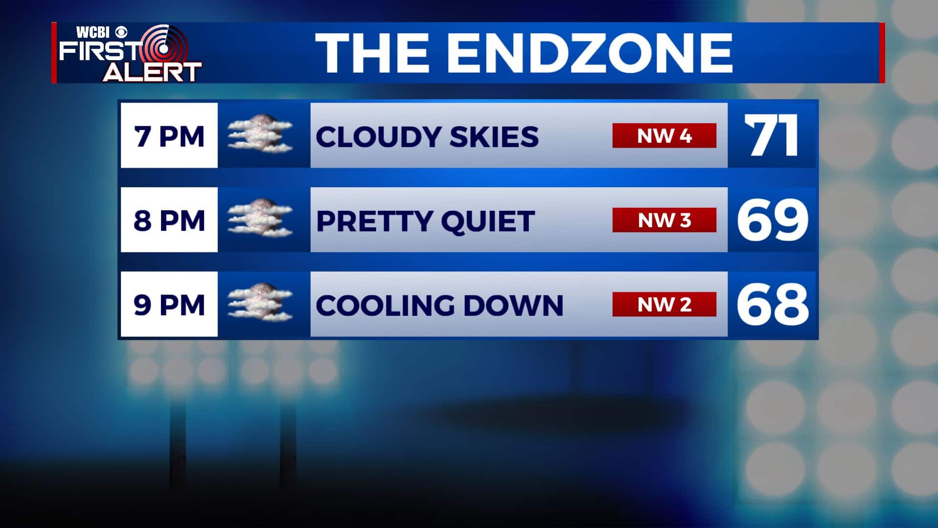
FRIDAY NIGHT: Dry conditions with temperatures in the 60s can be expected for high school football in the evening. Areas of low clouds and fog could develop by sunrise Saturday morning. Overnight lows in the lower 60s. Light wind.
SATURDAY: Extensive cloud cover to start the day with more sunshine developing into the afternoon as high pressure builds into the region. Highs should top out in the lower 80s if there is enough sunshine. Southerly winds 5-10 mph.
SUNDAY: A mix of sun & clouds with an isolated chance of showers ahead of our cold front. Highs remain in the 80s.
MONDAY: Increasing clouds with a chance of rain developing during the afternoon and evening as our cold front moves through. Highs in the upper 70s.
TUESDAY-FRIDAY: Recent models suggest that a second cold front will push through mid to late week. Highs will top out in the 70s with overnight lows tumbling into the lower 50s, maybe the upper 40s. Rain chances appear quite low during this time. Stay tuned!
Stay connected with @WCBIWEATHER on Facebook, Twitter, Instagram, and the WCBI News App


Leave a Reply