Cold Christmas, Milder Weekend
SUMMARY: Old Man Winter has returned just in time for Christmas. Bone chilling wind chills are in store for Thursday night/Friday morning with actual temperatures struggling into the upper 30s Christmas Day. Milder 50s are on track for the weekend with some 60s possible again next week. While a few showers are possible Monday, our next best chance of any heavy rain and storms will come during the middle of next week.
THURSDAY NIGHT: Mostly clear to partly cloudy and cold. Lows in the low 20s. Wind chill values in the teens and possibly single digits. Winds WNW 5-15 mph.
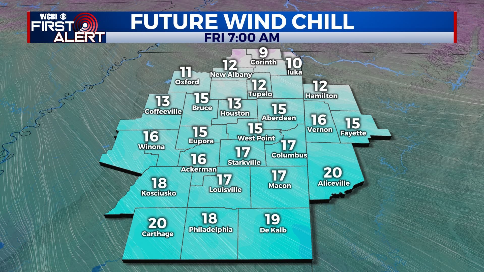
CHRISTMAS DAY: Sunny and cold. Highs ranging from the mid 30s to low 40s. Winds NW 10-20 mph with wind chills in the single digits and teens during the morning. Wind chills in the 20s and low 30s in the afternoon.
FRIDAY NIGHT: Clear and cold. Lows around 20. Calm wind.
SATURDAY: Sunny. Highs in the low 50s. Southerly winds 5-10 mph.
SATURDAY NIGHT: Mainly clear. Lows around 30.
SUNDAY: Mostly sunny. Highs in the upper 50s.
MONDAY: Mostly cloudy. A 20% chance of showers. Highs in the 50s.
TUESDAY: Sun & clouds. Highs around 60.
WEDNESDAY: Mostly cloudy. A 60% chance of rain and thunder. Highs in the low 60s.
Follow @WCBIWEATHER on Facebook, Twitter, Instagram, and the WCBI News App


Leave a Reply