Cold front pushing through to end the workweek
SUMMARY: Scattered storms in the forecast again for Thursday. On Friday, a cold front will approach the area and it is looking like a washout, but much cooler temperatures. The cold front should be out of here by Saturday morning, so that means a pretty nice & dry holiday weekend. Heat and humidity quickly returns to start next week, with a typical summertime pattern returning. We’ll also be keeping an eye on the tropics.
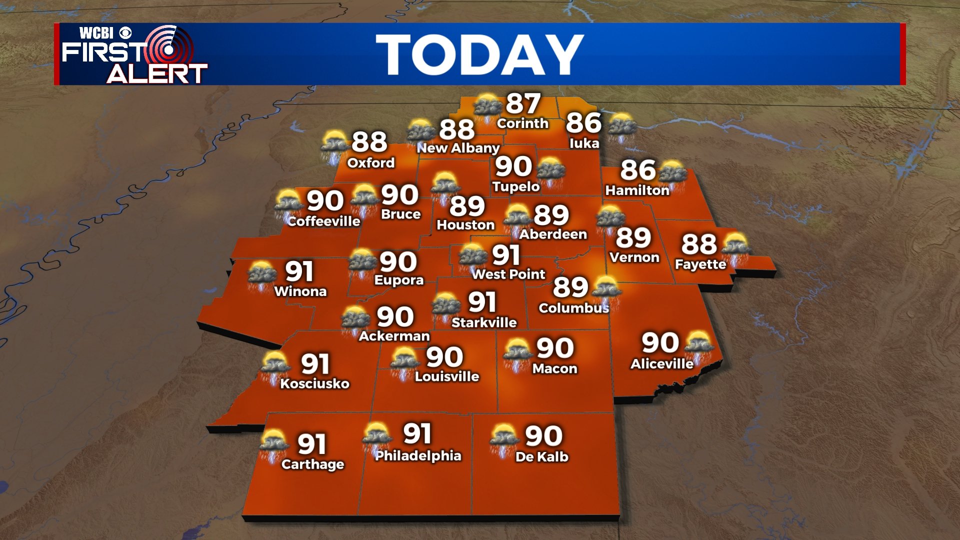
THURSDAY: As our cold front begins to approach the area, clouds will be increasing throughout the day. Afternoon showers and storms likely once again and chances will be higher. Highs in the upper 80s.
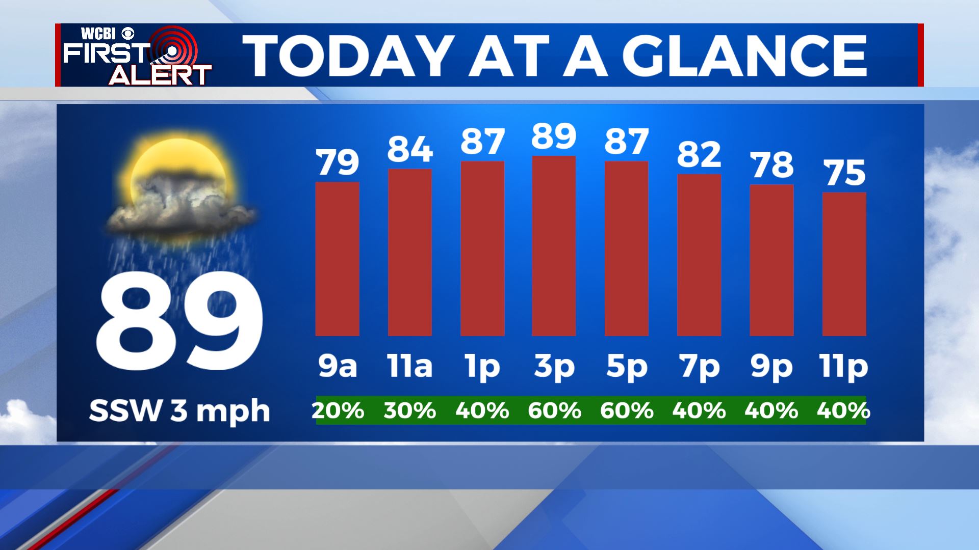
THURSDAY NIGHT: Showers will continue to pick up during the overnight hours, becoming more widespread. Overnight lows in the lower 70s.
FRIDAY: A washout across the WCBI Viewing Area widespread rain and storm chances throughout the entire day. Highs will only be in the upper 70s to lower 80s as our cold front pushes through.
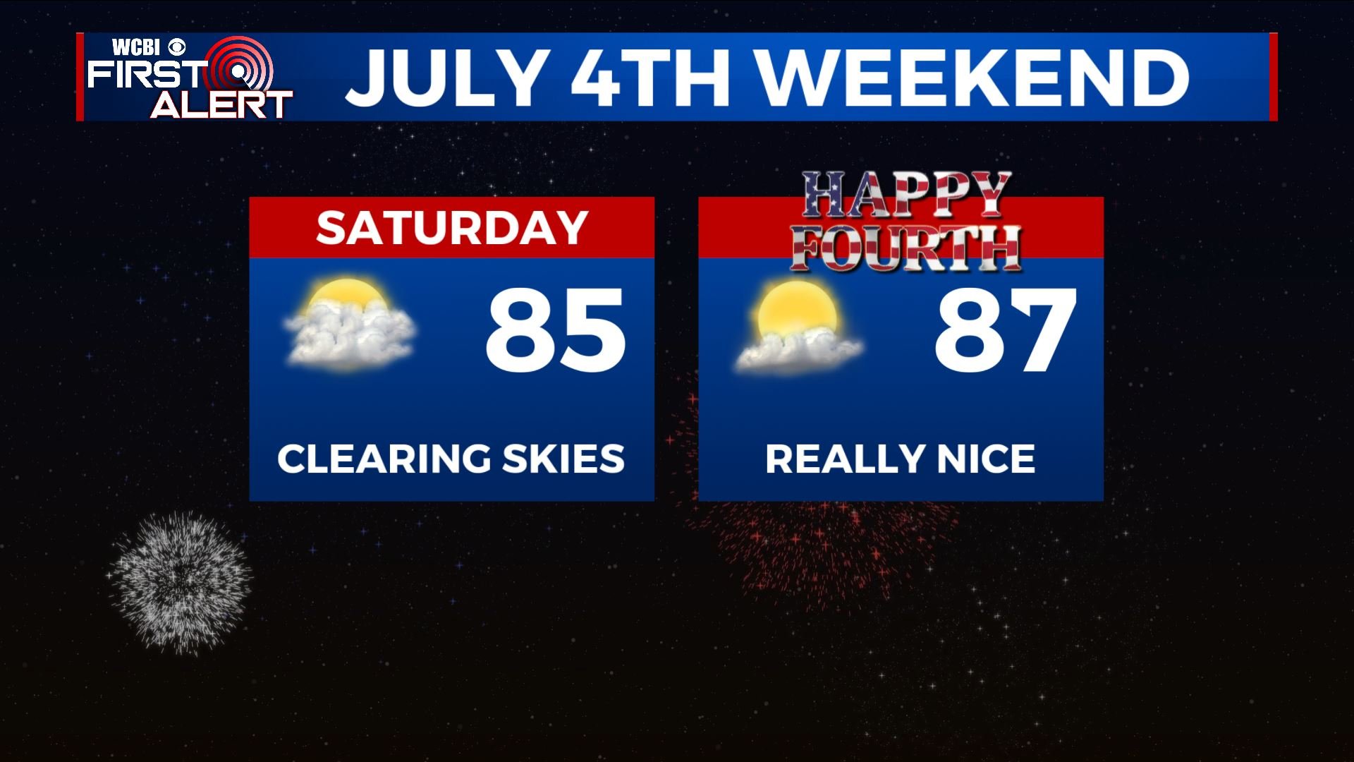
HOLIDAY WEEKEND: The cold front should start clearing out the rain late Friday night into early Saturday morning, leaving us with a dry and pleasant Saturday afternoon into the 4th of July holiday on Sunday with a mix of sun & clouds. High temperatures less humid & nice in the lower to mid 80s. Overnight lows will also be pretty nice in the low to mid 60s.
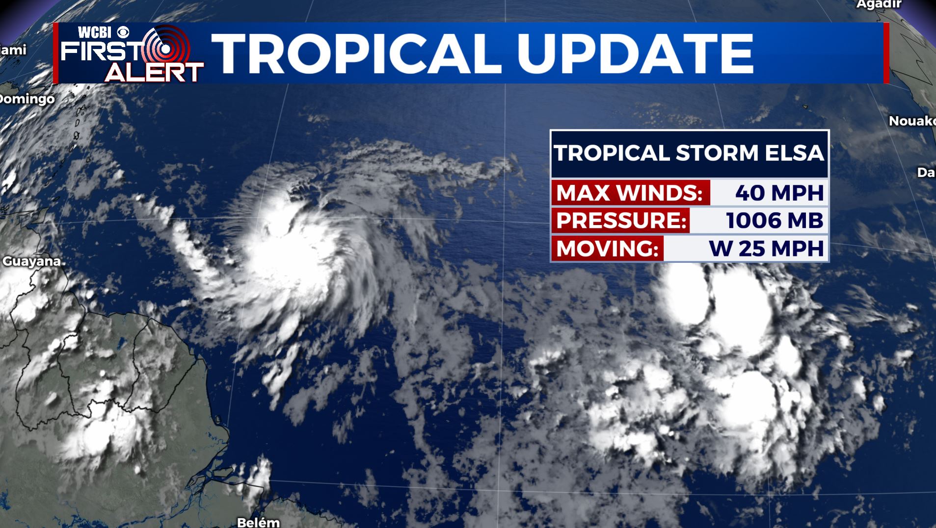
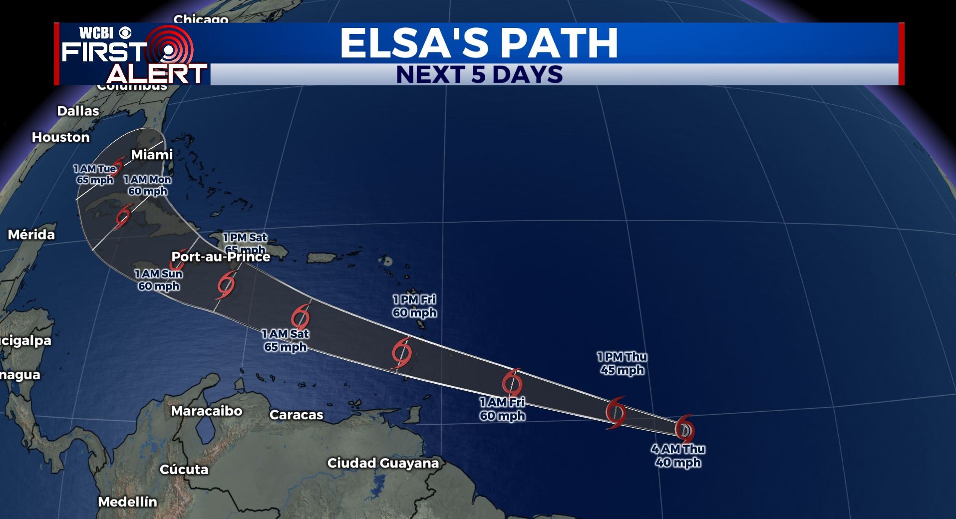
NEXT WEEK: Humidity and heat returns as we start the new workweek. Highs will be rising back to the mid to upper 80s. Scattered storm chances return for Tuesday. We’ll be watching the tropics closely next week to see where what Tropical Storm Elsa will go. Stay tuned!
Stay connected with @WCBIWEATHER on Facebook, Twitter, Instagram and the WCBI News App


Leave a Reply