Cold Halloween, sunny weekend coming
SUMMARY: A strong cold front will cross the region tonight. A slight chance for an isolated severe storm or two with gusty winds will remain in place until 1 or 2 a.m. Rain showers will gradually end from west to east Thursday morning as drier air blasts in from the northwest. A widespread frost and/or freeze is likely Friday morning.

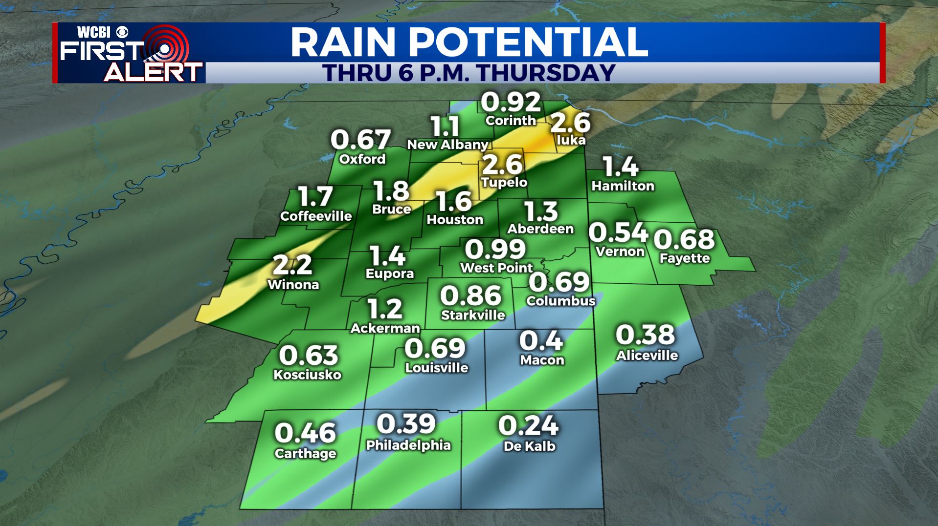
WEDNESDAY NIGHT: An isolated severe storm with strong wind is possible through 1 or 2 a.m. Rain will be possible throughout the night. Temperatures will be in the 60s to low 70s during the evening but they’ll drop into the 40s and 50s by sunrise. Gusty NW winds set up by the morning commute.
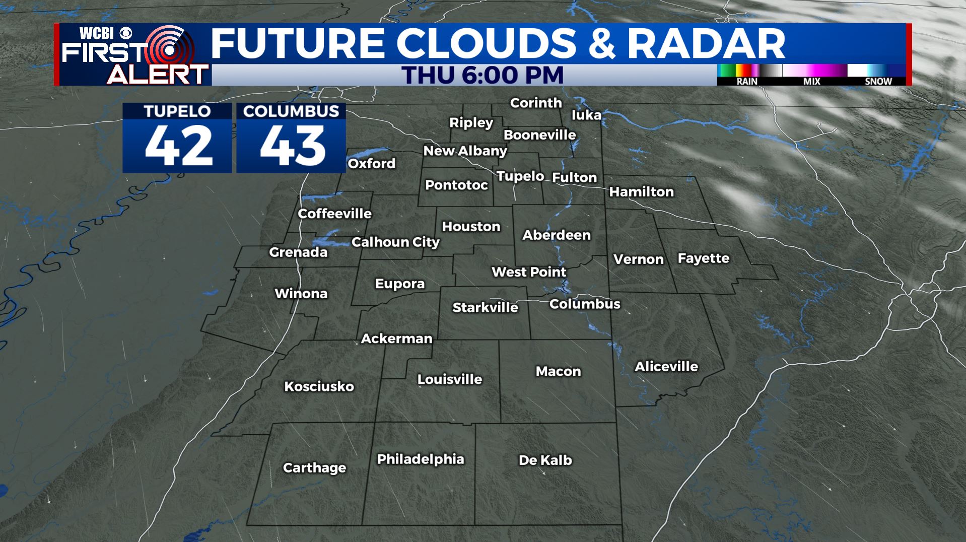
THURSDAY: Areas of rain will gradually come to an end from west to east during the morning hours. Clouds are going to break up during the afternoon with clear skies returning by evening. Temperatures should be mainly in the 40s with NW winds 10-20 mph. Some gust may be up to 25 mph.
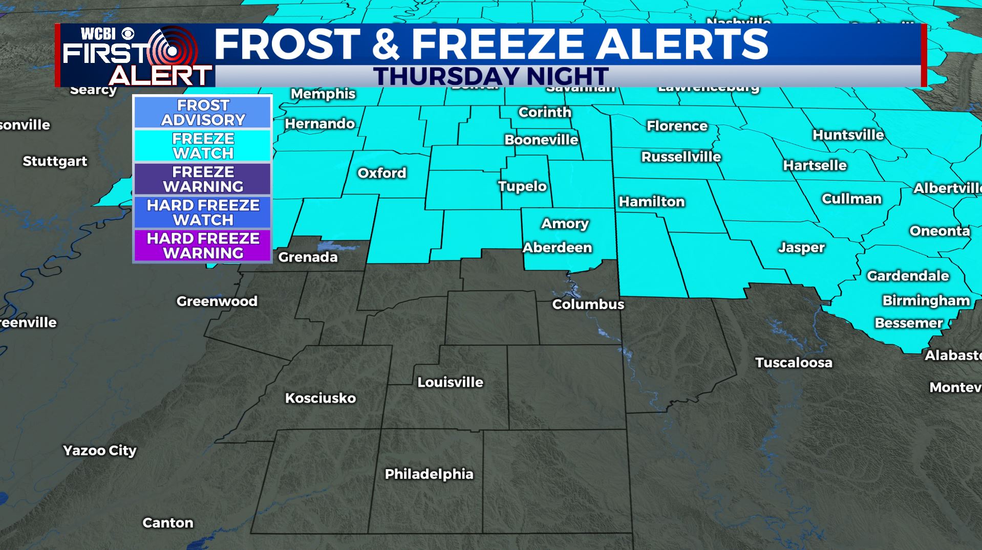
THURSDAY NIGHT: Clear and cold weather is on track for trick-or-treating in the evening. Make sure your little ghosts and goblins wear a good coat because temperatures will be in the low 40s and the wind will make it feel a bit colder. The wind will gradually relax and that should allow temperatures to cool to around 30 by daybreak Friday. A widespread frost or freeze is likely so make sure your tender plants are covered.
FRIDAY-MONDAY: High pressure will give us ample sunshine but temperatures are going to remain chilly. Daytime highs look to be in the 50s with overnight lows in the low 30s or even upper 20s.
NEXT WEEK: Temperatures should moderate a bit going into Election Day. We’re going to add just a slight chance for a few showers on Tuesday.
Follow @WCBIWEATHER on Facebook, Twitter, Instagram, and the WCBI News app.


Leave a Reply