Cold start to December
SUMMARY: Meteorological winter begins Tuesday and it will certainly feel like it, even with lots of sunshine. Below normal air is going to stick around for the rest of the work week and upcoming weekend. The next chance of rain will come Thursday.
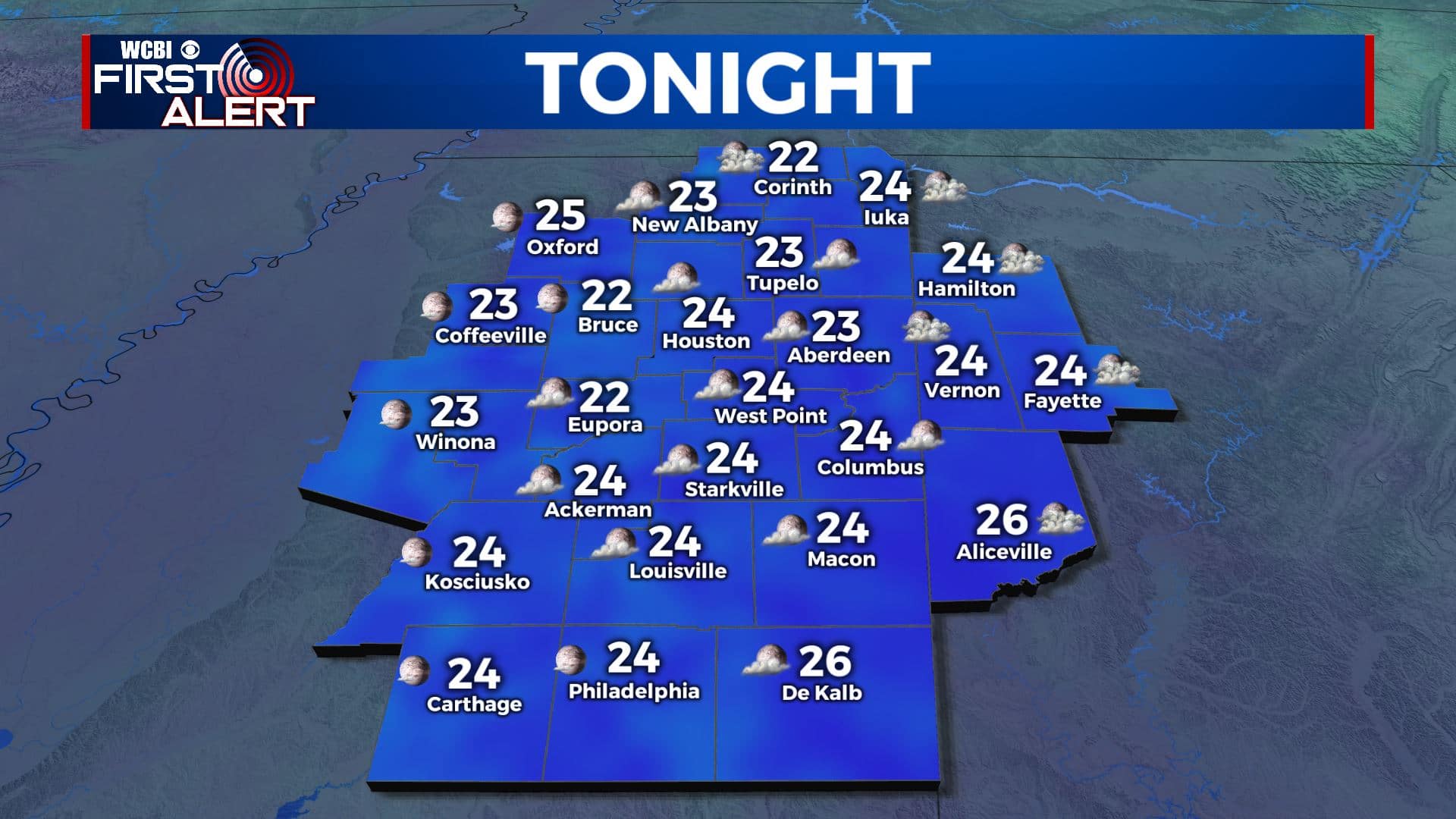
MONDAY NIGHT: Clearings skies with falling temperatures. Cold lows in the mid to low 20s. Winds WNW 3-8 mph. Wind chill values in the 20s all night long. Bundle up!
TUESDAY: Mostly sunny and chilly. Highs in the upper 40s to around 50. Westerly winds 5-10 mph.
TUESDAY NIGHT: Mainly clear and cold. Lows in the mid 20s. Calm wind.
WEDNESDAY: Mostly sunny in the morning with increasing clouds during the afternoon. Highs in the low to mid 50s.
WEDNESDAY NIGHT: Mostly cloudy. Lows in the mid to upper 30s.
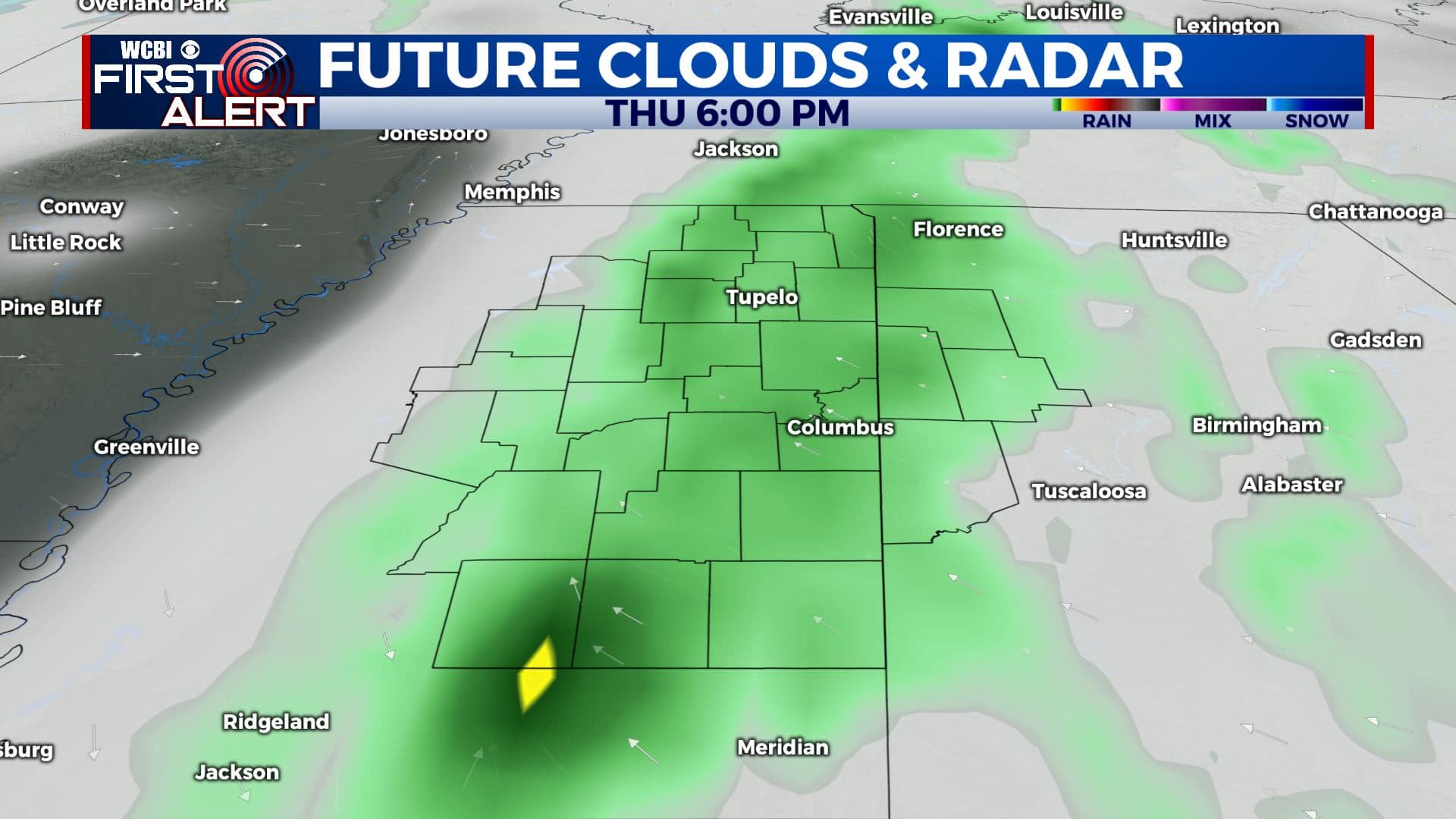
THURSDAY: Cloudy with a 50% chance of showers. Highs in the low 50s. Mid 30s for lows Thursday night.
FRIDAY: Mostly cloudy. A 20% chance of lingering showers. Highs in the upper 40s to around 50. Lows in the mid to low 30s Friday night.
SATURDAY: Sun & clouds. Highs in the 50s.
SUNDAY: Mostly sunny. Highs in the mid to upper 50s.
Follow @WCBIWEATHER on Facebook, Twitter, Instagram, and the WCBI News App


Leave a Reply