A very cold start with some snow then a little sunshine for your Tuesday
SUMMARY: Icy roads will continue to be a concern into Wednesday until the area can get back above freezing. We’ll see a bit of sunshine on Tuesday afternoon. Another system is set to push through and could yet bring us another possible round of winter weather late Wednesday into Thursday. Stay tuned!
TUESDAY: After some morning snow showers south, sunshine will try to peak through during the day. Highs should remain very cold, only in the mid 20s. Wind chill values will peak in the teens. We expect icy roads to continue so stay at home if you can. If not, be very careful.
TUESDAY NIGHT: Partly cloudy and cold. Lows in the mid teens. Icy roads will continue to be a problem.
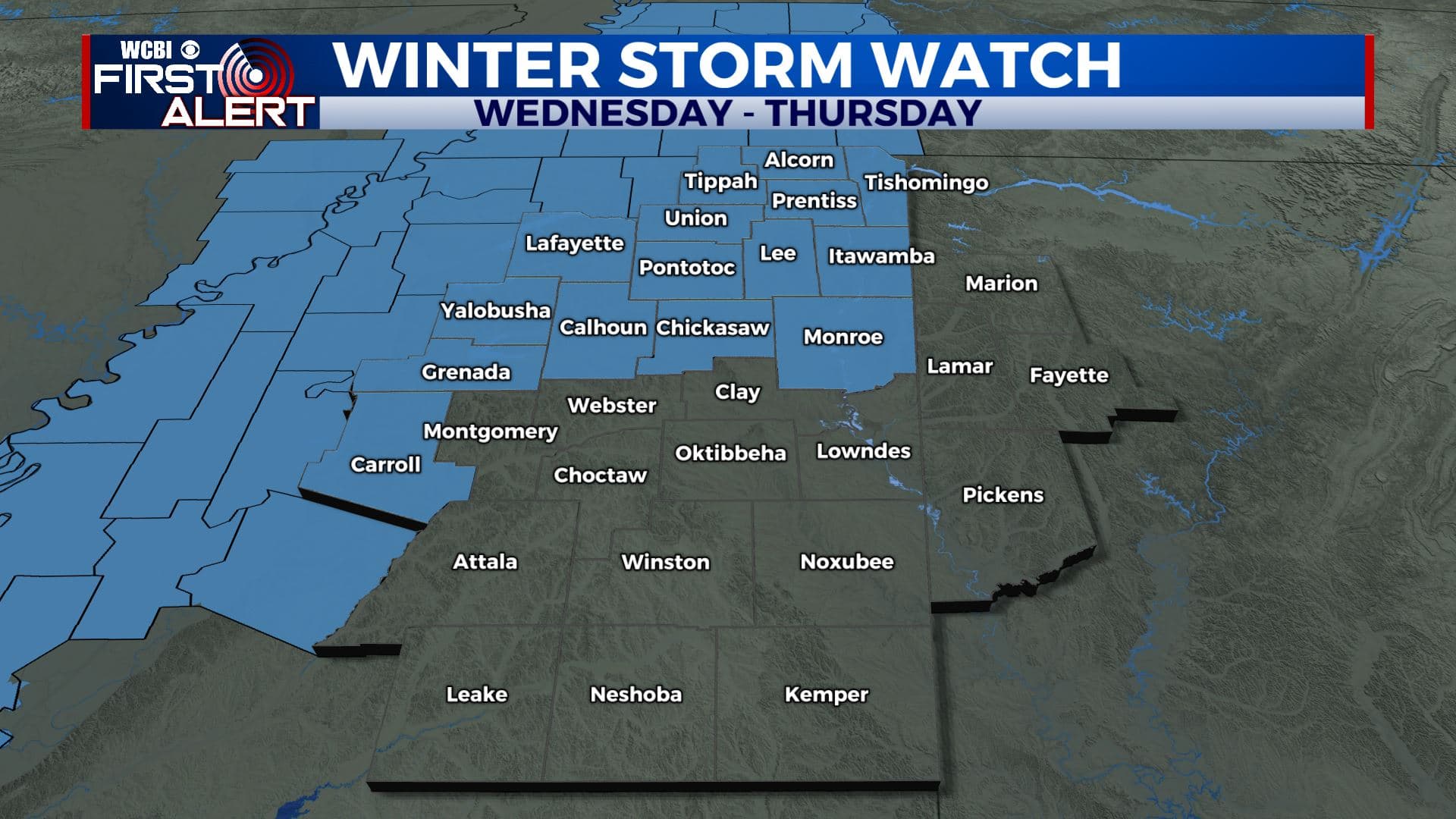
WEDNESDAY: Increasing clouds with a chance of afternoon rain, sleet, freezing rain, or snow in the afternoon depending on how fast the region can warm up. Highs should be in the upper 30s at some point. Areas north of Highway 82 are under a Winter Storm Watch as of Tuesday morning.
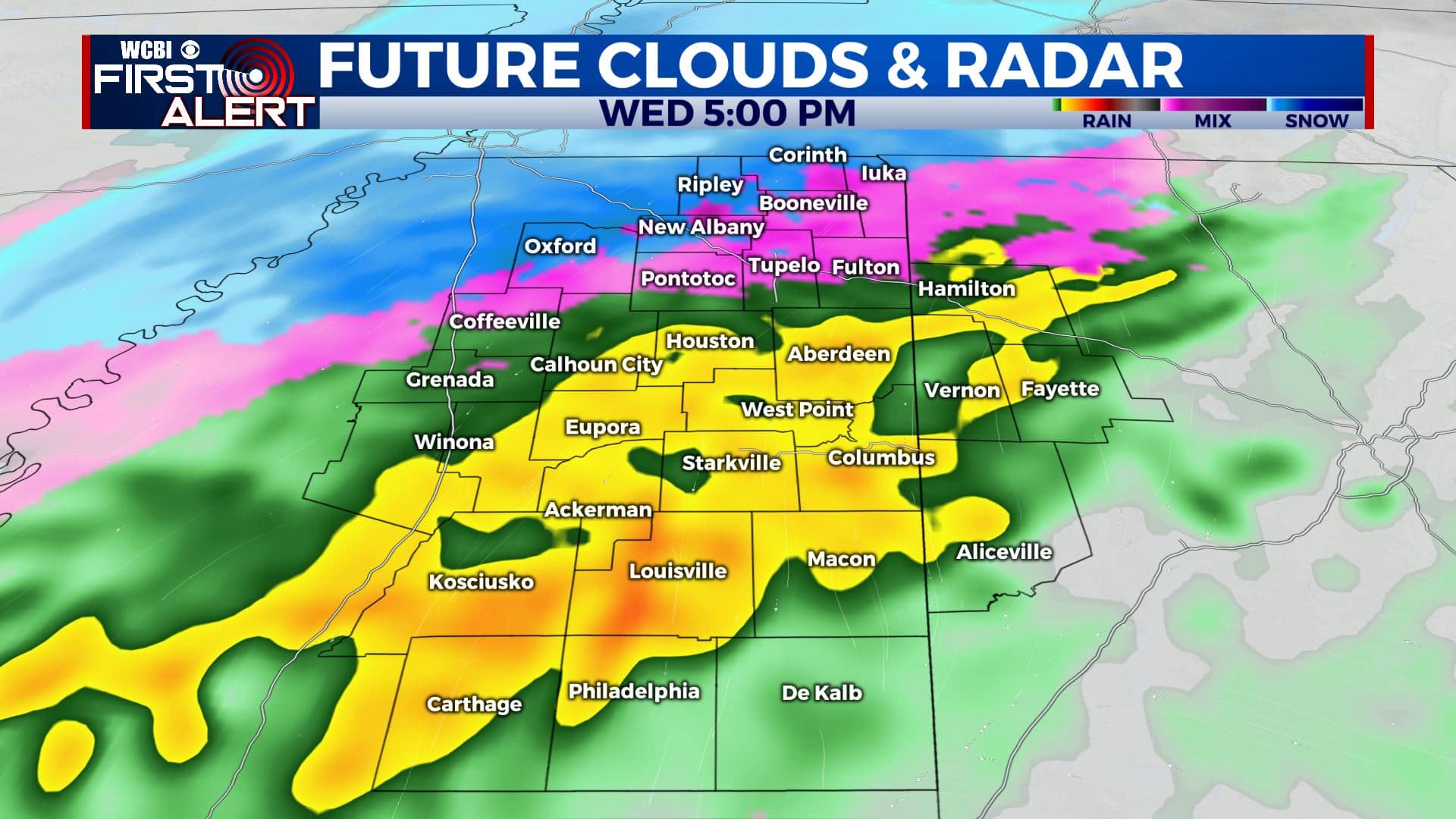
WEDNESDAY NIGHT INTO THURSDAY: More rain and wintry precipitation is expected, especially in our northern counties. We’ll continue to fine tune this forecast and accumulations so stay with WCBI for updates. Highs in the upper 30s are expected to continue into Thursday. Colder overnight lows in the upper 10s to near 20 degrees Thursday night.
FRIDAY: A mix of sun & clouds. Chilly. Highs in the mid 30s. Overnight lows in the 20s.
SATURDAY: Mostly sunny. Getting warmer again with highs near 50.
SUNDAY-MONDAY: A few showers are possible in the forecast. Mild with highs in the upper 50s.
Stay connected with @WCBIWEATHER on Facebook, Twitter, Instagram, and the WCBI News App


Leave a Reply