A cold start but the sunshine returns for Friday
SUMMARY: Long awaited sunny and dry conditions will settle in just in time for Friday and the weekend. Temperatures will be cold in the 20s Friday and Saturday morning with wind chills in the teens. We’ll see an increase in clouds on Sunday, but we will remain dry. The rain and perhaps some thunder will return late Sunday night into Monday. Another blast of cold air is possible by the middle of next week.
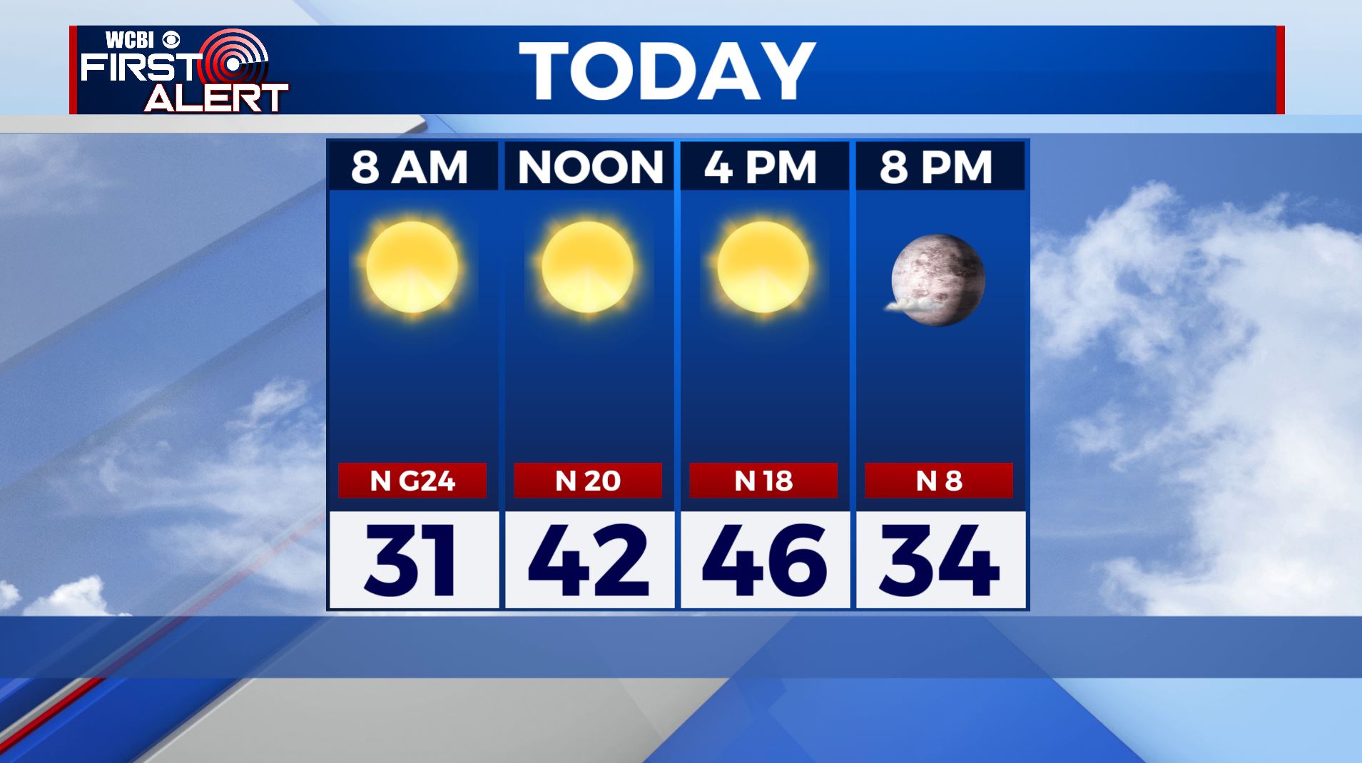
FRIDAY: BRRRRR!!!! It’s a cold start to our Friday with temperatures in the 20s. Bundle up because wind chills are in the teens in some spots. The sunshine makes a return today with highs only in the mid 40s. Winds N 10-20 mph, gusts up to 25.
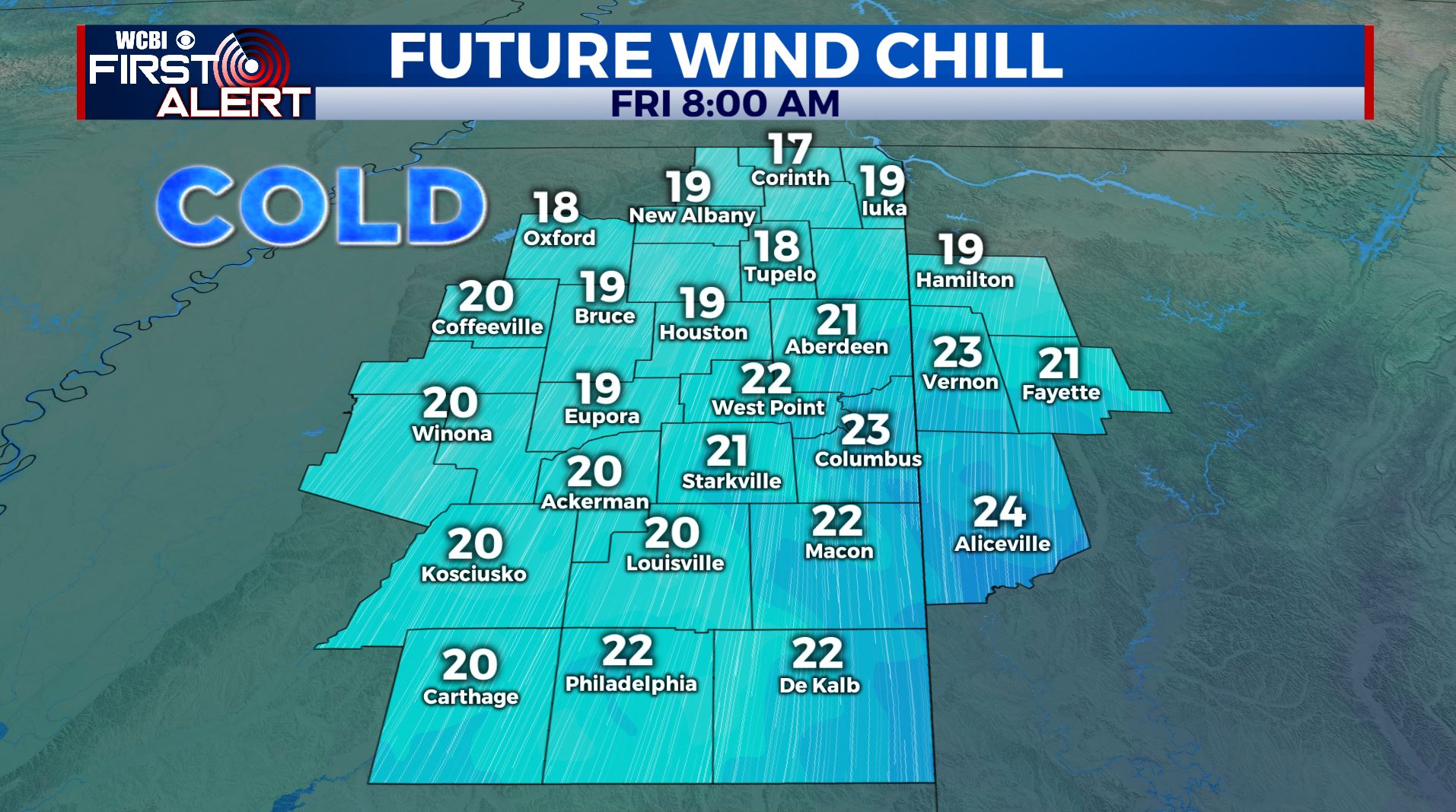
FRIDAY NIGHT: Clear, calm and another cold night. Lows in the mid to low 20s.
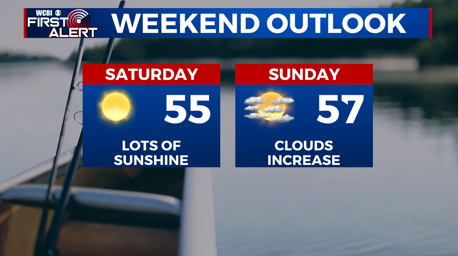
SATURDAY: Sunny skies. A bit warmer with highs in the low to mid 50s thanks to a light SW wind.
SATURDAY NIGHT: Mostly clear and chilly. Lows in the low 30s.
SUNDAY: Increasing clouds but staying dry. Some late day and evening showers are possible. Highs in the mid to upper 50s.
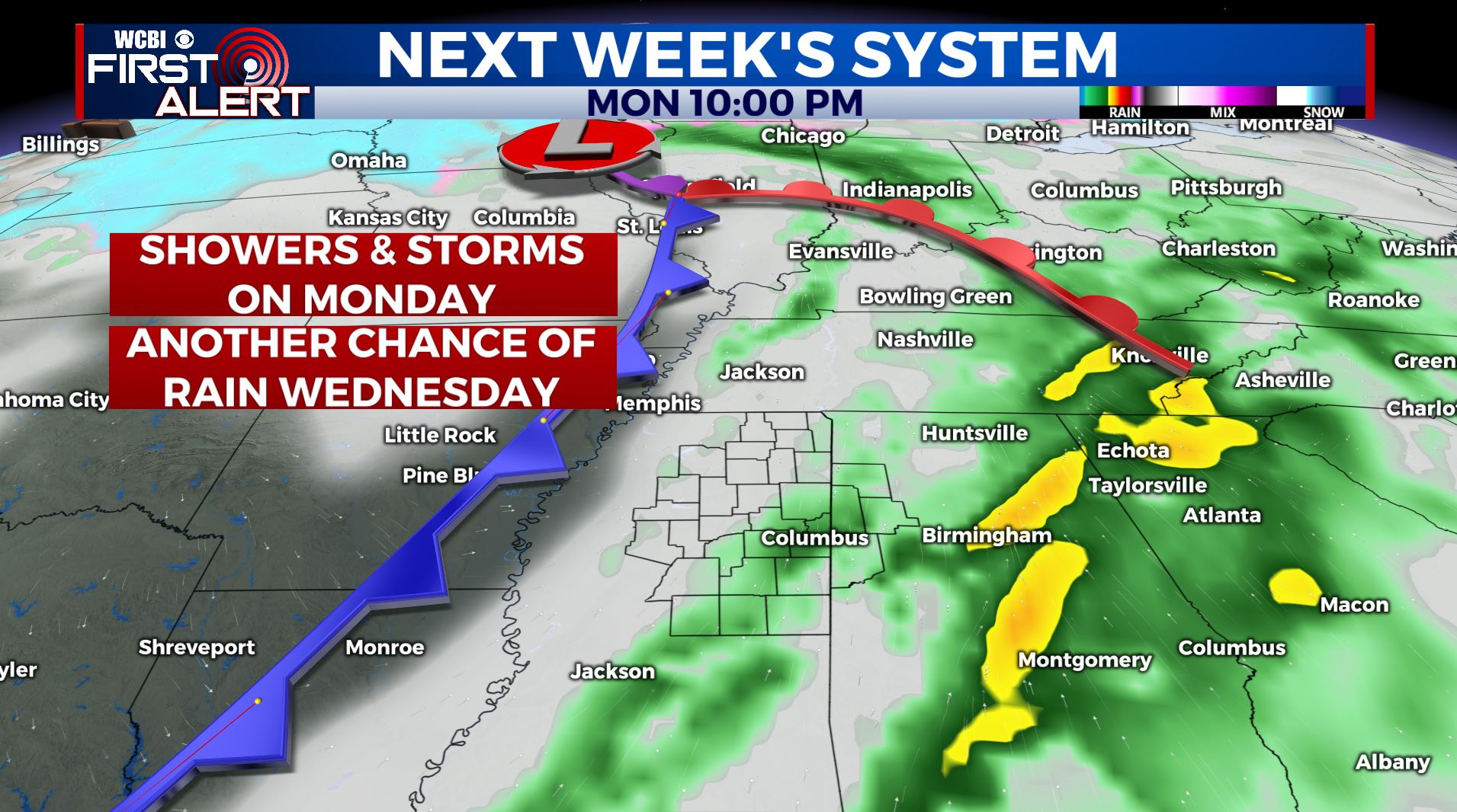
MONDAY: Warmer highs in the mid to upper 60s. Areas of rain with some embedded thunder. It doesn’t look like we’ll have any strong to severe storms to worry about at this point but we’ll keep watching it.
TUESDAY: A mix of sun and clouds. Seasonable highs in the low 60s.
WEDNESDAY: Turning much colder with temperatures topping out in the 40s. Some data suggest there could be some rain or a rain/snow mix around but we’re going to keep the chance of moisture at just 30%. Stay tuned for updates.
THURSDAY: The sunshine returns once again. Highs in the mid 40s.
Follow @WCBIWEATHER on Facebook, Twitter, Instagram, and the WCBI News App


Leave a Reply