Colder air on the way
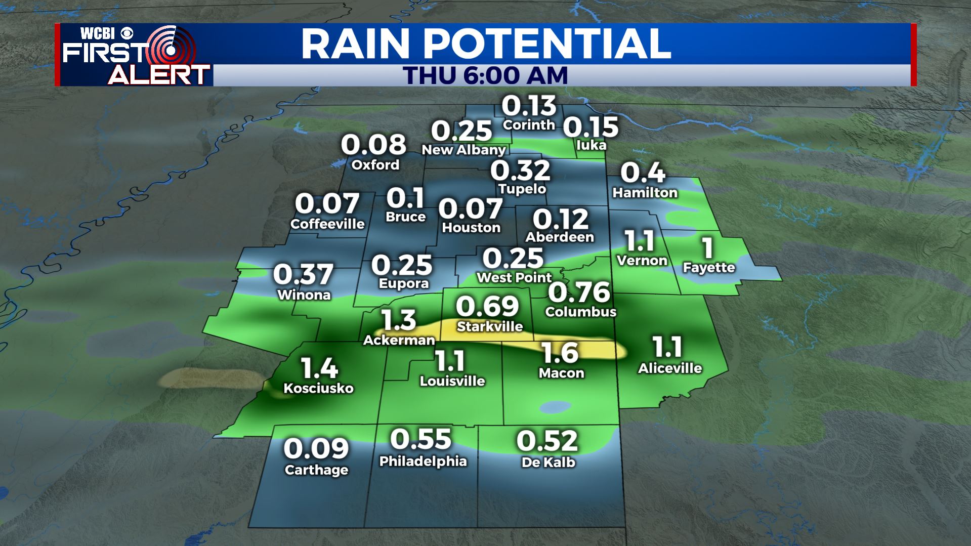
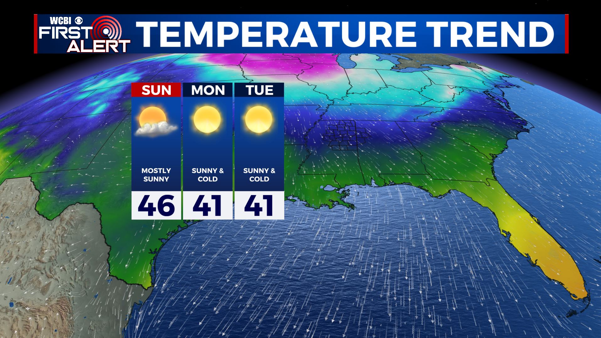
SUMMARY: The first of two cold fronts will spark some showers and storms tonight. The second front will move through Saturday. It may lead to more showers and storms and MUCH colder air. Temperatures will be only in the 40s Sunday and they will likely remain below normal for most of next week. The trade-off with the cold weather will be plentiful sunshine.
TONIGHT: Mostly cloudy with sct’d rain and storms. A few isolated strong storms with gusty wind and small hail are possible during the evening but widespread severe weather is not anticipated. Evening temperatures will be in the 60s with colder 50s and 40s returning by sunrise. Winds shift from SW to NE during the night and they’ll become quite gusty by morning.
THURSDAY: Mostly cloudy, breezy, and cooler. Highs in the 50s. Winds NNE 10-20 mph with some higher gusts.
THURSDAY NIGHT: Variably cloudy and cool. Lows in the low 40s.
FRIDAY: Mostly cloudy. Highs in the 50s. An isolated shower can’t be totally ruled out.
FRIDAY NIGHT: Mostly cloudy. Showers possible late. Lows near 50.
SATURDAY: Areas of rain and storms as a cold front moves across the region. The chance of rain is 70%. At this point it doesn’t look like we’ll have any strong or severe weather but we’ll continue to watch it. Look for highs in the 60s.
SATURDAY NIGHT: Clearing skies. Colder. Lows in the mid to low 30s.
SUNDAY-TUESDAY: Mostly sunny and cold. Highs in the 40s but a few spots may only have highs in the upper 30s. Lows each night will be in the 20s and 10s.
Follow @WCBIWEATHER on Facebook, Twitter, Instagram, and the WCBI News App


Leave a Reply