Cool through midweek, rain & storm chances return
SUMMARY: Cool and unsettled weather will remain the norm through the middle of the work week. Temperatures are going to moderate by the weekend as we finally get a needed break in the storm activity.
MONDAY NIGHT: Cloudy skies during the evening with showers possible late. Lows in the mid to upper 50s. Winds NE 2-6 mph.
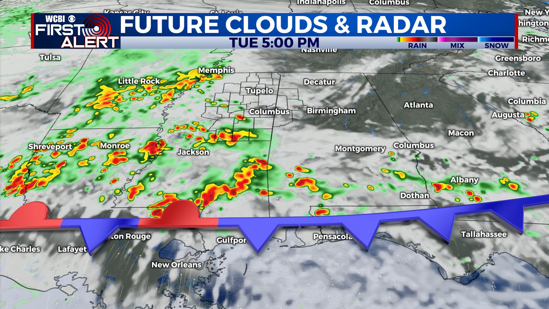
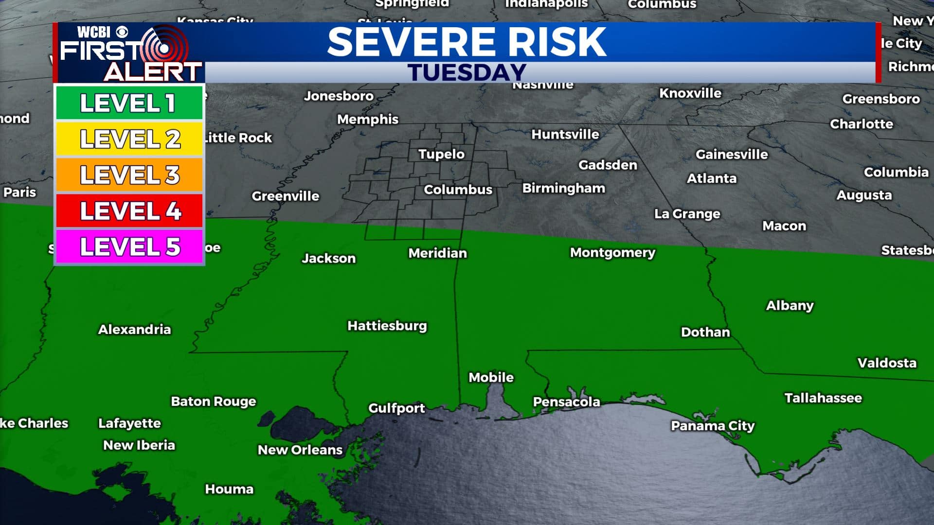
TUESDAY: Cloudy with area of rain and storms possible. The chance of rain is 60%. The best chance of any strong activity in the region should generally be from near Philadelphia to the south. Highs will range from the upper 60s to lower 70s. Winds ENE 5-10 mph.
TUESDAY NIGHT: Cloudy with a chance of showers. Lows in the mid 50s.
WEDNESDAY: Mostly cloudy. A 30% chance of a few showers. Highs in the upper 60s.
WEDNESDAY NIGHT: Cloudy. A continuing chance of a few showers. Lows in the mid 50s.
THURSDAY: Mostly cloudy. A 10-20% of a few lingering showers. Highs in the lower 70s. Variably cloudy Thursday night with cooler lows around 50.
FRIDAY: Partly cloudy. Highs in the mid 70s. Lows in the low 50s Friday night.
WEEKEND: Partly cloudy and much warmer. Highs in the low to possibly mid 80s. Lows in the 50s and low 60s.
Follow @WCBIWEATHER on Facebook, Twitter, Instagram, and the WCBI News App


Leave a Reply