Cooler fall air is on the way
SUMMARY: Our weather pattern is staying pretty quiet for the most part the rest of the workweek into the upcoming weekend. Temperatures will be warming back up midweek. A second cold front will push through here late Thursday that could bring in a few isolated showers. Much cooler but nice fall conditions Friday into Saturday.
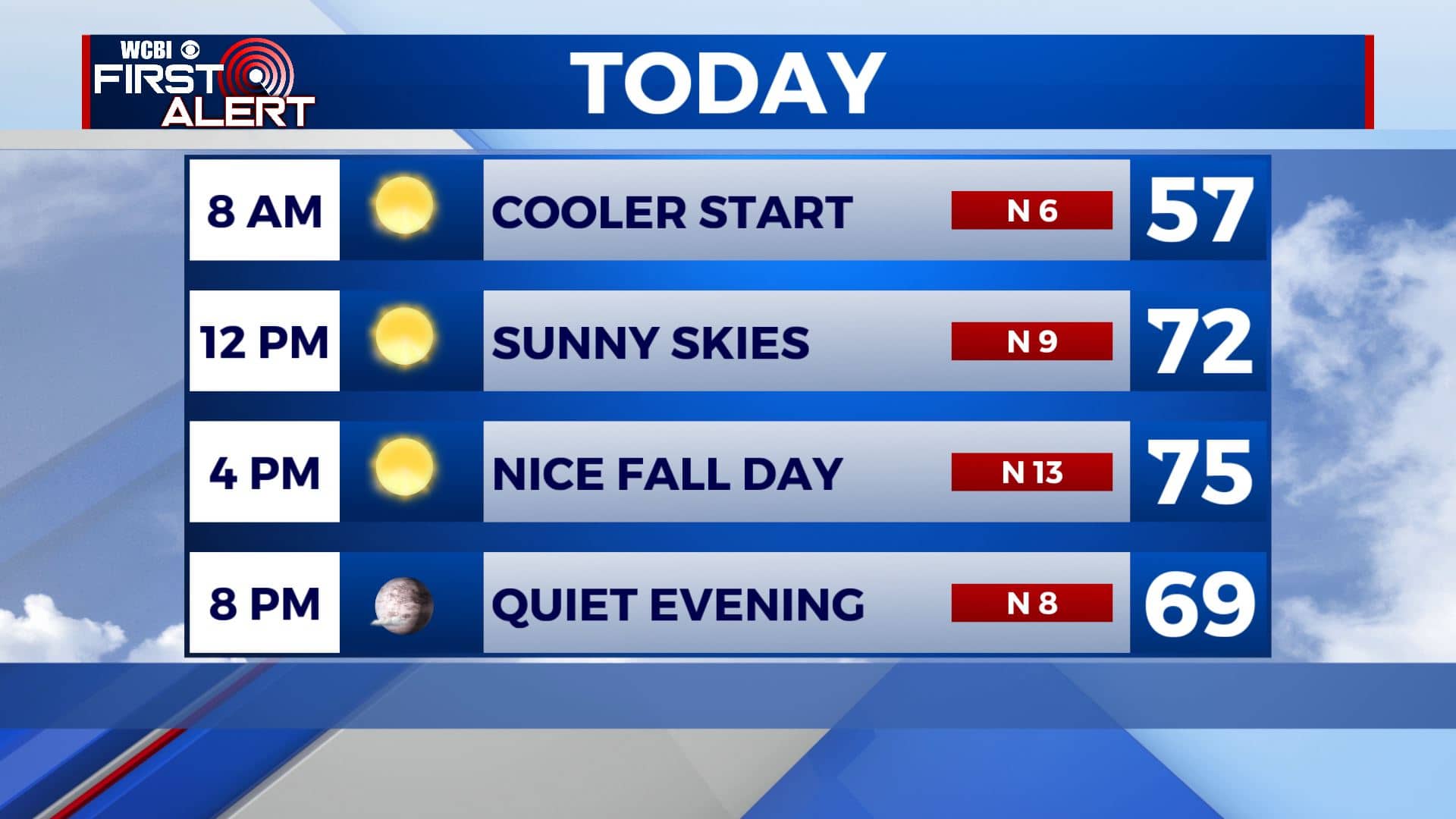
TUESDAY: Our first cold front of the week has pushed through. Cooler & drier air will continue to filter in for our Tuesday with lots of sunshine. Winds will be a bit breezy coming from the N 5-15 mph. It will help keep temperatures near average in the mid 70s.
TUESDAY NIGHT: Clear skies and a bit chilly. Overnight lows in the mid 40s. Light winds.
WEDNESDAY: Sunny skies. A bit warmer with highs back up in the lower 80s. Light southerly breezes.
THURSDAY: A mix of sun & clouds and staying warm. Highs in the lower 80s. Additional clouds late in the day with an isolated chance of showers during the evening as our second cold front approaches.
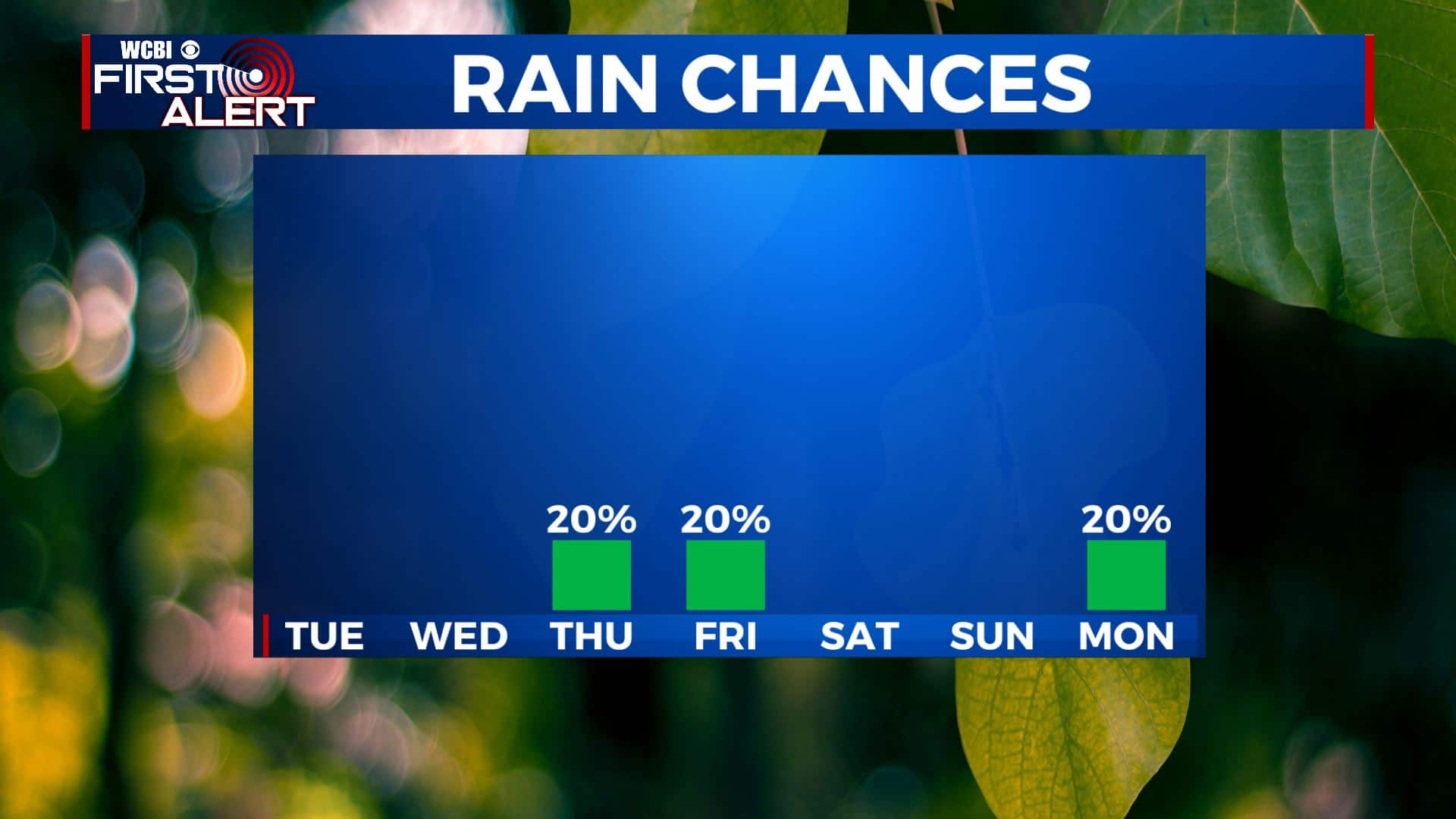
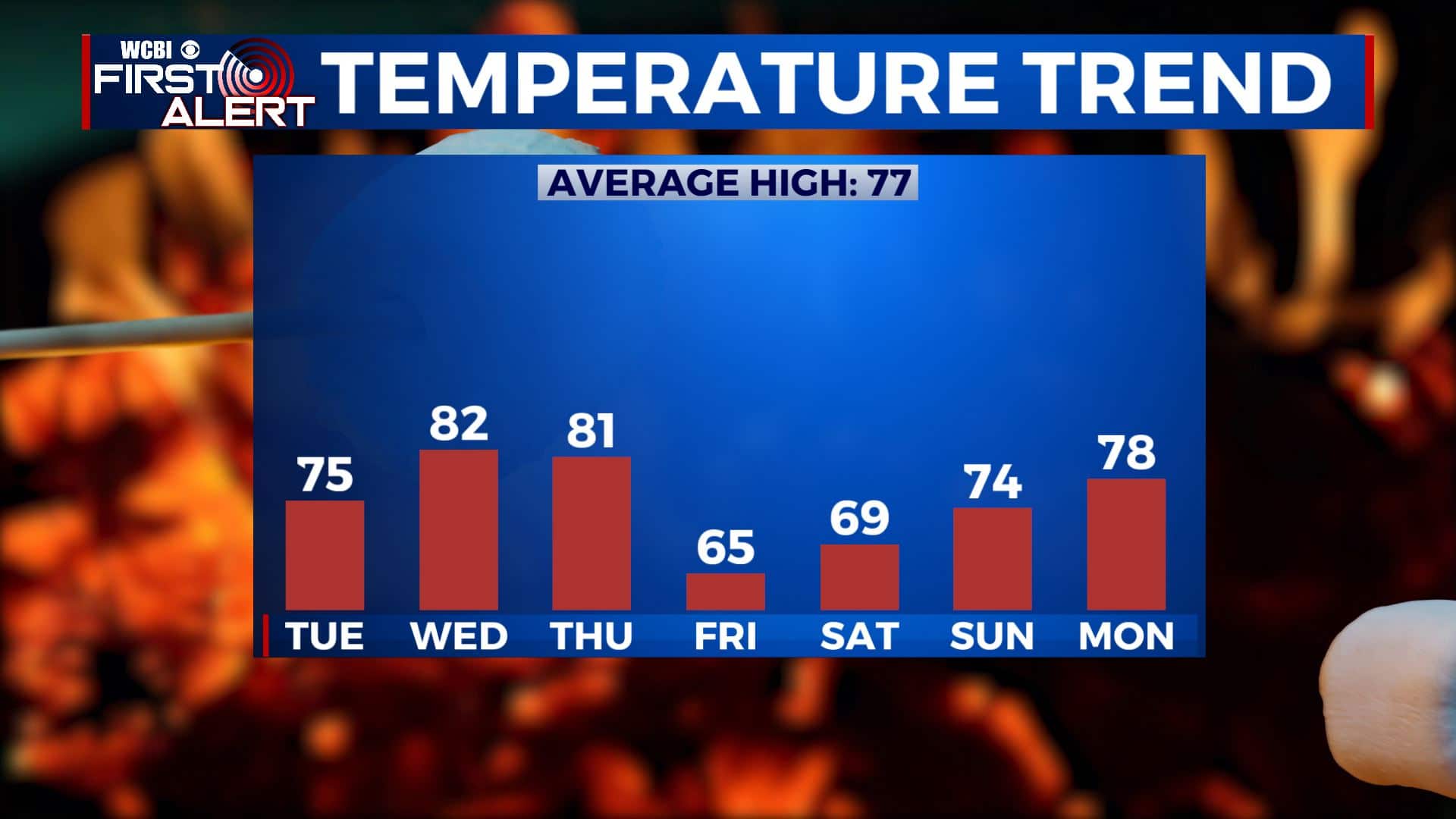
FRIDAY: Some morning clouds and the chance of a stray shower or two. Turning sunny, breezy, and cool. Highs below average in the mid 60s. Weather will be great for high school football but jackets will be needed.
SATURDAY: An awesome weekend is ahead for us for any fall outdoor plans. A chilly start with morning temperatures possibly in the upper 30s. Afternoon highs in the upper 60s with lots of sunshine.
SUNDAY: Sunshine with a few clouds. Highs back up to near average into the mid 70s.
MONDAY: Another cold front could possibly move through early next week. For now, just a mix of sun & clouds with a very slight chance of an isolated shower. Highs in the upper 70s.
Stay connected with @WCBIWEATHER on Facebook, Twitter, Instagram, and the WCBI News App


Leave a Reply