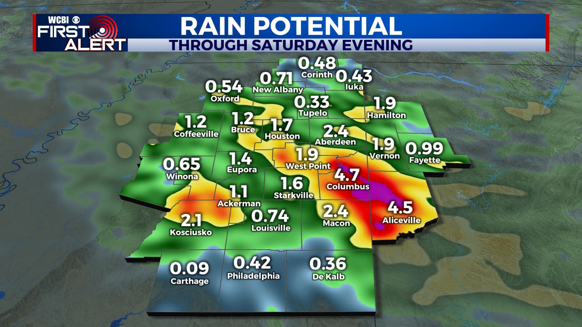
Flooding still possible on Friday
SUMMARY: Batches of rain and storms are possible going into the weekend. The ground is very saturated so it won’t take too much additional rain to cause more issues. Drier weather remains in the forecast for early next week.
THURSDAY NIGHT: Mostly cloudy. More showers and storms are expected to redevelop. Lows should hover around 70.
FRIDAY: Partly to mostly cloudy with a 70% chance of rain and storms. Locally heavy rain may lead to flooding. We’re forecasting highs in the 80s but things could be cooler if there are more storms around earlier in the day. Winds SW 5-15 mph.
FRIDAY NIGHT: Partly to mostly cloudy. A continuing chance of showers and storms. Lows in the lower 70s.
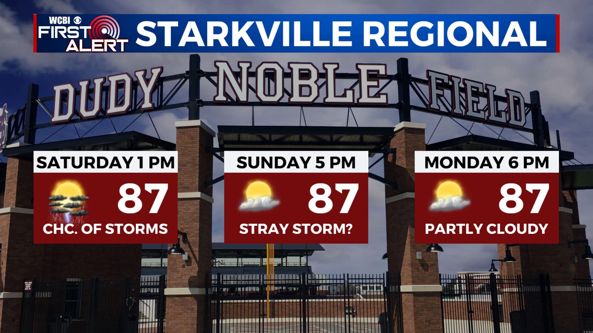
SATURDAY: Partly cloudy. A 50% chance of rain and storms during the day. Highs in the mid to upper 80s with heat indices around 100°. The MSU baseball game is scheduled for 1 p.m. and we hope for the best but keep in mind some rain is possible during the afternoon. Lows in the lower 70s Saturday night with additional showers and storms possible.
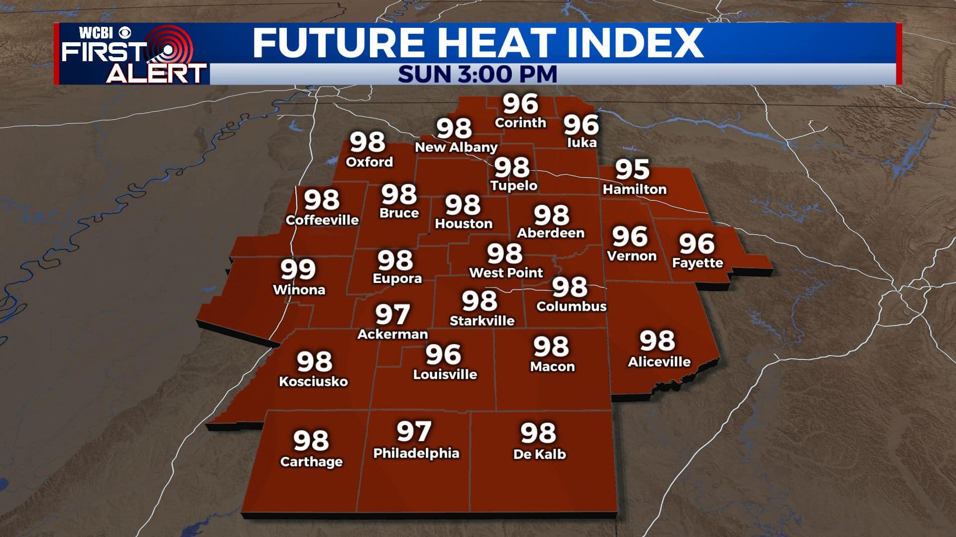
SUNDAY: We’re going to lower the odds of rain to 30%. Partly cloudy and muggy with highs in the upper 80s to around 90. Heat indices around 100°.
MONDAY & TUESDAY: Partly cloudy. Highs in the lower 90s. Lows in the lower 70s.
Follow @WCBIWEATHER on Facebook, Twitter, Instagram, and the WCBI News App


Leave a Reply