Heat Advisory in effect as a hot & humid Tuesday is ahead
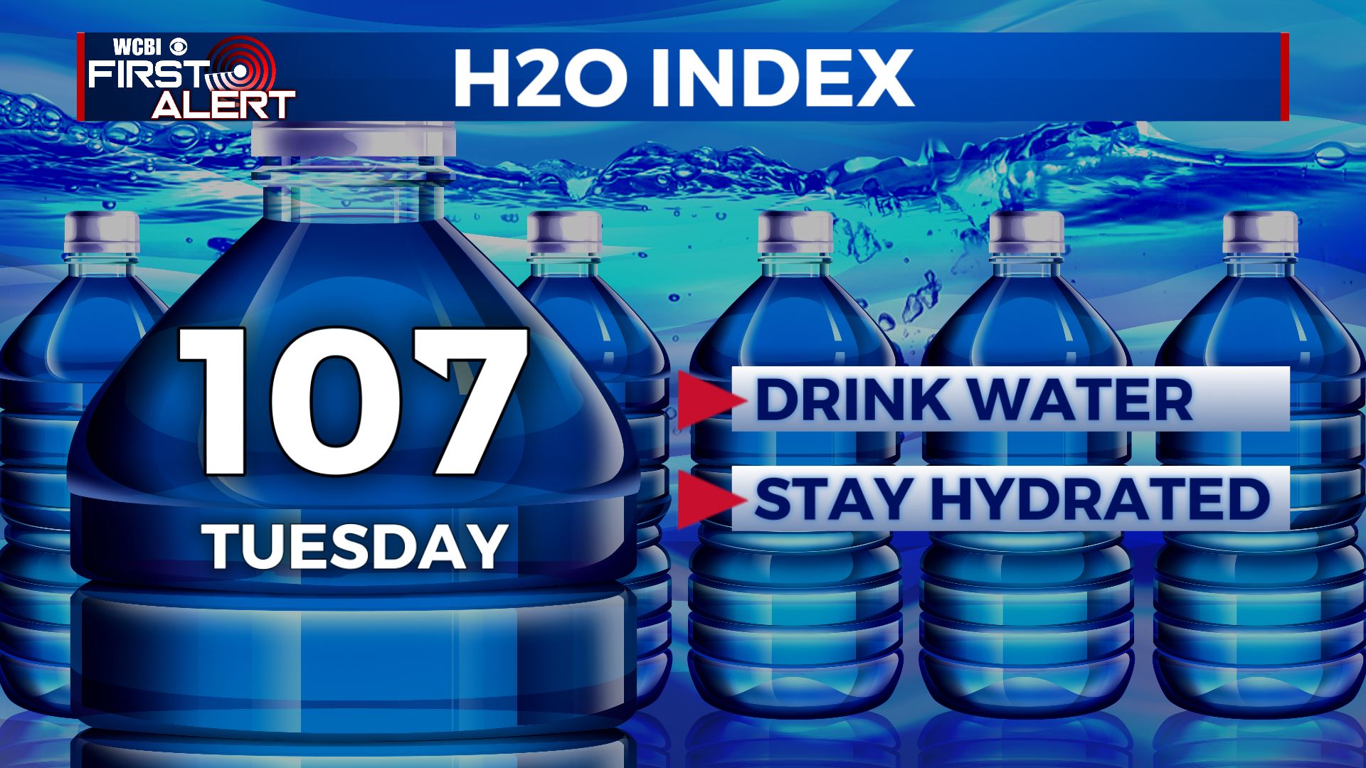
SUMMARY: A Heat Advisory is in effect for all our Mississippi and Alabama counties today as highs will get up to the mid 90s, but with the heat index..it’s going to feel like 105 degrees or more out there. 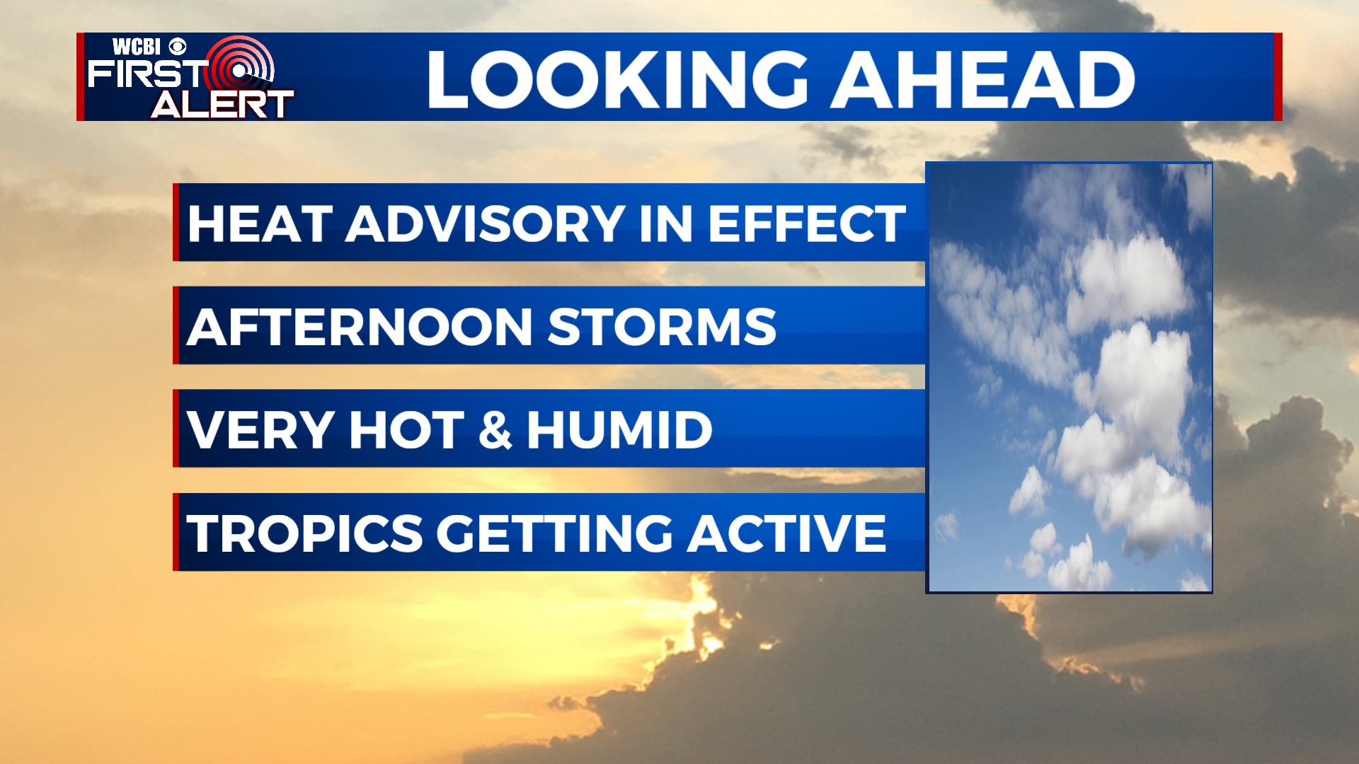 TROPICS: We area continuing to watch Potential Tropical Cyclone Six this morning. It’s likely to become Tropical Storm Fred later on today. It’s looking right now to be an issue for the Caribbean and Florida this week into the weekend! Stay tuned!
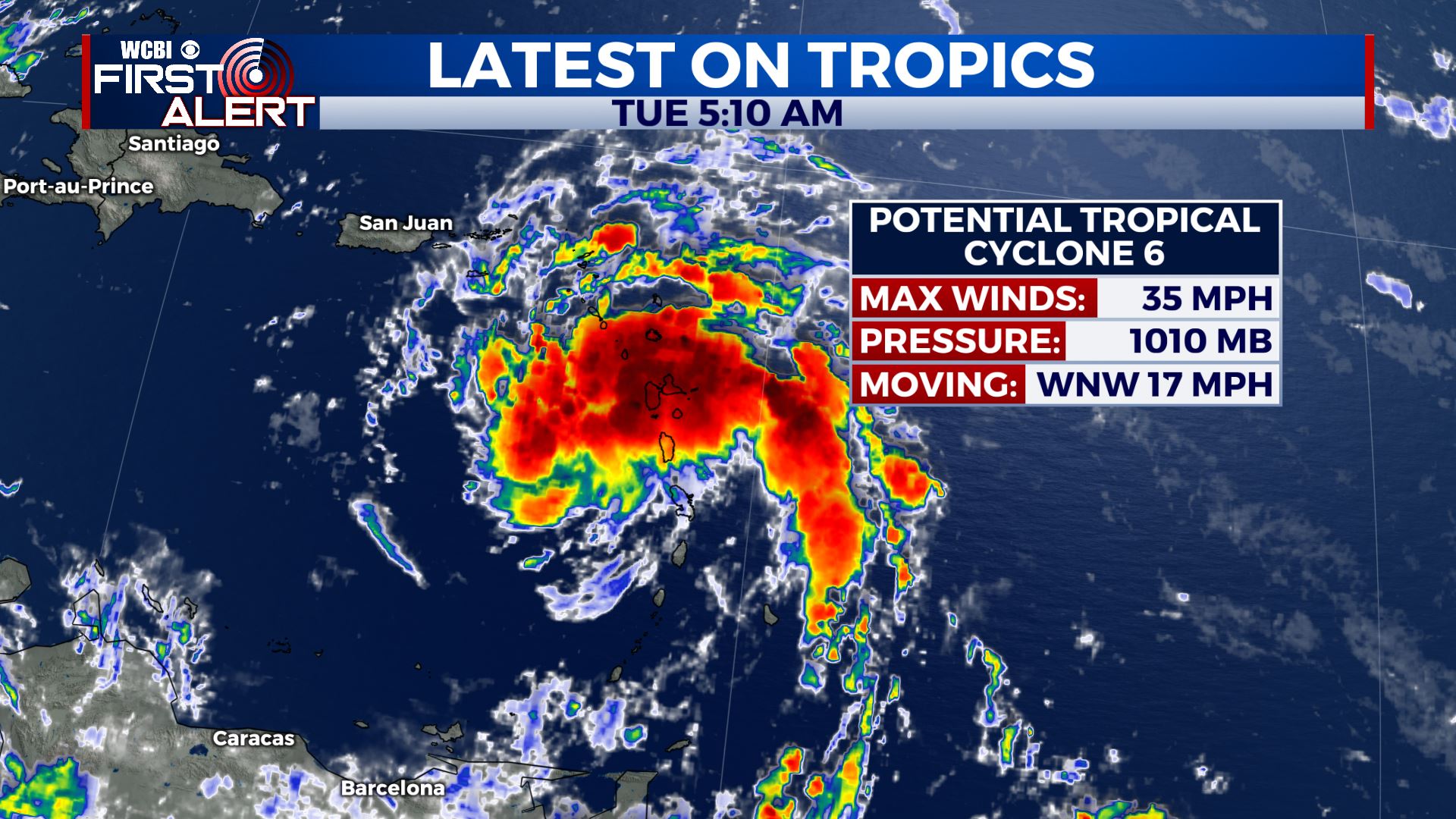
 TUESDAY: Expect a carbon copy of Monday’s weather for today with a mix of sun & clouds. A stray shower in the afternoon hours is possible, but I do think we’ll stay dry. Highs in the mid 90s with heat indices making it feel 105+. Stay cool & hydrated! Take frequent breaks indoors if you’ll be outside for a long period of time.
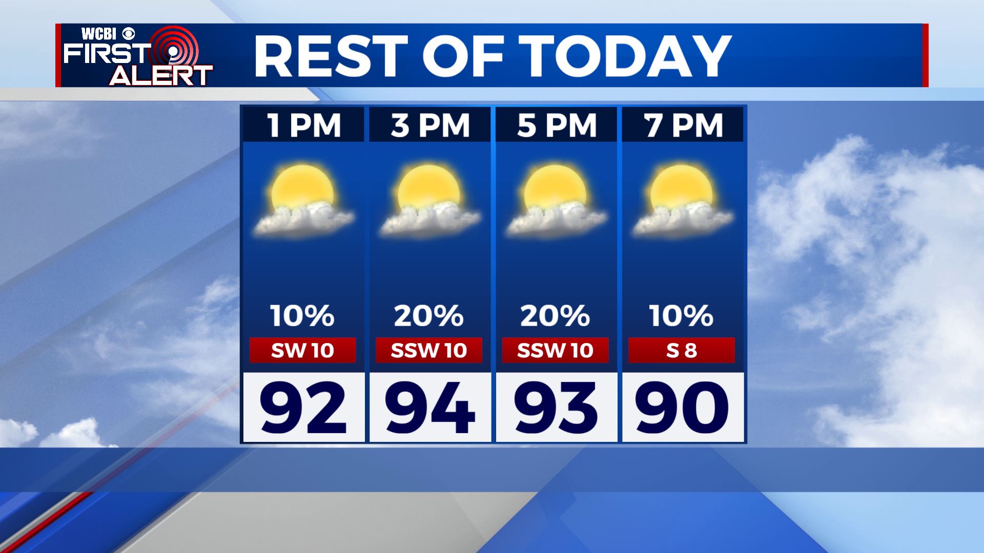
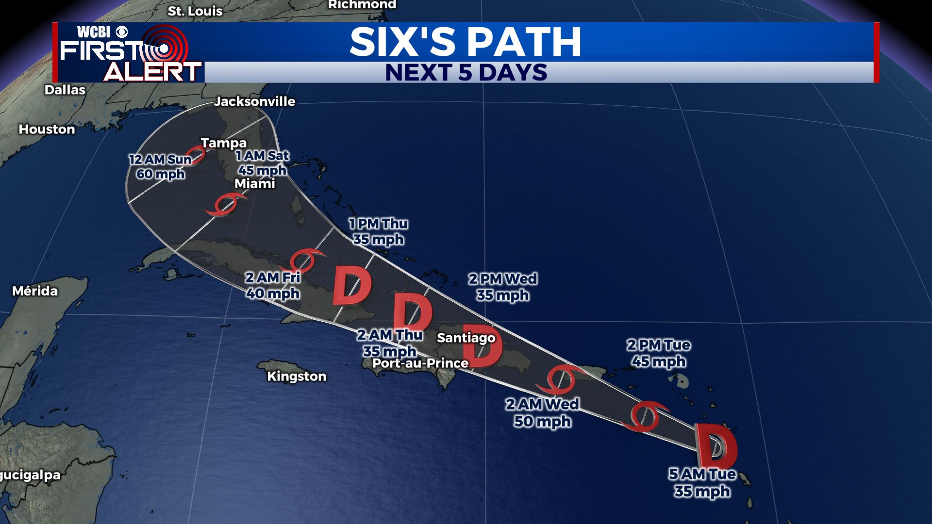
 TUESDAY NIGHT: Mild & muggy in the 70s overnight with partly cloudy skies. WEDNESDAY: A mix of sun & clouds. Highs in the 90s. Heat indices making it feel like 105+ again, a chance of showers& storms is possible in the afternoon as well. THURSDAY- FRIDAY: Our summer weather pattern continues. Temperatures will remain in the mid 90s with heat indices in the 100s. Rain and storms chances are possible in the afternoon. WEEKEND-MONDAY: Scattered showers & storms remain possible with a mix of sun & clouds. Chances could get higher by Monday as Fred moves into the Gulf. We’ll keep you updated! Highs in the upper 80s to lower 90s. Stay connected with @WCBIWEATHER on Facebook, Twitter, Instagram and the WCBI News App


Leave a Reply