It’s meteorological fall but it’s not feeling like it
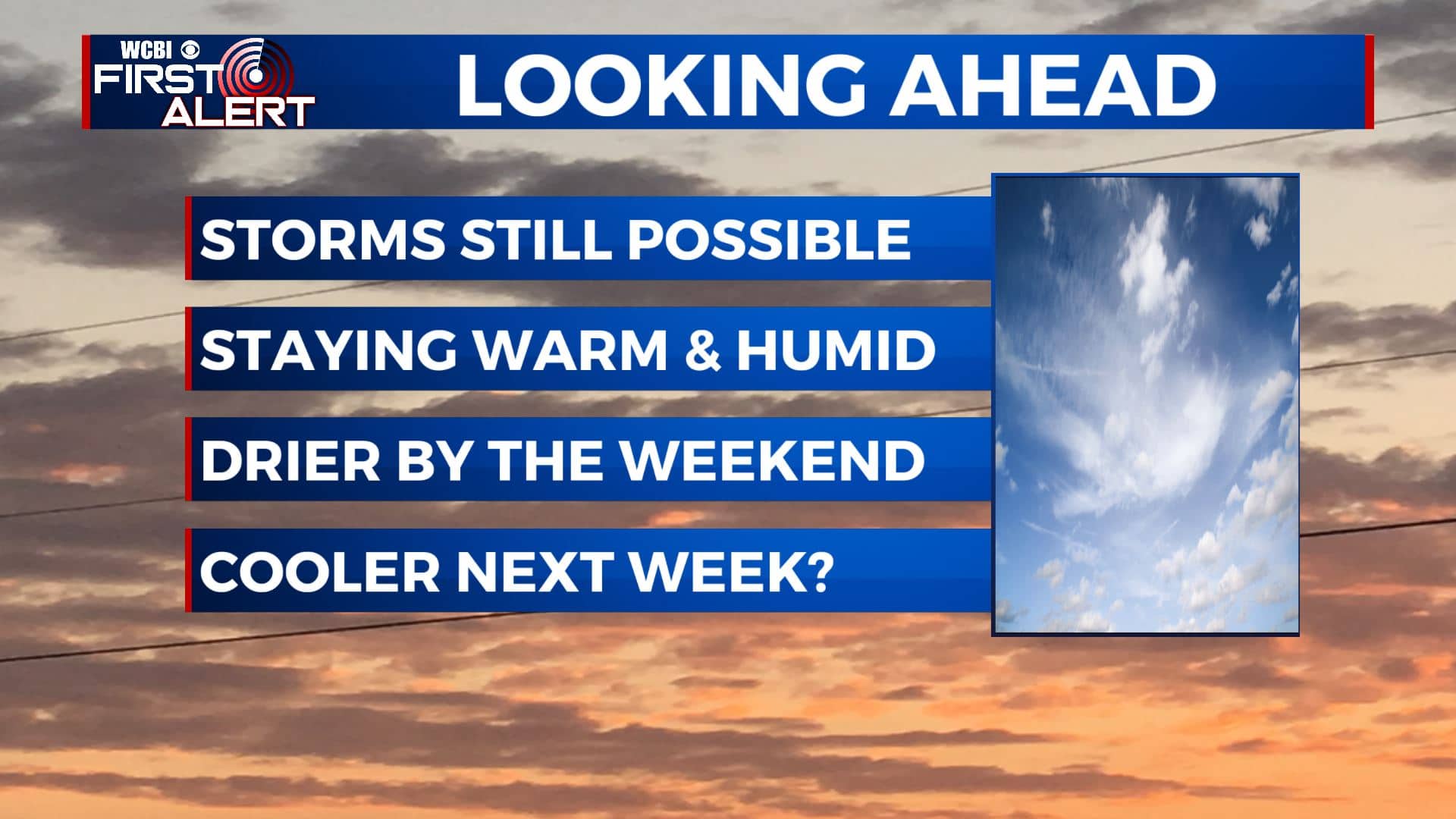
SUMMARY: A few more showers and storms are likely on Tuesday, but lower rain chances are on the way for the rest of the workweek. Slightly drier & less humid air is on the way for the Labor Day holiday weekend as a cold front should push through on Friday.
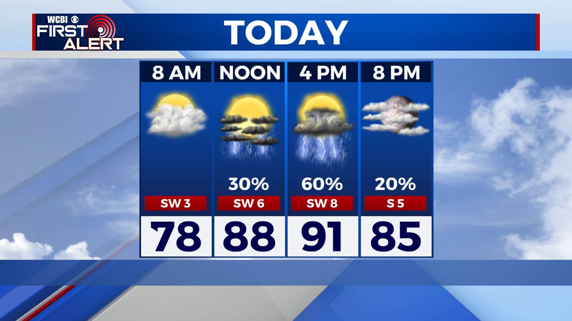
TUESDAY: Happy First Day of Meteorological Fall but it’s sure not feeling like it. Some of you are dealing with misty & foggy conditions this Tuesday morning. We’ll have a mix of sun & clouds with showers and storms likely by late afternoon. Highs in the lower 90s with heat indices ranging from 100 to 105. Winds SW 5-10 mph.
TUESDAY NIGHT: A few clouds and reasonably quiet. Overnight lows still muggy in the mid to low 70s.
WEDNESDAY-THURSDAY: A but drier for the middle part of the workweek with a mix of sun & clouds, just a chance of some isolated showers & storms. Staying very warm and humid. Highs in the lower to mid 90s with heat indices around 100. Overnight lows stay in the 70s.
FRIDAY: Scattered storms are possible with a cold front moving through the region. Highs near 90 degrees.
SATURDAY-SUNDAY: More sunshine for the long holiday weekend. Maybe a few clouds with an isolated shower or two, but we’ll take it. Still warm but a little less humid. Highs in the mid to upper 80s. Overnight lows dipping back into the mid to upper 60s.
LABOR DAY: Partly sunny with scattered chances of showers and storms. High temperatures still in the 80s.
Stay connected with @WCBIWEATHER on Facebook, Twitter, Instagram, and the WCBI News App


Leave a Reply