Keep the rain gear handy as we end the workweek
SUMMARY: A disturbance to our west and a stationary front to our north will help keep rain and storm chances likely through the end of the workweek. Any stronger storms may produce heavy rain, lightning, and gusty winds. It won’t be as hot, but the humidity will stick around through the weekend but drier & cooler summer air returns next week.
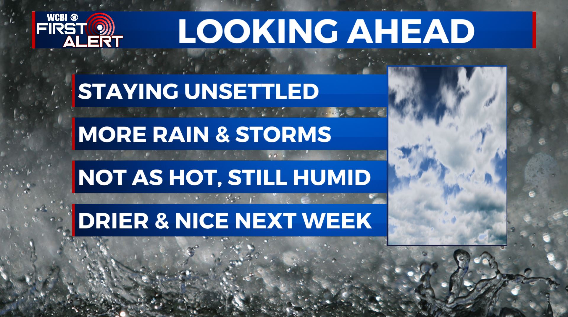
THURSDAY-FRIDAY: Afternoon showers and storms will remain possible through the second half of the workweek. Some storms could produce locally heavy rainfall and gusty winds at times. Afternoon highs will only go up to the upper 80s to lower 90s as the cloud cover and the rain will help us to cool down a bit.
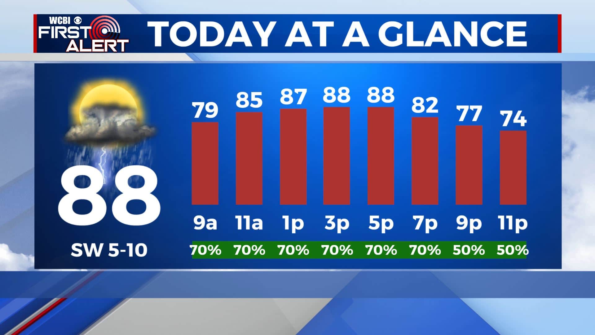
THURSDAY NIGHT: Showers and storms should come to an end early evening. Mostly cloudy skies Lows in the lower 70s. Calm wind.
WEEKEND: Pop-up storms will remain in the forecast for the weekend and even into early next week as temperatures will also remain hot and humid. Highs will climb to the lower and mid 90s each afternoon with overnight lows in the low 70s. Heat index values nearing 100.
TROPICS: We have Tropical Depression 11 out in the Atlantic. Most likely will become Josephine over the next couple of days.
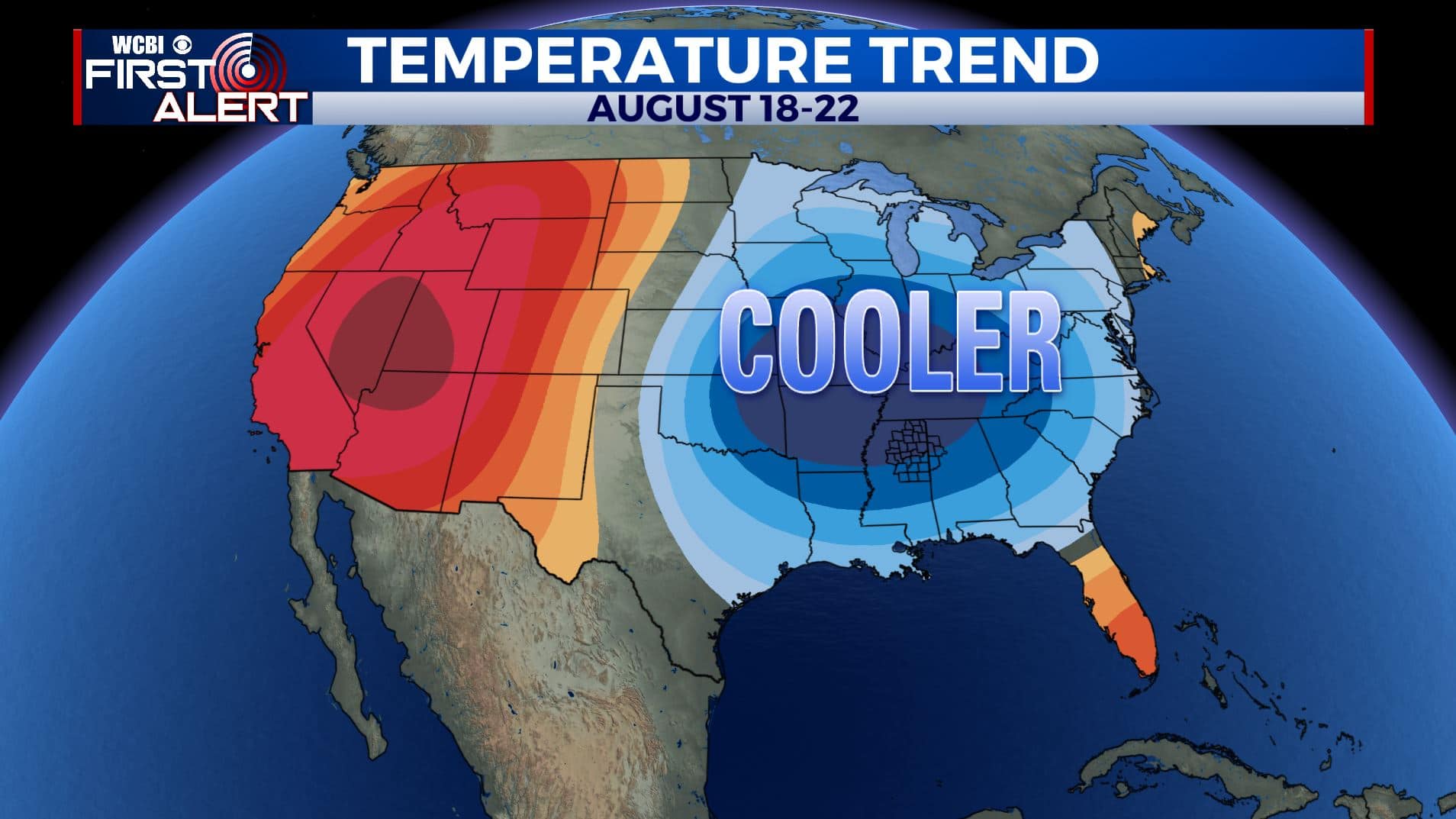
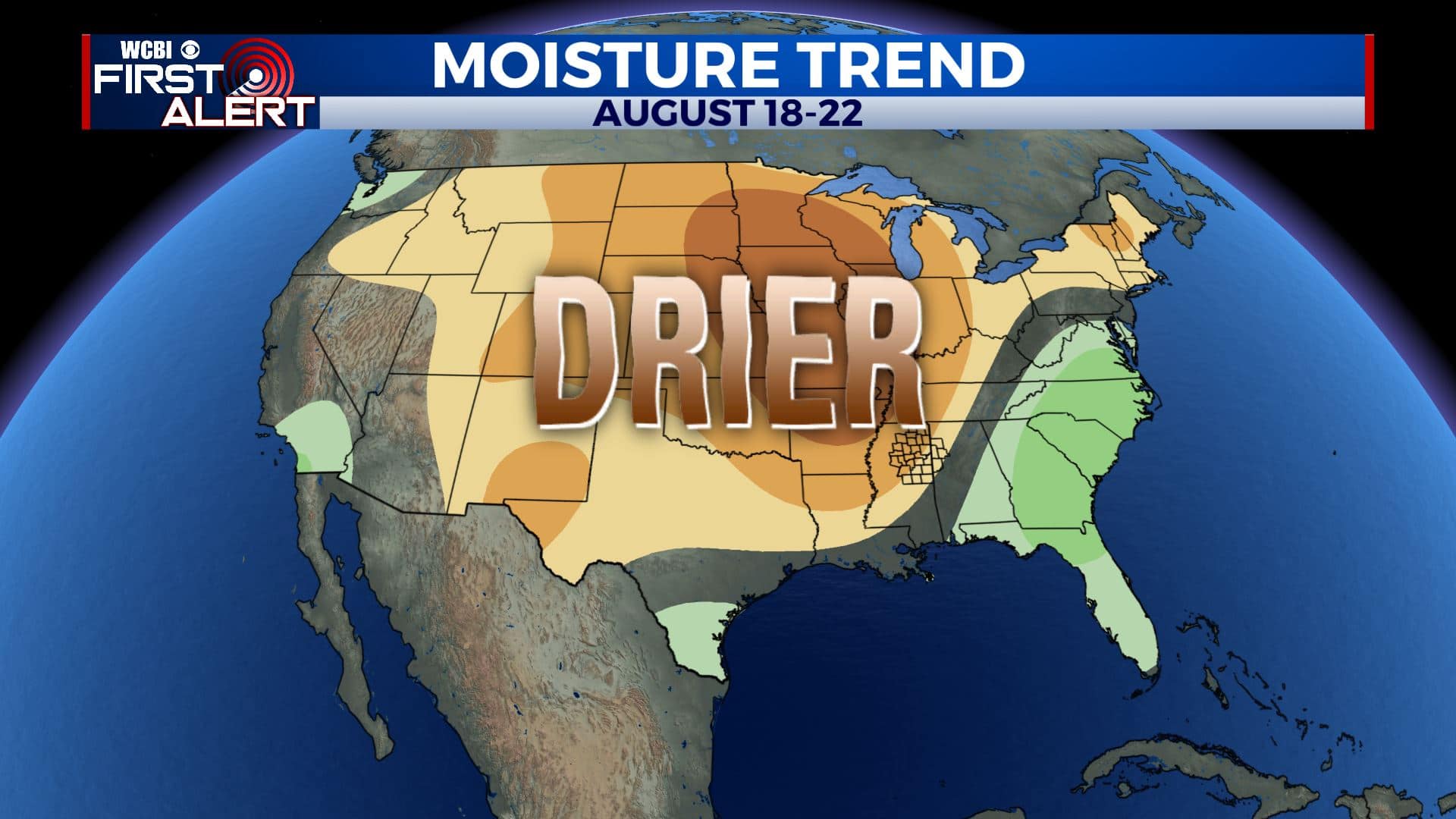
NEXT WEEK: Some summer heat relief is on the way as cold front is expected to move through Monday and that will usher in “cooler” and less humid air by Tuesday or Wednesday. Lows may dip back into the 60s by Wednesday morning. Stay tuned!
Stay connected with @WCBIWEATHER on Facebook, Twitter, Instagram, and the WCBI News App


Leave a Reply