Last Weekend Of Summer Looking Good
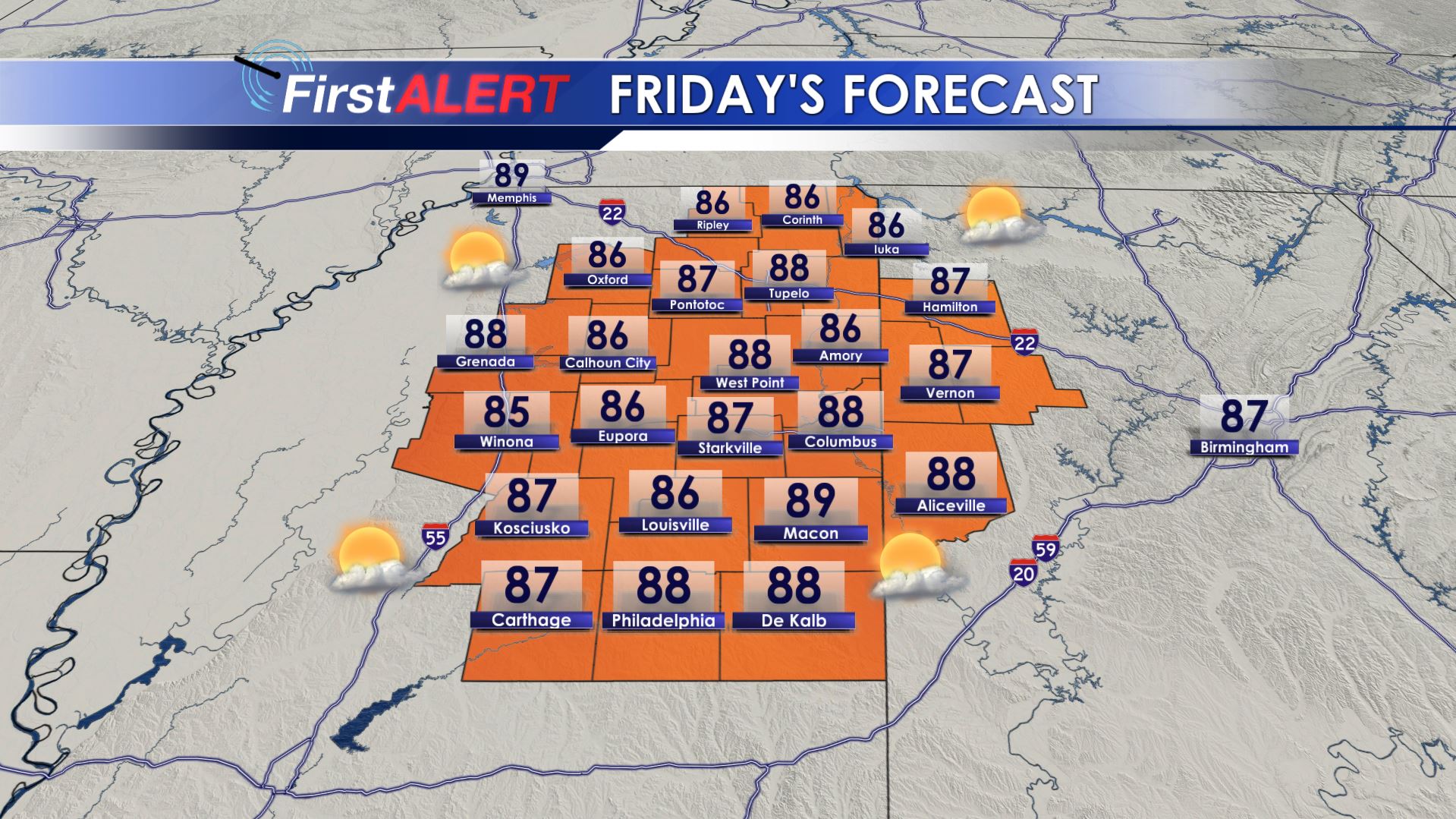
Friday’s Forecast
SUMMARY: Cooler (“less hot”) & drier is building built back into the region and it will remain in place through the weekend. Rain chances will be zero Friday – Sunday so any outdoor plans should be A-OK.
THURSDAY NIGHT: A few isolated evening showers are possible across the western 1/2 of the area. Otherwise expect partly cloudy skies and cooler lows in the 60s.
FRIDAY: Mostly sunny and seasonably warm. Highs in the mid to upper 80s in most spots with SE winds 5-15 mph. Ideal conditions are expected for high school football with evening temperatures in the 70s under mainly clear skies.
FRIDAY NIGHT: Clear and cool. Lows in the low 60s.
SATURDAY-SUNDAY: Mostly sunny skies hold on all weekend long. Highs should top out in the upper 80s to around 90 while overnight lows stay in the 60s. Don’t forget your sunscreen, sun glasses, and hats if you’ll be attending those college football games on Saturday.
EARLY NEXT WEEK: Model data suggest the possibility of a weak front moving across the area. We’re going to keep a 10-20% chance of rain going but the amount of moisture available is far from certain at this time. Highs look to stay in the upper 80s to lower 90s. Fall officially begins early Monday morning at 2:50 a.m. CDT.
Stay connected with @WCBIWEATHER on Facebook, Twitter, and Instagram


Leave a Reply